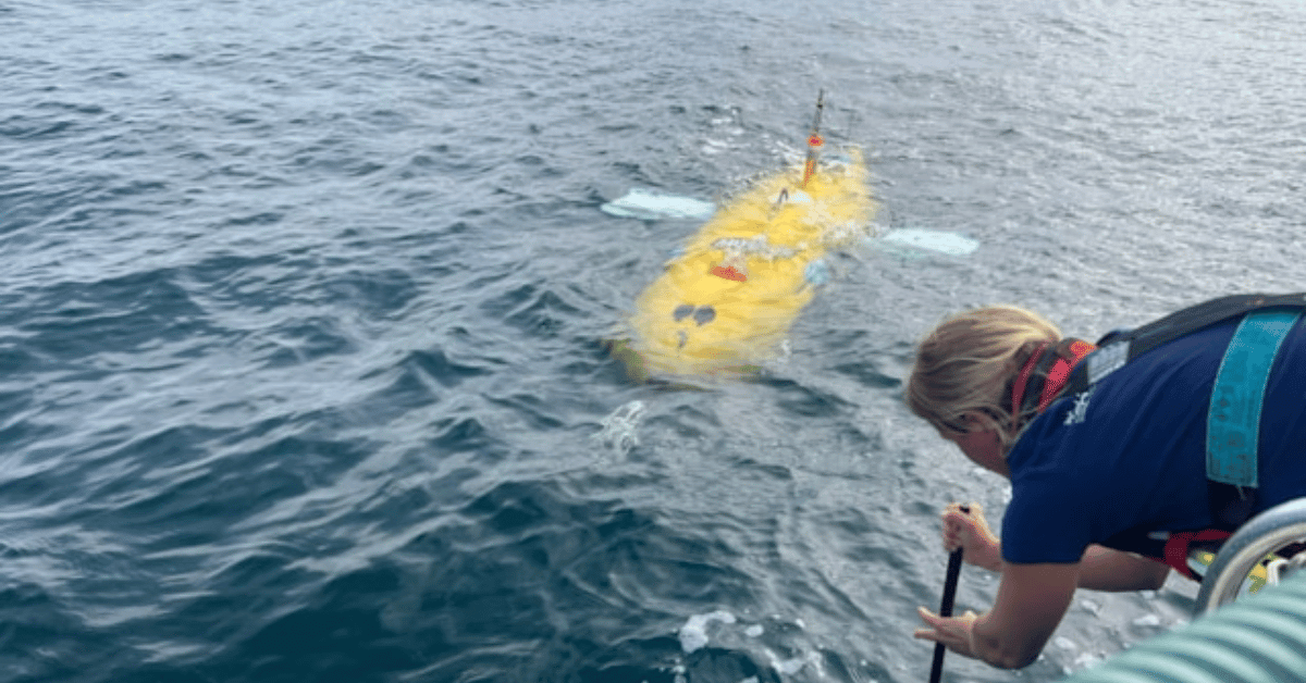
Ocean intelligence is not a luxury; it is a prerequisite for responsible industrial expansion. The recent sensor trials aboard the National Oceanography Centre's ALR1500, better known as Boaty McBoatface, off Plymouth demonstrate exactly this principle in action. We see this as a calibrated step toward ensuring that the deployment of floating offshore wind is guided by empirical data rather than assumption. The successful integration of a scientific echosounder, hydrophone, and holographic plankton imager onto a long-endurance autonomous vehicle represents a measurable advance in our ability to observe marine life in concert with the physical and biogeochemical conditions that shape its distribution. This matters because, as 2025 Global Surface Temperature Data Validates Measurable Climate Indicators reminds us, validated environmental baselines are the only foundation upon which we can assess change. Similarly, the Frontline consortium's approach of linking satellite observations with autonomous underwater missions echoes the principles of integrated data ecosystems described in Digital data ecosystems empower ecological governance in South China Sea island villages, where surface-level monitoring gains its true power when connected to subsurface reality.
The practical significance of this trial lies in what it enables: near-real-time adaptive surveying of dynamic ocean fronts. These fronts, boundaries between mixed coastal waters and stratified offshore waters, are the engines of biological productivity in the Celtic Sea, shaping plankton blooms, fish aggregations, and the foraging grounds of marine predators. Floating offshore wind infrastructure will alter the physical environment around these fronts by generating wakes and enhanced mixing. The team's ability to pilot Boaty McBoatface over the horizon, using satellite-derived frontal maps to guide the AUV across these features, is a direct demonstration of how marine autonomy can deliver the kind of longitudinal, integrated data required to understand these interactions. The initial observation of a large fish school followed by bottlenose dolphins is not just a charming anecdote; it is a validation that the sensor suite can capture the biological signal we need to monitor. This is purposeful science, designed to produce peer-reviewed, measurable outcomes that industry regulators and developers can use.
What makes this effort particularly credible is the collaborative structure behind it. The trial was not a single-institution showcase but a consortium spanning the University of Plymouth, Plymouth Marine Laboratory, the National Oceanography Centre, SINTEF Ocean, HiDef Aerial Surveying Ltd, and KONGSBERG Discovery. The funding from NERC and The Crown Estate signals that the UK's scientific and economic stakeholders recognize the urgency of this work. The specific challenge now is to translate these successful two-week trials into the sustained surveys planned for 2027. The team's candid acknowledgment that they are still learning how to get the best from the combined system is exactly the right tone: science advances through iteration, not marketing hype.
The open question that remains is whether the operational approaches developed here can scale to the spatial and temporal scales required for the Celtic Sea's planned floating wind developments. The trial demonstrated the sensor combination works in shallow, busy waters; the 2027 surveys will test its endurance in deeper, seasonally stratified environments where ocean fronts are more dynamic. The specific detail to watch is how the HOLOtag plankton imager performs over longer missions, as it represents the first step toward sustained, rapid observation of the ocean's foundational food web. If this sensor suite can deliver the kind of integrated, real-time biological and physical data that satellite remote sensing alone cannot provide, it will offer a replicable model for how to develop floating wind without compromising the ecosystems we depend on.