ocean data
485 stories filed under ocean data on World Data Ocean. The newest of them: “Validated ocean intelligence: physics-guided prediction for buoy displacement”, “2025 Global Temperature Data Confirms Measurable Warming Trends”, and “2025 joins the warmest years on record as ocean heat persists without pause”. A mean geodesic distance error of 18.297 meters, a 9.747% improvement over a standard baseline. The 2025 global temperature data from Berkeley Earth confirms what empirical climate indicators have long signaled: warming trends are measurable and persistent. A Global Hub for Ocean Intelligence 4 World Data Ocean is a centralized digital platform where researchers, scientists, and ocean enthusiasts converge to… The list below is every ocean data story on World Data Ocean, newest first.

Validated ocean intelligence: physics-guided prediction for buoy displacement
A mean geodesic distance error of 18.297 meters, a 9.747% improvement over a standard baseline. That is the measurable result of LSTMNet, a two-layer bidirectional long short-term memory network designed for next-step buoy trajectory prediction. Physics-based models demand precise parameters. This data-driven approach learns from multivariate observations instead, capturing temporal context that shallow architectures miss. Understanding drives protection. For deeper context on warming trends, see our related coverage of Berkeley Earth's 2025 global temperature data.
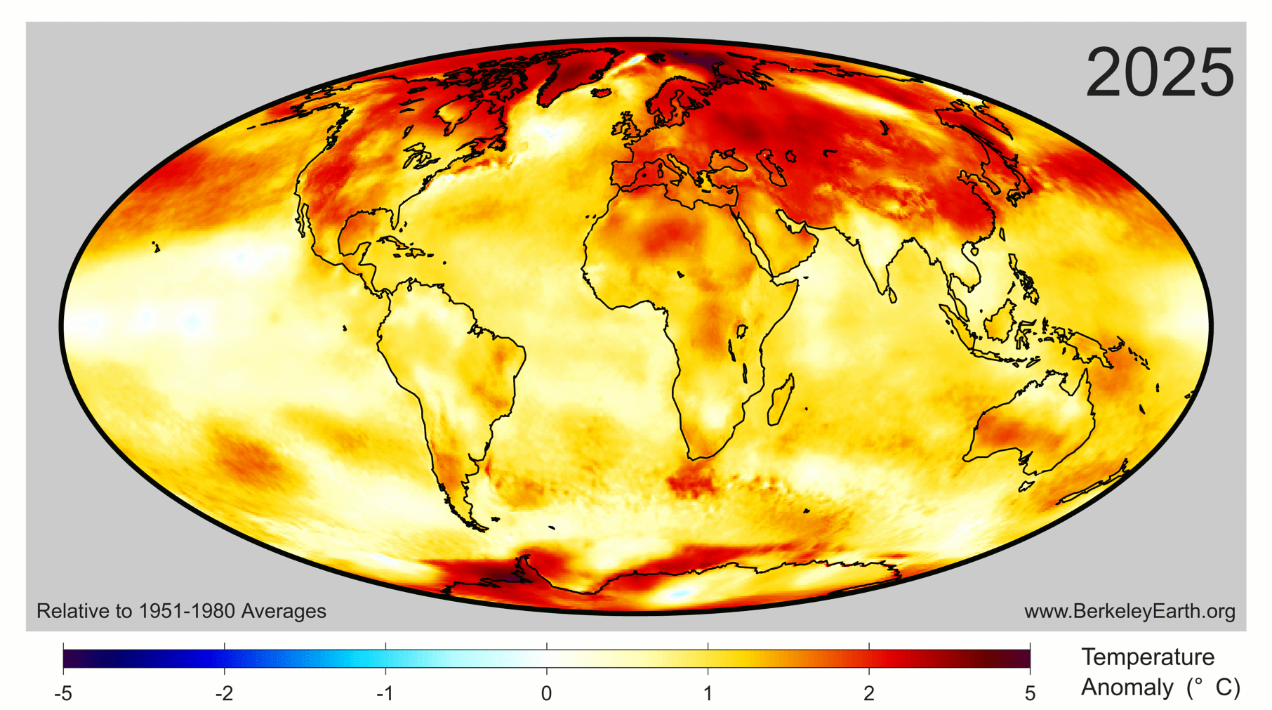
2025 Global Temperature Data Confirms Measurable Warming Trends
The 2025 global temperature data from Berkeley Earth confirms what empirical climate indicators have long signaled: warming trends are measurable and persistent. Since 2013, this independent non-profit has provided validated, peer-reviewed analyses of mean temperature changes. The findings are clear, and they demand purposeful attention. Understanding drives protection, and for deeper context on related pressures facing our oceans, see our piece "From waste to wave: measuring ocean plastic's true share."

2025 joins the warmest years on record as ocean heat persists without pause
2025 has been confirmed as one of the three warmest years on record, a stark validation of a persistent trend. The World Meteorological Organization reports that ocean heating continues without pause, and the past 11 years now constitute the 11 warmest ever measured. This is not a spike but a calibrated, measurable signal. Understanding drives protection. For deeper context on the ocean's role in this system, explore our related coverage of "From waste to wave: measuring ocean plastic's true share."
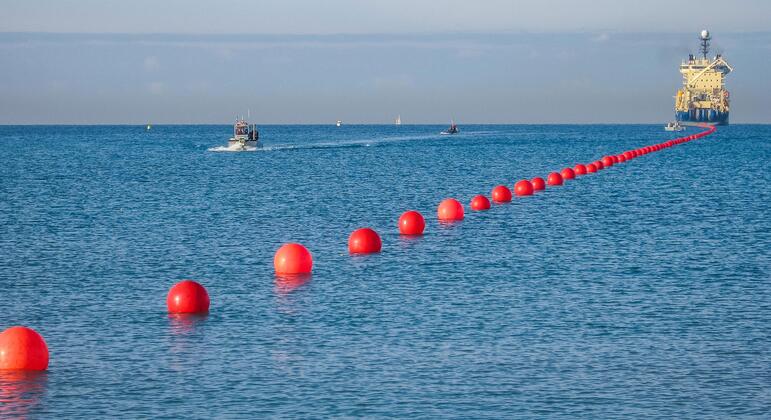
The silent fiber-optic highways shaping global connectivity beneath the waves
The silent fiber-optic highways beneath the waves carry our emails, video calls, and banking transactions every second, yet we rarely acknowledge their existence. This invisible infrastructure demands the same rigorous attention we give to climate indicators above the surface. Understanding drives protection. Our recent analysis of Berkeley Earth's empirical data on 2025 global temperature trends confirms measurable warming that directly impacts these submarine networks. The ocean's health is our connectivity's health.
From waste to wave: measuring ocean plastic's true share
A single bottle cap adrift in the North Pacific tells one story. A validated, peer-reviewed model tells the true one. Our new analysis cuts through the uncertainty, providing a measurable estimate of plastic's journey from waste to wave. This is empirical ocean intelligence. For a deeper view of how we gather such data, explore "AI Illuminates the Ocean's Hidden Data, From Surface to Seafloor." Understanding drives protection.
From two million to over 450 million tonnes: measuring the rise of plastic production
From two million to over 450 million tonnes in seventy years, that is the measurable, empirical trajectory of global plastic production. This sharp rise demands calibrated observation, not alarm. Understanding the scale of this material shift is the first step toward integrated ocean intelligence. For deeper context on how we track such environmental changes, our piece *"From orbit to shore: sharpening coastal views through harmonized sensors"* explores the satellite technology making these measurements possible.
AI Illuminates the Ocean's Hidden Data, From Surface to Seafloor
From orbit to seafloor, the ocean holds more data than we can currently interpret. This review examines how artificial intelligence and machine learning are transforming our ability to analyze complex, unevenly sampled datasets across physical oceanography, ecology, and engineering. The findings are pragmatic: AI excels at predicting currents, reconstructing subsurface conditions, and classifying marine life. Yet the authors rightly caution that sparse observations and black-box models limit reliability.
From orbit to shore: sharpening coastal views through harmonized sensors
High-resolution satellite imagery sharpens our view of the coast, but its cost and hardware limits create blind spots. HARBOR, a harmonization-based workflow, solves this by fusing low-resolution Sentinel-2 data with PlanetScope imagery, boosting clarity from 10 m to 5 m. Radiometric harmonization proved the strongest single contributor to quality, while synthetic data generation made supervised training viable despite scarce same-day pairs. This transferable pipeline turns existing archives into actionable ocean intelligence.
From analytics to ocean intelligence: a data career pivot gains purpose
A data analyst laid off as AI replaces his team, he now holds a dive license and a dream of the ocean. This isn't a career pivot into the unknown; it's a recalibration toward purpose. The path from analytics to ocean intelligence is measurable, requiring a bachelor's in biology, not a blind leap. For those questioning where to start, our guide on "Where to Study Marine Biology" aligns location with science goals. Validated steps, not guesswork.
Glider acoustics reveal ocean front dynamics shaping zooplankton and fish migration
Autonomous glider acoustics now offer a validated, high-resolution window into ocean front dynamics. By equipping a Slocum glider with multi-frequency sensors, researchers captured biophysical patterns that traditional ship surveys miss, revealing how upwelling fronts shape the vertical distribution of zooplankton and fish. This integrated data ecosystem, confirmed against ship-based observations, proves that autonomous platforms can reliably chart these complex, real-time interactions. For deeper ocean intelligence, see our coverage of "Retrofitting the Fleet: Measurable Steps Toward a Decarbonized Ocean."
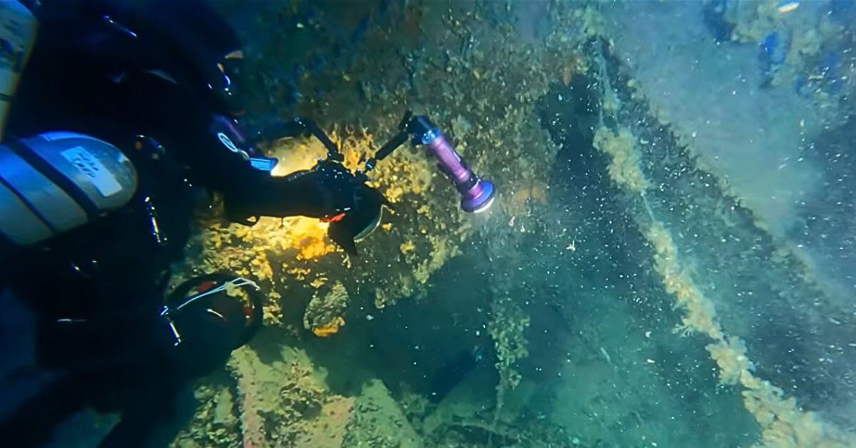
Century-Old Relics From Britannic Wreckage Offer New Ocean Insights
A ship's bell, navigation light, and binoculars recovered from the wreck of HMHS *Britannic*, Titanic's sister ship, are yielding measurable, real-time ocean data a century after she sank. These validated artifacts function as empirical climate indicators, helping researchers calibrate long-term shifts in deep-sea conditions. It is a compelling reminder that historical wreckage can become an integrated data ecosystem. For deeper context on preservation, see our coverage of the 4,700-year-old Mediterranean shipwreck.

Retrofitting the Fleet: Measurable Steps Toward a Decarbonized Ocean
The fleet that must decarbonise by 2035 is already at sea, making retrofits a matter of measurable necessity rather than future planning. Retrofitting the Fleet offers empirical steps for this transition, grounded in real-world data. For deeper context on ocean acoustics, our related coverage, "Listening to the Deep: 46 Hours of Acoustic Data from an Offshore Platform," explores how industrial operations reshape marine soundscapes. Understanding drives protection, and this work provides the calibrated path forward.
Listening to the Deep: 46 Hours of Acoustic Data from an Offshore Platform
A 24.41 Hz fundamental tone, measured at 122.29 dB re 1μPa²/Hz, dominates the underwater acoustic signature of a large truss-type offshore aquaculture platform, roughly 16 dB above idle. This 46-hour campaign under calm seas confirms that structural vibrations from the propulsion system travel through the rigid pile foundation, not through the water column. Above 2 kHz, platform noise vanishes into the background. Day-night shifts in the sound-speed profile and semi-diurnal tidal modulation further shape this soundscape.
Aligning Blue Finance Governance for China-ASEAN Ocean Climate Action
Blue finance must be understood as a governance mechanism, not merely a funding stream. This study builds a multi-agent framework to address the primary constraint on China-ASEAN cooperation: the lack of operational coordination among taxonomies, data systems, and verification protocols. Capital is not the bottleneck. Governance is. For deeper context on measurable ocean intelligence, see our related coverage on calibrating port resilience against cyclone-driven economic loss.
Validating Northern Krill as a Calibrated Source of Ocean Protein
Northern krill (*Meganyctiphanes norvegica*) remains a largely uncalibrated source of ocean protein, despite its ecological prevalence. Our systematic review, conducted to PRISMA 2020 standards, reveals critical knowledge gaps: insufficient long-term population studies, incomparable biomass estimates, and a lack of toxicity data on protein concentrates. The constraint to sustainable use is not the processing chemistry, but responsible biomass access. Understanding drives protection. For deeper context on how marine environments are changing, see our coverage of Japan's earlier cherry blossoms.
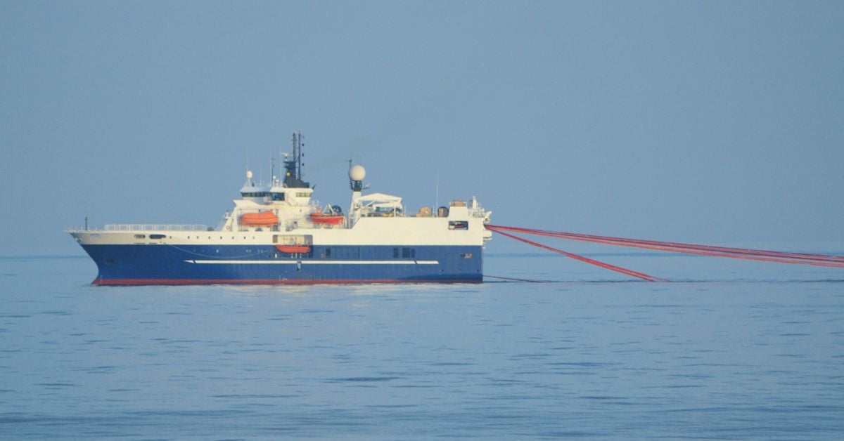
A 10,000-ton survey ship extends ocean intelligence to 5,000-meter depths
A 10,000-ton survey ship with a 5,000-meter drilling tool represents a new chapter in ocean intelligence. Chinese engineers have designed this 11,023-ton vessel to extend our empirical reach into the deep. It is a calibrated, measurable step toward understanding the abyss. For context on how we validate marine life as a climate indicator, see our related coverage of "Validating Northern Krill as a Calibrated Source of Ocean Protein."
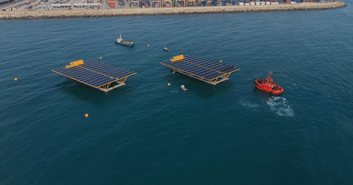
Floating solar enters European waters with Valencia's first pre-commercial array
València Port's first 1 MW floating solar array, now entering testing, marks a validated step for solar energy in European waters. This pre-commercial installation integrates renewable generation into a working port environment, offering measurable data for scaling ocean-based clean energy. Understanding drives protection, and empirical results from projects like this inform smarter coastal infrastructure. For deeper context on solar cost trends, see our related piece on the measured decline in solar costs tracking each doubling of global capacity.

Coast Guard Medevac Responds to Medical Need 86 Miles Off Hawaii
Eighty-six miles off Hawaii, the U.S. Coast Guard evacuated a sick crew member from a U.S.-flagged cargo ship on Wednesday, October 7. This medevac is a reminder that even far from shore, human need demands immediate, coordinated response. Such operations rely on the same integrated data ecosystems that help us track threats like the 350 million tons of annual plastic waste documented in our related coverage, "Tracking 350 million tons of annual plastic waste to its ocean sink."
Tracking 350 million tons of annual plastic waste to its ocean sink
350 million tonnes of plastic waste enters the global system each year, but where does it finally settle? Tracking this debris to its ocean sink requires calibrated, real-time data, the kind of integrated ocean intelligence that reveals the measurable impact of human activity. Understanding this pathway is protection in action. For deeper context on how we validate such environmental signals, see our related coverage of measured sea level rise validated across decades of ocean data.

Measured sea level rise validated across decades of ocean data
Measured sea level rise, validated across decades of ocean data, tells a clear story. Seasonal estimates from Church and White (2011) align with the University of Hawaii's Fast Delivery data, both showing change in millimeters against the 1993-2008 average. This is empirical, peer-reviewed evidence of a measurable climate signal. For deeper context, our coverage of 2025 Temperature Anomalies reveals how these climate indicators connect. Understanding drives protection.
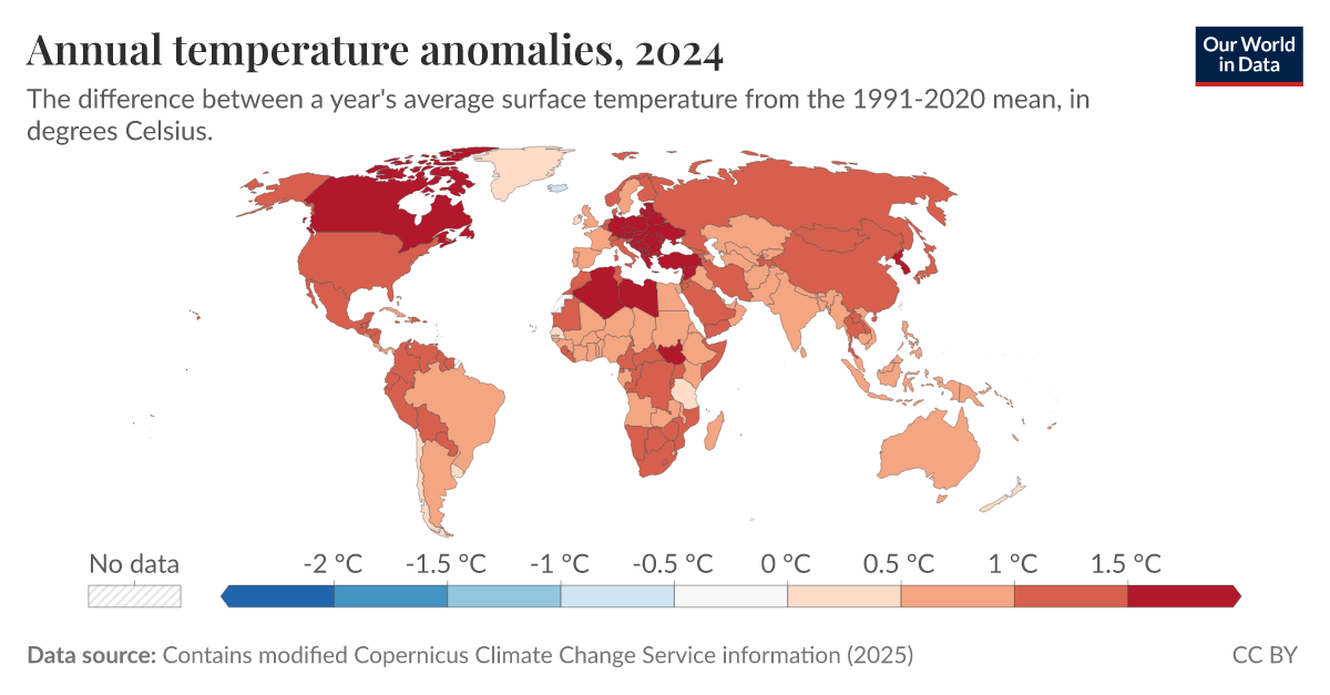
2025 Temperature Anomalies Reveal a Measurable Climate Signal
The 2025 temperature anomalies present a measurable, validated climate signal, not a speculative projection. These annual readings offer empirical evidence of systemic change, reinforcing the urgency of integrated ocean intelligence. Understanding drives protection, and this data sharpens our focus. For deeper context on how warming oceans reshape global systems, see our related coverage on seismic data revealing intensifying wave energy. These findings demand a shared, collaborative response grounded in scientific integrity.

Seismic data reveals warming oceans are intensifying global wave energy
Seismic data is giving us a measurable, real-time look at how warming oceans are intensifying global wave energy. Richard Aster, a geophysics professor at Colorado State University, presents empirical evidence that connects rising ocean temperatures directly to increasing wave power. This is not speculation; it is a validated, peer-reviewed finding that underscores the urgency of ocean stewardship. For deeper context, readers may explore "A Shared Data Ecosystem to Deepen Global Ocean Understanding."

A Shared Data Ecosystem to Deepen Global Ocean Understanding
Understanding drives protection. On World Oceans Day, a new e-book makes the case for a shared data ecosystem, one that unites researchers, government agencies, students, and technology around a single goal: deeper ocean intelligence. This is not about isolated studies; it is about an integrated data ecosystem where calibrated, real-time observations become climate indicators we can act on. For those tracking the human and environmental pressures reshaping marine science, this collaborative framework is a practical step forward.
Validating the global ocean mixed layer with a profile-based climatology
A new study in AGU Publications validates the global ocean mixed layer using a profile-based climatology, offering empirical rigor to a critical climate indicator. Understanding this boundary between surface and deep waters is measurable, and this work strengthens the integrated data ecosystem we rely on. For deeper context on how shared data deepens global ocean understanding, our e-book "A Shared Data Ecosystem to Deepen Global Ocean Understanding" explores that collaborative framework.