Scientists find a huge hidden ice reservoir beneath Utah’s mountains
Our take
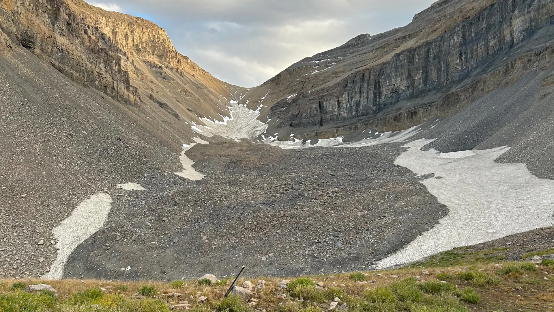
The recent discovery of a substantial ice reservoir beneath Mount Timpanogos in Utah offers a compelling new dimension to our understanding of freshwater storage and climate dynamics. Utilizing gravity measurements to map the buried glacier in three dimensions, researchers have revealed an ice volume equivalent to 600 Olympic swimming pools – a significant finding that underscores the potential for widespread, previously unquantified freshwater reserves globally. This discovery builds upon existing research exploring the complexities of past climate conditions, as highlighted in “Mapped: How ‘proxy’ data reveals the climate of the Earth’s distant past - Carbon Brief,” showcasing the critical role of indirect indicators in reconstructing historical climate patterns. The formation of these rock glaciers, where falling debris effectively buries and preserves snow for millennia, suggests a far more pervasive mechanism for ice accumulation than previously recognized, and its implications extend beyond the immediate region of Utah. Understanding how these systems function is vital, particularly as we grapple with the impacts of a changing climate on regional water resources.
The significance of this finding lies not just in the sheer volume of ice uncovered, but in the broader implications for regional hydrology and climate modeling. The research suggests that similar rock glacier formations may exist across mountainous regions worldwide, potentially storing tens of gigatons of hidden water – a substantial amount with implications for water availability during warmer periods. The process itself, where debris acts as an insulator, preserving snow and allowing it to accumulate over extended timescales, is a crucial mechanism in maintaining water resources in arid and semi-arid environments. Furthermore, the discovery connects to ongoing investigations into the deep Earth’s influence on climate, as explored in “Forces deep inside Earth helped Antarctica freeze before the Arctic,” demonstrating how geological processes can profoundly impact ice sheet formation and stability over vast time scales. The ability to accurately map and quantify these hidden reserves is critical for developing informed water management strategies and refining climate predictions. We see a similar application of geophysical techniques in our own work, such as when exploring the ocean floor in Indian EEZ and asking “What is the deepest point on the ocean floor in Indian EEZ?” – both studies highlight the power of advanced mapping to reveal previously unknown features and resources.
The methodology employed – gravity measurements – is particularly noteworthy. This non-invasive technique allows scientists to infer the presence and distribution of subsurface ice without direct excavation, providing a scalable approach for assessing similar formations across diverse terrains. The longitudinal nature of data collection and analysis, a hallmark of rigorous scientific inquiry, strengthens the validity of these findings and allows for a more accurate assessment of ice volume and persistence. This contrasts with traditional methods that are often localized and less representative of the broader geological context. The validated data generated through this process contributes to a more comprehensive understanding of the Earth's cryosphere and its role in the global water cycle. Empirical evidence of such widespread ice storage reinforces the need for continued investment in remote sensing technologies and geophysical surveys to better characterize these hidden reservoirs.
Looking ahead, the most pressing question revolves around the potential for these buried ice reservoirs to contribute to regional runoff as temperatures rise. Will these formations act as a buffer, slowly releasing water and mitigating the impacts of drought, or will they rapidly melt, leading to unpredictable flooding and ultimately diminishing water resources? Further research is needed to calibrate climate models to account for the presence and behavior of rock glaciers, ensuring more accurate predictions of future water availability. Understanding the dynamics of these hidden ice stores is not merely an academic exercise; it is a matter of ensuring the long-term sustainability of water resources in a rapidly changing world.
Read on the original site
Open the publisher's page for the full experience