geomorphology
World Data Ocean keeps geomorphology in one place: 6 stories so far. The section currently leads with “Atoll systems: a critical yet overlooked frontier in coral reef conservation”, “Digital Twin Reveals Vulnerable Atoll, Enabling Ocean Monitoring”, and “Massive Iceberg Calving and Transit: A Longitudinal Arctic Observation”. Atolls cover 27,211 km² of mapped shallow reefscape across 309 Indo-Pacific systems, representing 41.5% of all reef area in the region. Remote coral atolls like Oeno remain critically under-observed, not because they lack importance, but because isolation makes traditional surveys nearly impossible. A Global Hub for Ocean Intelligence 4 World Data Ocean is a centralized digital platform where researchers, scientists, and ocean enthusiasts converge to… The list below is every geomorphology story on World Data Ocean, newest first.

Atoll systems: a critical yet overlooked frontier in coral reef conservation
Atolls cover 27,211 km² of mapped shallow reefscape across 309 Indo-Pacific systems, representing 41.5% of all reef area in the region. That makes them one of the world's major coral reef networks by area, yet they remain largely overlooked in conservation planning. These dynamic reef-ocean-land systems may also harbor corals with elevated thermal tolerance, positioning them as critical local-to-regional coral sources as warming accelerates. Understanding drives protection. For deeper context on accelerating ocean change, see "Ocean's early warnings grow urgent as climate signals accelerate."
Digital Twin Reveals Vulnerable Atoll, Enabling Ocean Monitoring
Remote coral atolls like Oeno remain critically under-observed, not because they lack importance, but because isolation makes traditional surveys nearly impossible. This digital twin changes that. By integrating satellite imagery, drone data, and acoustic bathymetry into a single calibrated framework, the team has produced the first high-resolution representation of the atoll's lagoon, benthic habitats, and terrestrial structure. It is a practical, scalable model for monitoring shoreline evolution and coral bleaching, and a clear demonstration that integrated geospatial data can close observation gaps elsewhere.

Massive Iceberg Calving and Transit: A Longitudinal Arctic Observation
A 76-square-kilometer iceberg broke from Greenland's Petermann Glacier in August 2026, the Arctic's largest calving event in six years. It struck Joe Island yet held together, and satellites now track its drift through Nares Strait. Such empirical, real-time observation is essential for calibrating climate indicators. Understanding drives protection. For deeper context on Arctic maritime shifts, see our coverage of Russia's icebreaker fleet revenue plans.
Arctic Glacier Retreat Creates New Coastal Lagoons, Expanding Ecosystems
Retreating glaciers across the Arctic are redrawing coastlines, and Svalbard now hosts a growing number of coastal lagoons where none existed before. These newly emerged paraglacial systems remain largely absent from regional monitoring, despite their rapid expansion. We see this as a missed opportunity: the lagoons form a developmental continuum, from glacier-influenced basins to biologically structured systems, and early evidence suggests they act as biogeochemical reactors, including potential methane sources.
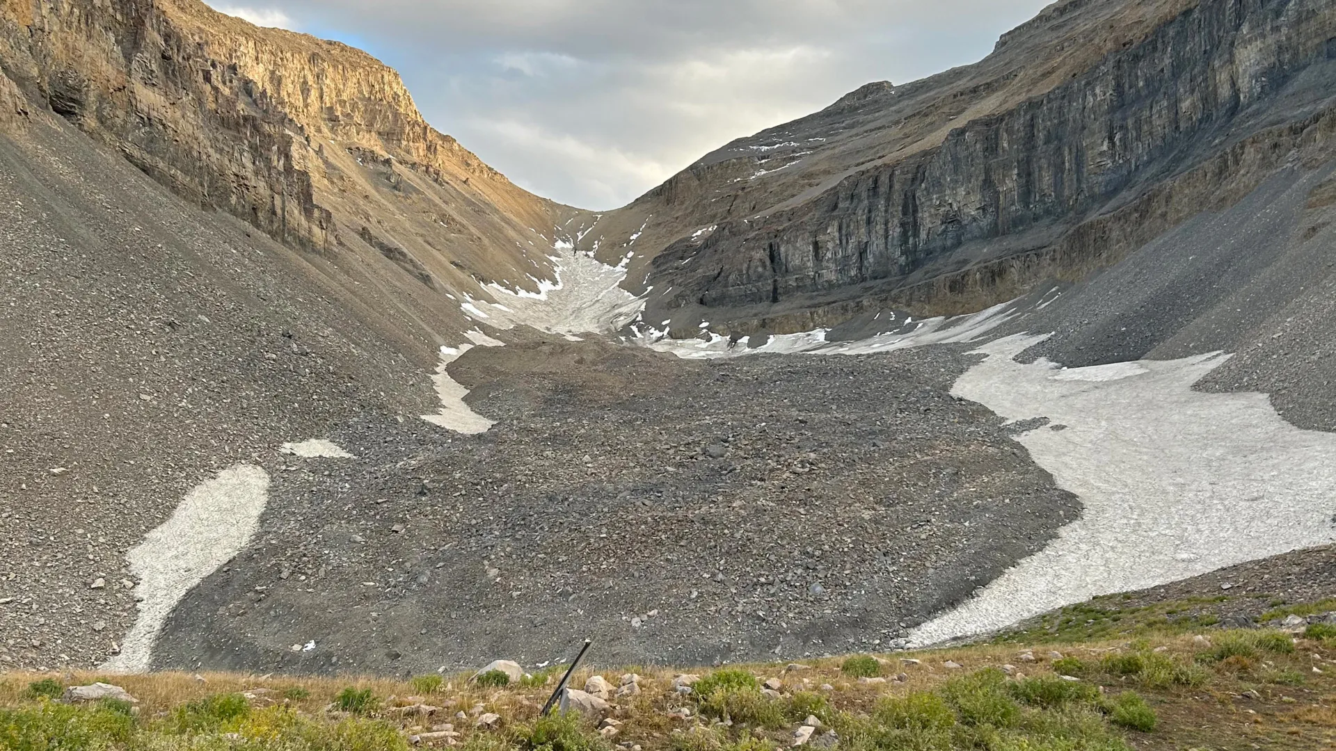
Hidden Ice Reservoir Discovered Beneath Utah’s Mountains
Beneath Mount Timpanogos's rocky slopes, gravity measurements have revealed a buried glacier composed of 83% ice, holding enough water to fill 600 Olympic swimming pools. This discovery clarifies how rock glaciers form when debris preserves persistent snow for millennia. The find is a measurable reminder that hidden water reserves may exist worldwide, potentially storing tens of gigatons. It complements our coverage of Cascadia's Subduction Zone Reveals a Fragmented Tectonic Process, reinforcing how much of Earth's subsurface dynamics remain unseen yet consequential.
Analyzing Coastal Change: Equilibrium of Rizhao's Artificial Beach.
Rizhao's artificial beach is a laboratory of sediment, tide, and time, and new analysis reveals the fragile equilibrium that keeps it viable. This isn't static engineering; it's a calibrated, ongoing negotiation with natural forces. The findings validate what we advocate: coastal resilience depends on empirical, longitudinal observation. As port activity surges elsewhere, as our coverage of record Chinese exports shows, the pressure on these engineered shorelines only intensifies. Understanding that balance is no longer optional; it is the foundation of lasting ocean intelligence.