remote sensing
33 stories filed under remote sensing on World Data Ocean. The newest of them: “AI Illuminates the Ocean's Hidden Data, From Surface to Seafloor”, “Two weeks after launch, Sentinel-3C delivers calibrated first views of a changing ocean”, and “Front lines recede as ocean warming reshapes chlorophyll trends”. From orbit to seafloor, the ocean holds more data than we can currently interpret. Two weeks after launch, Sentinel-3C has already delivered calibrated first views of a changing ocean, from the frozen Arctic to the Caribbean. A Global Hub for Ocean Intelligence 4 World Data Ocean is a centralized digital platform where researchers, scientists, and ocean enthusiasts converge to… The list below is every remote sensing story on World Data Ocean, newest first.

AI Illuminates the Ocean's Hidden Data, From Surface to Seafloor
From orbit to seafloor, the ocean holds more data than we can currently interpret. This review examines how artificial intelligence and machine learning are transforming our ability to analyze complex, unevenly sampled datasets across physical oceanography, ecology, and engineering. The findings are pragmatic: AI excels at predicting currents, reconstructing subsurface conditions, and classifying marine life. Yet the authors rightly caution that sparse observations and black-box models limit reliability.
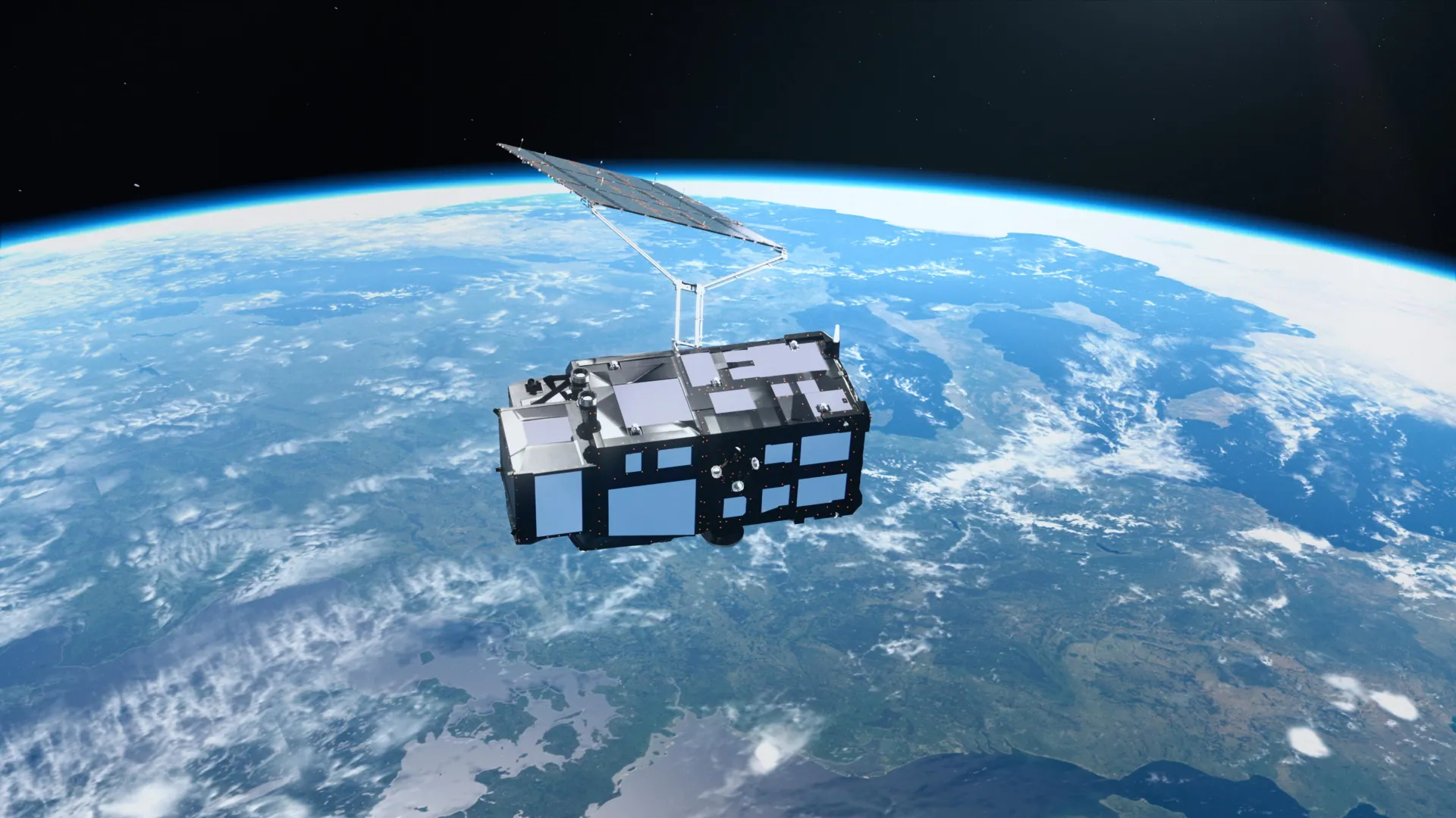
Two weeks after launch, Sentinel-3C delivers calibrated first views of a changing ocean
Two weeks after launch, Sentinel-3C has already delivered calibrated first views of a changing ocean, from the frozen Arctic to the Caribbean. These early measurements validate the satellite's capacity to track rising seas and melting ice with empirical precision. Understanding drives protection, and this instrument is now part of an integrated data ecosystem. For context on how such observations support coordinated maritime action, see our coverage of Europe's COASTEX 2026 trial.
Front lines recede as ocean warming reshapes chlorophyll trends
Front lines of ocean productivity are shifting, and not toward recovery. A new study in *Nature* reveals that as the ocean warms, chlorophyll trends are being reshaped, with frontal boundaries receding in response. This is measurable, empirical evidence that climate indicators are rewriting marine ecology in real time. Understanding these patterns drives better protection. For deeper context on how we track these planetary signals, see our coverage of atmospheric CO₂ reaching record highs in 2024, validated by global data from the WMO.
Daily Global Eddy Tracks Now Calibrated for Ocean Intelligence
Daily global mesoscale eddy tracks have now been calibrated for ocean intelligence, offering scientists a validated, real-time view of these powerful rotating currents from satellite altimetry. This dataset transforms how we measure ocean energy transport and climate indicators. Understanding these eddies is essential, and for deeper context on ocean carbon fluxes, the ECCO‑Darwin model delivers first multi‑decadal global ocean CO₂ flux estimates. From orbit to ocean floor, we are building an integrated data ecosystem for a measurable, shared future.
A calibrated shipboard dataset now measures the full ocean water cycle
A calibrated shipboard dataset now measures the full ocean water cycle from the deck of a vessel. OceanRAIN delivers validated, real-time data on all water-cycle components, giving us an empirical view of precipitation and evaporation at sea. This is ocean intelligence built on measurement, not model. Understanding drives protection. For a deeper look at how marine environments can host next-generation computing infrastructure, see our coverage of submerged servers validating a new frontier for efficient ocean intelligence.

Open Source Data Charts a Measurable Course for Global Ocean Mapping
A new open-source data framework charts a measurable course for global ocean mapping, turning fragmented observations into a coherent, integrated data ecosystem. This isn't abstract theory, it's a calibrated, peer-reviewed foundation for action. We see this as essential to building ocean intelligence. For a deeper look at how empirical data traces pollution back to its sources, see our related piece, "Tracing ocean plastic to its land-based sources via empirical data." Understanding drives protection.
Machine learning sharpens two decades of East China Sea carbon flux insight
Two decades of satellite data now reveal a sharper truth about the East China Sea: machine learning has cut prediction errors in turbid waters by 81 percent, and the region's carbon budget is not what conventional models claimed. By classifying optical regimes and applying a CatBoost model, this study shows turbid waters act as a weak source, not a sink, overestimating uptake by nearly half. That correction matters. Understanding drives protection, and here, precision changes the map.
Satellite Imagery Reveals South Georgia's Elephant Seal Population Assessment
Satellite imagery has delivered the first comprehensive count of South Georgia's elephant seals in nearly three decades, and the numbers carry weight. We estimate 107,630 breeding females, down from 113,444 in 1995, but the authors rightly caution against reading this as stability. The census followed highly pathogenic avian influenza through the region, so this is a perturbed population, not a baseline. It is a reminder that remote, challenging sites need innovative tools.
Hydrographic Surveyors Share Data, Expanding Ocean Intelligence Insights
When hydrographic surveyors share their datasets, they turn individual measurements into a shared foundation for ocean intelligence. This collaborative act strengthens the integrated data ecosystem that informs navigation, climate indicators, and marine policy. We see this as a practical step toward measurable progress. For those tracking how such information shapes regional stability, our related piece on Ukraine's support for India's Black Sea shipping initiative offers useful context. Sharing data is not just transparent; it is how we build a more resilient understanding of our oceans.
Mediterranean Phytoplankton Diversity Shifts Observed Over 25 Years
In the Mediterranean, the balance of phytoplankton is shifting, and the implications reach far beyond the water's surface. Over 25 years, our analysis of satellite-derived chlorophyll data reveals a basin-wide decline in bulk chlorophyll, paired with a consistent move from larger to smaller organism classes. Diatoms and Green Algae are retreating in relative abundance while Prokaryotes rise, suggesting a potential weakening of the biological carbon pump and the silica cycle. These changes are subtle but measurable, and they underscore why long-term, validated ocean intelligence matters.

Controlling the Cosmos: Space-Based Illumination and the Future of Night
A satellite that beams light on demand sounds like a solution in search of a problem, until you consider who gets to decide what that means. Astronomers are rightly concerned: the night sky is not a blank canvas for commercial convenience. Illumination on command reshapes more than visibility; it reshapes our shared scientific baseline. We think this is a conversation about governance as much as technology.
Digital Twin Reveals Vulnerable Atoll, Enabling Ocean Monitoring
Remote coral atolls like Oeno remain critically under-observed, not because they lack importance, but because isolation makes traditional surveys nearly impossible. This digital twin changes that. By integrating satellite imagery, drone data, and acoustic bathymetry into a single calibrated framework, the team has produced the first high-resolution representation of the atoll's lagoon, benthic habitats, and terrestrial structure. It is a practical, scalable model for monitoring shoreline evolution and coral bleaching, and a clear demonstration that integrated geospatial data can close observation gaps elsewhere.

Massive Iceberg Calving and Transit: A Longitudinal Arctic Observation
A 76-square-kilometer iceberg broke from Greenland's Petermann Glacier in August 2026, the Arctic's largest calving event in six years. It struck Joe Island yet held together, and satellites now track its drift through Nares Strait. Such empirical, real-time observation is essential for calibrating climate indicators. Understanding drives protection. For deeper context on Arctic maritime shifts, see our coverage of Russia's icebreaker fleet revenue plans.

Mapping the Ocean Floor: Geospatial Innovation Drives Global Discovery
The ocean floor remains Earth's least mapped frontier, yet geospatial innovation is closing that gap with measurable precision. This piece from Geography Realm examines how integrated data ecosystems and calibrated technologies are accelerating the effort to complete a global seafloor map. It is a practical, empirical look at a monumental task. For readers tracking maritime infrastructure's role in this work, our coverage of Van Oord's new fallpipe vessels, "Vindnes and Vestnes," offers a fitting complement.
Ocean Potential Detected on Distant Exoplanet, Data Sparks Debate.
A planet 124 light-years away may hold a global ocean beneath a hydrogen-rich atmosphere, and the data is already sparking debate. Webb has delivered two tentative hints of dimethyl sulfide, a gas tied to marine microbes on Earth, yet independent analyses dispute the find. That tension is the story: not certainty, but calibrated curiosity. We read this as a reminder that ocean intelligence grows through rigorous questioning. For context on how we assess such systems, our World Ocean Assessment coverage offers a grounded counterpoint.
Mapping Ocean Winds: NASA Data Fuels New Integrated Atlases
NASA's new integrated atlases turn decades of satellite measurements into a single, coherent view of ocean winds. This is more than data compilation; it is the kind of calibrated, peer-reviewed synthesis that makes our ocean intelligence actionable. The clarity here is a direct result of validated science, and it sets a standard for how we track climate indicators. For those following how such monitoring connects to broader maritime security, our coverage of the Puntland tanker rescue offers a stark contrast in real-world stakes.
Empowering Ocean Insights: Global Fishing Watch Data Now in ArcGIS.
Global Fishing Watch data is now live in ArcGIS Online and the Living Atlas, bringing validated, real-time ocean intelligence directly into the hands of researchers and policymakers. This integration is a practical step toward measurable stewardship, and we're glad to see it. For those tracking enforcement efforts, our related piece on Maritime Interdictions shows how such tools support security at sea. Understanding drives protection, and this data ecosystem makes that understanding more accessible than ever.
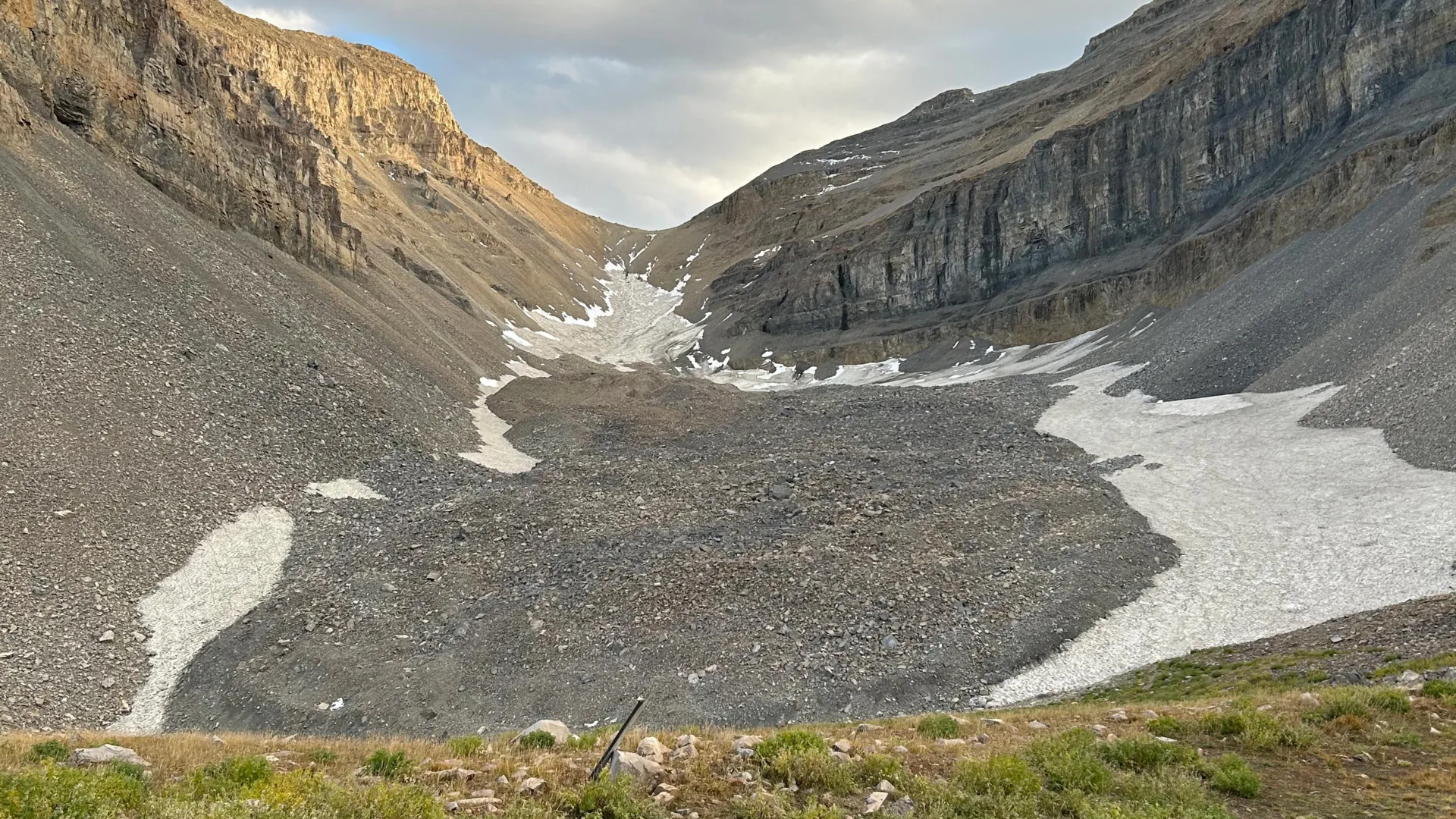
Hidden Ice Reservoir Discovered Beneath Utah’s Mountains
Beneath Mount Timpanogos's rocky slopes, gravity measurements have revealed a buried glacier composed of 83% ice, holding enough water to fill 600 Olympic swimming pools. This discovery clarifies how rock glaciers form when debris preserves persistent snow for millennia. The find is a measurable reminder that hidden water reserves may exist worldwide, potentially storing tens of gigatons. It complements our coverage of Cascadia's Subduction Zone Reveals a Fragmented Tectonic Process, reinforcing how much of Earth's subsurface dynamics remain unseen yet consequential.
Mapping American Samoa's Depths: An Exploration of Ocean Intelligence.
Beneath the waves of American Samoa lies a terrain as uncharted as it is vital, and this latest expedition turns raw data into actionable insight. We're encouraged by how this work transforms seabed mapping into a tool for stewardship, not just discovery. It's precise, purposeful, and exactly the kind of empirical effort our shared ocean future demands.

Mapping the Earth's Hidden Layers with Seismic Rumbles
Beneath our feet, the ground is rarely silent. Scientists have turned fiber-optic cables into seismic ears, capturing the faint rumble of "thunderquakes" to map the hidden layers of the Earth. It is a clever recalibration of existing infrastructure, transforming a network of light into a tool for urban hazard detection. This approach offers a measurable way to see what is buried below, and it pairs well with our coverage of the Cascadia Subduction Zone, which reveals a similarly fragmented tectonic process.
Mapping American Samoa’s Depths: An Exploration with Advanced Underwater Technology
American Samoa's waters hold more than meets the eye, and this expedition proves it. Mapping these depths with advanced underwater technology reveals a seabed shaped by volcanic force and time, a place where bathymetry becomes biography. We find this work compelling because it turns raw data into actionable ocean intelligence, grounding conservation in measurable truth. For those seeking the broader picture, our related article, "Mapping American Samoa's Seabed: An ROV Exploration in 2026," expands on the tools behind this effort.
Mapping Marine Connections: Understanding Biodiversity’s Role in Ocean Health
Marine species do not drift idly in the current; they are the ocean's connective tissue, moving energy and nutrients across entire basins. Marine Functional Connectivity science is making that invisible web visible, yet our knowledge remains fragmented. We can now track migrations through genetics and telemetry, but major gaps persist across depths and regions. This is not an abstract research problem. It is a governance failure.
Tracking Plastic's Reach: Ocean Intelligence from Remote Waters.
Plastic debris doesn't stay where we drop it. New tracking from remote waters shows how far it travels, and the data is telling a clearer story than ever before. This kind of ocean intelligence turns scattered observations into something measurable, something we can act on. It's a reminder that the problem isn't out of sight, just out of sightlines. For readers drawn to the unseen, our piece on unidentified marine life offers a complementary glimpse into what else moves beneath the surface.
Nitrogen Fixation Linked to Ocean Conditions in Northern Australia
Along Australia's northern coast, Trichodesmium blooms paint the surface in visible slicks, a signal of active nitrogen fixation. During a 1999 cruise from Townsville to Broome, we mapped these diazotrophs alongside picophytoplankton, linking their distribution to distinct water masses identified through cluster analysis. Where Trichodesmium thrived, it drove up to 25% of primary production and dominated surface biomass.