seabed
16 stories filed under seabed on World Data Ocean. The newest of them: “The silent fiber-optic highways shaping global connectivity beneath the waves”, “Malaysia restricts tanker traffic and bunkering in new Strait marine protected zone”, and “The 25-Day Countdown to Shape Deep Sea Mining's Future”. The silent fiber-optic highways beneath the waves carry our emails, video calls, and banking transactions every second, yet we rarely acknowledge their existence. Malaysia has taken a measured but decisive step in its newest marine protected zone, restricting tanker traffic and bunkering while imposing speed limits on all vessels. A Global Hub for Ocean Intelligence 4 World Data Ocean is a centralized digital platform where researchers, scientists, and ocean enthusiasts converge to… The list below is every seabed story on World Data Ocean, newest first.
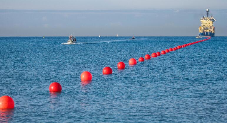
The silent fiber-optic highways shaping global connectivity beneath the waves
The silent fiber-optic highways beneath the waves carry our emails, video calls, and banking transactions every second, yet we rarely acknowledge their existence. This invisible infrastructure demands the same rigorous attention we give to climate indicators above the surface. Understanding drives protection. Our recent analysis of Berkeley Earth's empirical data on 2025 global temperature trends confirms measurable warming that directly impacts these submarine networks. The ocean's health is our connectivity's health.
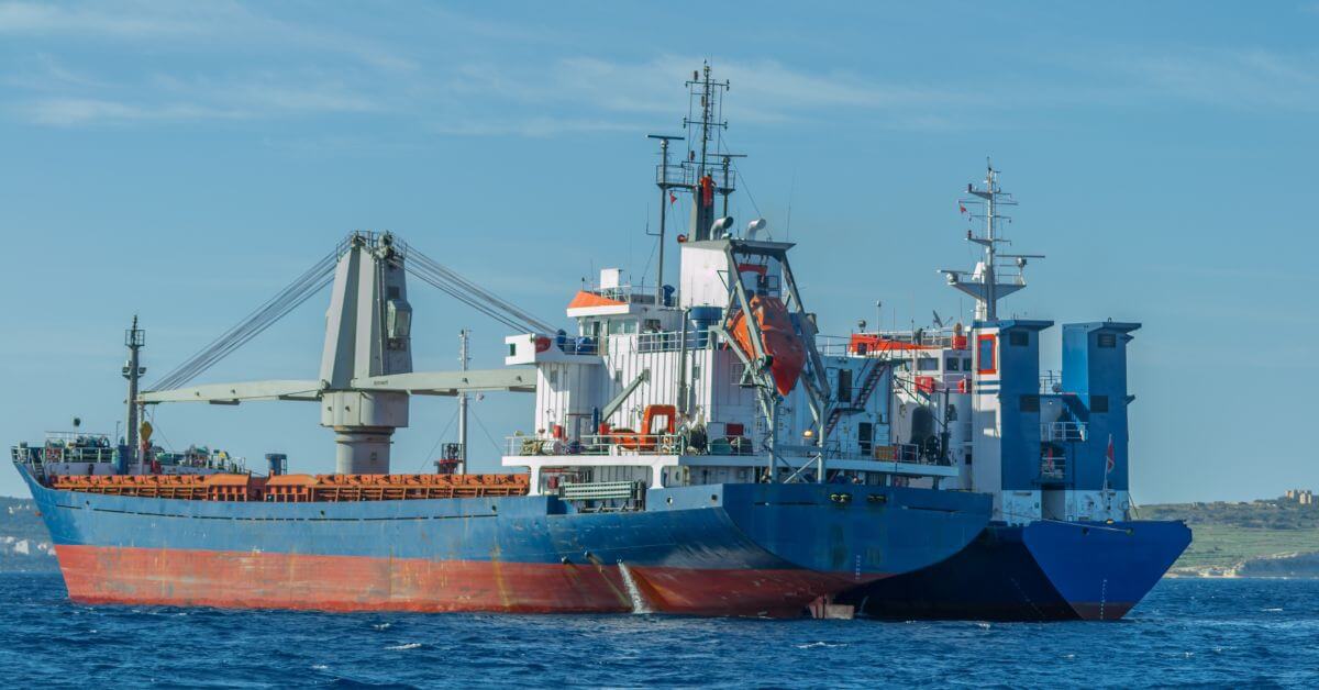
Malaysia restricts tanker traffic and bunkering in new Strait marine protected zone
Malaysia has taken a measured but decisive step in its newest marine protected zone, restricting tanker traffic and bunkering while imposing speed limits on all vessels. Large cargo ships and oil tankers are now forbidden from entering the Strait. This is a calibrated move to protect critical marine habitat without shutting down commerce entirely. For those tracking how citizen science can inform ocean policy, our piece on identifying an unidentified marine object from citizen observations in Tarifa offers a parallel example of community-driven data collection.
The 25-Day Countdown to Shape Deep Sea Mining's Future
Twenty-five days remain for public comment on The Metal Company's deep sea mining application, yet only 228 submissions have landed. That number stands in stark contrast to previous notice periods, where online campaigns generated thousands of responses. The silence is puzzling, especially given the surge of TikTok awareness earlier. One wonders if the urgency faded or if the conversation simply migrated. For those seeking deeper context, our related piece on verifying historical deep-sea claims offers a useful parallel.
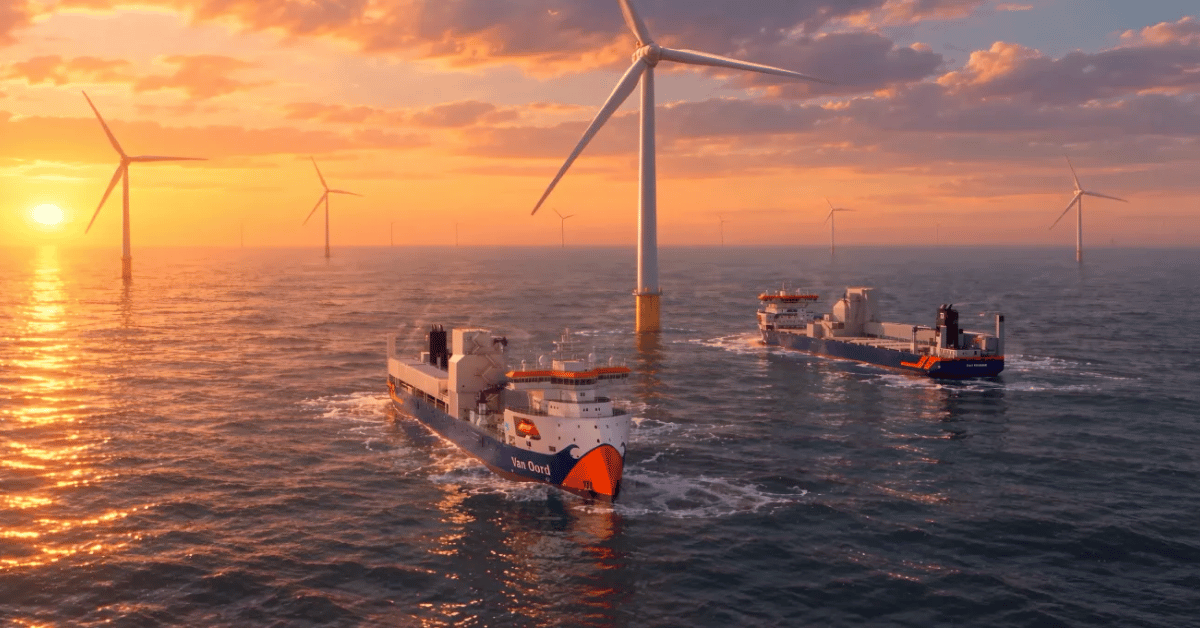
Vindnes and Vestnes: New Fallpipe Vessels Advance Subsea Rock Installation
Van Oord's decision to name its two new 35,000-tonne flexible fallpipe vessels Vindnes and Vestnes signals a measured step forward in subsea rock installation. Scheduled for delivery in 2028 and 2029, these ships will expand the capacity for precise, large-scale marine construction. The investment reflects a practical commitment to meeting rising demand for offshore energy infrastructure, where dependable seabed preparation matters.

Centennial TNT Leak Highlights Risks from Historic Submarine Wrecks
A century after sinking, a World War I submarine wreck off Denmark is leaking TNT into the surrounding water, seabed, and marine life. This is not a distant historical footnote, it is a measurable, real-time warning. Thousands of similar corroding wrecks could pose growing environmental risks. Understanding drives protection. For deeper coverage of maritime challenges, see our related article on India's expanded naval fleet, which reflects the evolving pressures on our oceans.
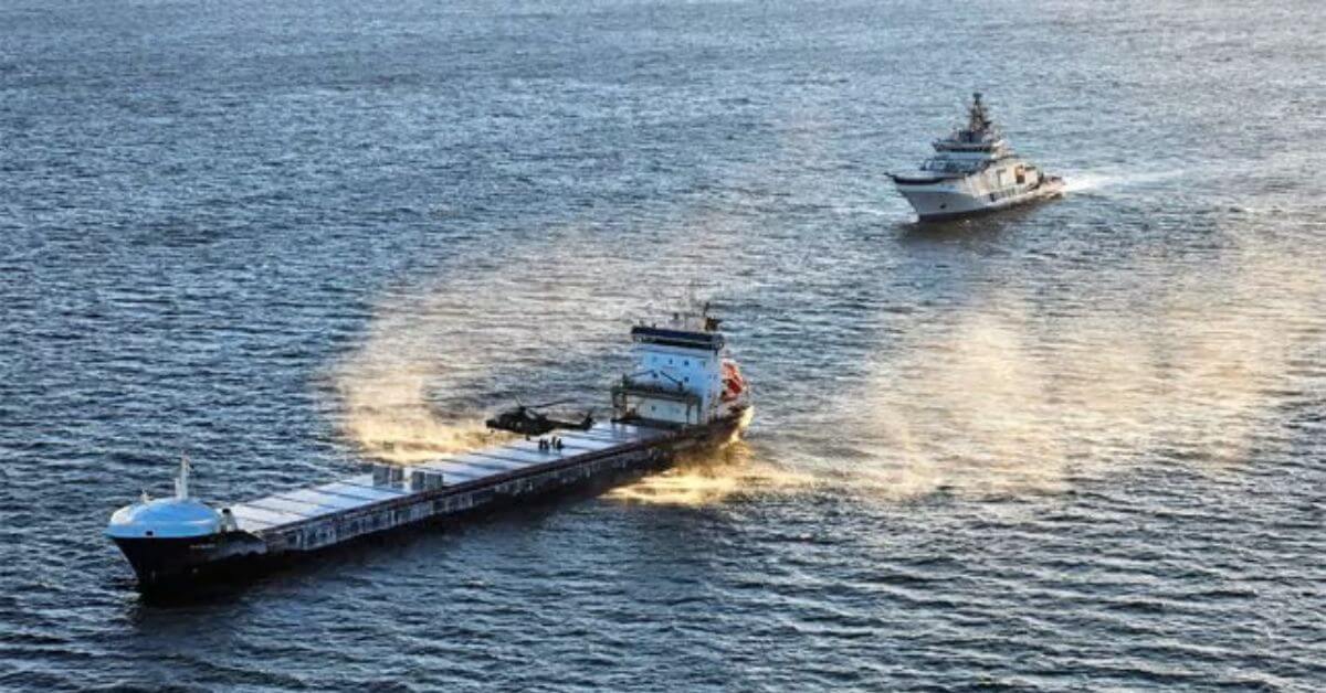
Subsea Cable Damage Trial: Finnish Court Considers Penalties for Ship's Crew
Prosecutors in Finland are seeking prison sentences of at least two years and six months for a ship's crew in a subsea cable damage trial. This case underscores the tangible legal consequences when critical ocean infrastructure is compromised. Validated accountability matters here. The proceedings reflect an integrated approach to protecting the data ecosystems that underpin global climate monitoring. For deeper context on the vessels involved in seabed operations, see our coverage of Van Oord's *Vindnes and Vestnes* new fallpipe vessels. Understanding drives protection.
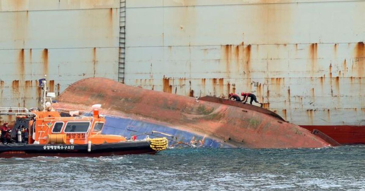
Tugboat Sinking Near Busan: Search Underway for Six Missing Crew.
A 286-tonne tugboat capsized and sank east of Oryukdo Island, leaving six crew members missing. The TNS Catcher went down at roughly 1:29 p.m., fully disappearing beneath the surface by 3:27 p.m. Search operations are underway, and every minute matters in these waters. Maritime emergencies like this remind us how quickly conditions can turn. For broader context on recent incidents, our coverage of the cargo ship fire near Mykonos offers a similar case of rapid response.

Mapping the Ocean Floor: Geospatial Innovation Drives Global Discovery
The ocean floor remains Earth's least mapped frontier, yet geospatial innovation is closing that gap with measurable precision. This piece from Geography Realm examines how integrated data ecosystems and calibrated technologies are accelerating the effort to complete a global seafloor map. It is a practical, empirical look at a monumental task. For readers tracking maritime infrastructure's role in this work, our coverage of Van Oord's new fallpipe vessels, "Vindnes and Vestnes," offers a fitting complement.
Ocean Intelligence: Measuring Change in the Underwater World.
The ocean's most consequential changes often occur beyond the reach of sunlight, yet measuring them demands precision that matches the depths. NOAA's National Centers for Environmental Information anchors this effort, turning raw underwater data into validated, climate-ready intelligence. That rigor matters; without it, we are guessing at the pulse of a system that regulates everything. For those tracking how marine infrastructure evolves alongside such monitoring, our piece on Van Oord's new fallpipe vessels, *Vindnes* and *Vestnes*, offers a fitting glimpse of industrial adaptation.

Acadia: Pioneering Subsea Rock Installation for Coastal Resilience
The Acadia now holds the title of the first U.S.-flagged, Jones Act-compliant subsea rock installation vessel, a milestone that sharpens our domestic coastal resilience capabilities. Great Lakes Dredge & Dock Corporation's delivery of this SRIV is a measured step forward in protecting shorelines with precision. We see this as a practical expansion of ocean intelligence, not hype. For broader context on the technology's evolution, our coverage of Van Oord's Vindnes and Vestnes offers useful comparison. Understanding drives protection, and the Acadia strengthens that equation.

Subsea Cable Faults Prompt Australian Investigation of Potential Damage
Two subsea communication cables off Perth have failed in quick succession, and Australia's Federal Police is now assessing a report of criminality. That is a serious step, and it signals that authorities are not treating this as routine infrastructure strain. Sabotage is not confirmed, but the pattern warrants scrutiny. Vessels transiting these corridors have become a known risk, as recent coverage of Russian drone activity in the Mediterranean reminds us.
Underwater Explosions and Ocean Floor Exposure: A Scientific Examination.
Underwater detonations do more than disturb the seabed; they strip away the fragile sediment layers that hold centuries of climatic and biological record. This examination, submitted by /u/Lopsided-Fig6818, treats the exposed ocean floor as a scientific archive, not a casualty. We appreciate the focus on measurable, peer-reviewed evidence over alarm. For readers tracking how human activity reshapes marine geology, our related piece, "Integrated Subsea Infrastructure Shifts to Enhance Indian Ocean Connectivity," offers a parallel view of engineered change.

Container Ship Sinks Near Zhoushan; Typhoon Threatens Recovery Efforts
Aged 20 and already facing the sea's harshest realities, the container ship that sank near Zhoushan now confronts a second threat: an inbound typhoon is set to complicate salvage efforts. The vessel's fate underscores how quickly recovery can turn perilous, even for seasoned crews. Weather remains the great variable in maritime response, and this operation will test both patience and precision. For deeper context on how vessels endure such trials, our piece on the bulk carrier freed near Gladstone offers a useful counterpoint.
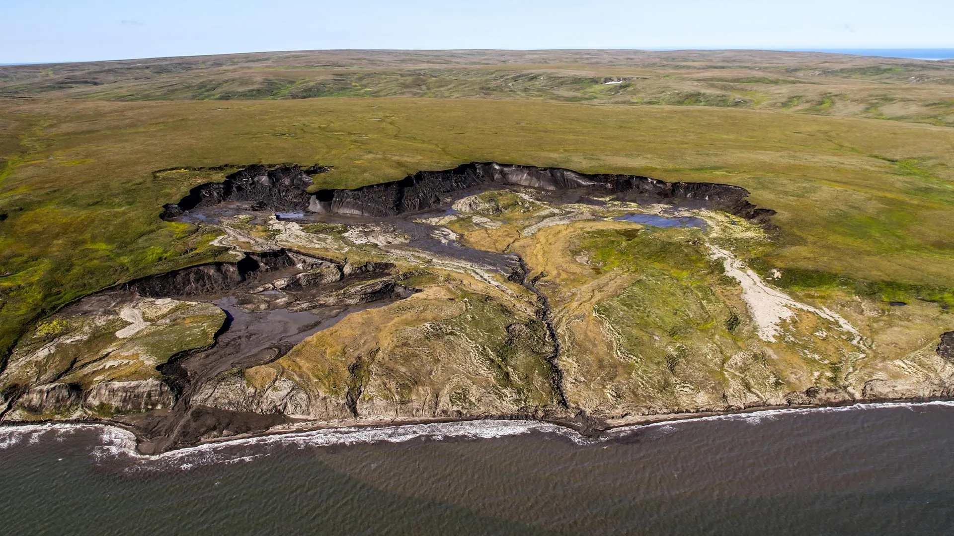
Arctic Carbon Release: Seafloor Sediment Limits Greenhouse Gas Impact
Sediment cores pulled from the seabed near Canada's Herschel Island deliver a measured counterpoint to alarm. Thawing permafrost is releasing ancient carbon into the ocean, yet the data show most of it gets buried in the seafloor, with only about 10 percent converted into greenhouse gases. That distinction matters for climate projections. We read this as a validation of integrated observation, not complacency.

Scaling Ocean Power: China's New Wind Converter Station Signals Progress
A hundred kilometers off Yangjiang's coast, China has switched on what it calls the "Heart of Offshore Wind," a new converter station designed to transmit clean energy from distant turbines to the grid. The move signals measurable progress in scaling ocean power, turning ambitious engineering into practical climate infrastructure. It is a reminder that offshore wind's next chapter depends less on turbine size alone and more on the integrated systems moving that energy ashore.
Exploring the Cook Islands Depths: A 2026 ROV Mission.
In early 2026, an ROV mission will descend into the waters surrounding the Cook Islands, where the seafloor remains largely uncharted. This is the kind of methodical, empirical work that turns raw data into ocean intelligence. By capturing validated, real-time imagery from the depths, the mission strengthens the integrated data ecosystem that researchers and policymakers rely on. For those tracking how these efforts connect, our piece on NOAA's calibrated ocean intelligence offers useful context. Understanding drives protection, and this expedition brings us closer to both.