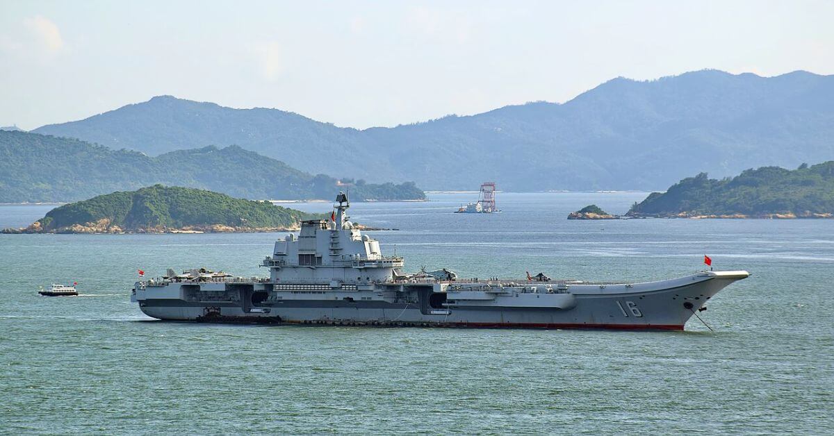
Parallel carrier-group movements in the western Pacific are not an ocean intelligence failure, they are the clearest signal yet that the region's maritime domain is being measured, mapped, and contested in real time. The Liaoning group's anticlockwise transit around the Philippine archipelago, overlapping with the Keen Sword exercise involving the USS Theodore Roosevelt, is a textbook demonstration of how empirical, observable naval behavior provides the data we need to understand strategic competition. For our readers, researchers, analysts, and policy practitioners, the practical question is not whether these forces will meet, but how we calibrate our understanding of risk when both sides are operating within the same integrated data ecosystem.
The route itself is informative. By passing through the Miyako Strait on October 14, turning south toward the South China Sea, and then heading past the southern Philippines, Liaoning has reversed its October 2024 trajectory. This is not random; it is a measurable pattern of behavior that, when combined with longitudinal tracking, reveals how China is validating its ability to operate beyond the first island chain under different geopolitical conditions. The presence of Type 055 destroyers Wuxi and Anshan alongside Liaoning confirms that this is a high-end, peer-reviewed (in the operational sense) capability demonstration. Meanwhile, the Keen Sword exercise runs from October 19 to 29 with forces from the United States, Japan, Australia, Canada, and France, a multinational calibration of allied interoperability. The two sets of forces are in the same broad operating area, but no evidence suggests either has altered its movements in response to the other. That restraint is itself a climate indicator worth watching.
This deployment also illustrates how A Measured Shift in Maritime Capacity Signals Evolving Ocean Intelligence is not an abstract concept. China's dominance in new ship orders, nearly 82% of global orders in the first three quarters of this year, directly funds the kind of sustained, far-sea training that Liaoning is now conducting. Every sortie, every interception (such as the J-15 fighters that warned off Japanese P-3C patrol aircraft in June), and every transit generates empirical data on readiness, logistics, and rules of engagement. Our related analysis on AI and oceanography converging to predict coastal cesium levels shows how hybrid frameworks can reconstruct and predict environmental concentrations from sparse observations. The same principle applies here: sparse, episodic carrier deployments can be integrated into probabilistic models of maritime risk, provided the data is collected and shared openly.
The specific consequence to watch is whether the Liaoning group's deployment overlaps with the conclusion of Keen Sword on October 29 and whether either side chooses to close the distance. If Japanese or Philippine vessels continue to shadow the Chinese formation, and if the USS Theodore Roosevelt remains on station, the empirical baseline for what constitutes safe separation will be tested. That test will produce measurable outcomes, radio communications, aerial intercepts, transit speeds, and formation spacing, that analysts can use to update their threat assessments. The ocean does not lie, and neither do the tracks these vessels leave behind. The takeaway is direct: this is not a crisis, but it is a data point. We should treat it as such, integrating it into the same rigorous frameworks we use to understand climate indicators and ocean health, because the two are increasingly inseparable.