Ever wonder how we keep track of the ocean’s "rainforests"? Kelp forests are the unsung heroes of our coastlines, provid...
Our take
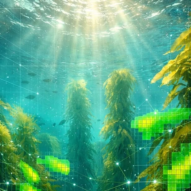
The recent World Data Ocean feature on kelp‑forest monitoring arrives at a pivotal moment for marine stewardship, echoing the data‑centric urgency highlighted in 30x30 means protecting 30% of the ocean by 2030. The goal is clear. The bottleneck is not ambition, it’s coverage: data ... and reinforcing the need for calibrated, longitudinal observations that can translate policy ambition into measurable outcomes. By leveraging AI‑driven deep‑learning pipelines, World Data Ocean moves beyond the “we think” paradigm that has long constrained coastal management, delivering a real‑time, integrated data ecosystem that resolves kelp canopies at tenfold the previous spatial resolution. This technical leap is not merely a showcase of computational prowess; it establishes a validated baseline from which empirical, peer‑reviewed assessments of habitat health can be derived, enabling policymakers to allocate resources with confidence and researchers to test climate‑indicator models against a richer, more precise dataset.
Kelp forests function as climate buffers, sequestering carbon, attenuating wave energy, and providing habitat for myriad species. Yet their cryptic underwater distribution has historically limited coverage, creating blind spots in global ocean intelligence. The new high‑resolution dashboards address this gap by fusing satellite‑derived bathymetry, multispectral imaging, and autonomous vehicle surveys into a calibrated product stream. The result is a measurable, longitudinal record that can be cross‑referenced with other coastal stressors, such as the hydrodynamic alterations explored in Impacts of jetty construction on hydrodynamics, seabed morphology and marine ecology: a case study of Tongzhou Bay, Nantong, China. By integrating these datasets, scientists can isolate the specific contribution of kelp to shoreline resilience, moving the discourse from anecdotal evidence to quantifiable impact. Moreover, the open‑access data portals invite collaboration across disciplines, fostering a global network of stakeholders who can co‑develop predictive models and test mitigation strategies in near real‑time.
The broader significance of this development lies in its capacity to operationalize the concept of “ocean intelligence” for climate adaptation planning. As coastal communities confront accelerating sea‑level rise and storm intensity, the ability to monitor kelp health with empirical precision becomes a cornerstone of adaptive governance. Decision‑makers can now anchor coastal resilience budgets to calibrated metrics—such as kelp canopy density trends or carbon uptake rates—rather than relying on periodic, coarse‑scale surveys. This shift also aligns with emerging international frameworks that demand transparent, verifiable data for biodiversity targets, reinforcing the credibility of conservation commitments and reducing the risk of greenwashing. In practice, the dashboards can inform where to prioritize restoration projects, how to design marine protected areas, and which socioeconomic sectors stand to benefit most from enhanced ecosystem services.
Looking ahead, the integration of AI‑enhanced kelp monitoring with other marine observatories promises a unified, real‑time portrait of ocean health. As the data volume grows, the challenge will be to maintain the rigor of peer‑reviewed validation while scaling computational pipelines. Future research should explore how these calibrated kelp metrics interact with broader climate indicators—such as sea surface temperature anomalies and nutrient fluxes—to refine predictive models of coastal ecosystem trajectories. The question that now beckons the community is whether this amplified visibility will translate into decisive, coordinated action that safeguards the blue planet for the next generation.
Read on the original site
Open the publisher's page for the full experience
Related Articles
- Ever wondered how long it takes to map a mountain range under the sea? Traditionally, it takes months of painstaking man...Ever wondered how long it takes to map a mountain range under the sea? Traditionally, it takes months of painstaking manual data processing. But at World Data Ocean, we're seeing a shift from months to mere days. For our 'Weekly Ocean Data & Innovation Highlights,' we're diving into the AI vs. Human speed gap. While a team of experts can spend weeks cleaning acoustic data, modern AI neural networks can process that same information up to 25x faster. This isn’t just about being quick: it’s about ocean intelligence in real-time. For our partners in conservation and the maritime industry, this speed is a game-changer. Faster mapping means faster protection for vulnerable ecosystems and smarter decisions for offshore operations. We're turning validated scientific data into immediate action. Science is moving fast, and we’re here to make sure you’re at the forefront of it. #OceanData #AIInnovation #MarineScience #DeepSeaMapping
- Imagine a living, breathing model of our ocean that predicts changes before they happen. This is the 'Digital Twin' of t...Imagine a living, breathing model of our ocean that predicts changes before they happen. This is the 'Digital Twin' of the ocean: a cornerstone of the UN Ocean Decade and the future of marine stewardship. At World Data Ocean, we’re bridging the gap between raw data and actionable intelligence. By integrating validated scientific datasets with real-time sensors, we are helping build this digital mirror. From tracking deep-sea temperature fluctuations to monitoring cyclone paths, our platform provides the high-fidelity data needed to simulate and understand complex marine ecosystems. This isn’t just a map; it’s an interactive, predictive tool for researchers, policymakers, and industry leaders to test solutions in a virtual environment before applying them to the real world. Together, we are creating a more transparent and sustainable ocean for everyone. Explore how we’re making ocean intelligence accessible at worlddataocean.com. #OceanDecade #DigitalTwin #OceanData #Sustainability
- Turning Passion into Professional-Grade Science 🌊📈 High-quality ocean data isn't just for the ivory tower anymore. The...Turning Passion into Professional-Grade Science 🌊📈 High-quality ocean data isn't just for the ivory tower anymore. The UN Ocean Decade recently released new guidelines for citizen science data sharing, and we’re here for it! At World Data Ocean, we’re bridging the gap between community passion and rigorous scientific standards. Our tools are designed to help you contribute data that researchers and policymakers can actually use for real-time decision-making. Whether you're tracking marine debris or monitoring local sea temperatures, let’s turn your observations into global impact. 🌍✨ Explore our data portals and see how you can contribute to a healthier ocean. [Link in Bio] #OceanDecade #CitizenScience #MarineData #TechForGood
- The future of marine research is looking a lot quieter, cleaner, and smarter. At World Data Ocean, we're watching the tr...The future of marine research is looking a lot quieter, cleaner, and smarter. At World Data Ocean, we're watching the transition from traditional survey ships to autonomous robotic fleets in real-time. Through our Ocean Infinity Operations, these sleek Uncrewed Surface Vessels (USVs) are revolutionizing how we collect data across huge stretches of the open sea. Why is this a massive win? For one, it’s about stewardship. These fleets significantly slash carbon emissions compared to traditional vessels. But it’s also about the science. By integrating AI and autonomous tech, we’re capturing ocean intelligence with a level of accuracy and scale that was once impossible. We’re moving from orbit to the ocean floor, ensuring every byte of data is validated and ready to drive real change. The future of marine surveys isn't just coming: it’s already out there, working 24/7. #MarineInnovation #OceanData #SustainableTech #AutonomousFleets