climate monitoring
World Data Ocean keeps climate monitoring in one place: 59 stories so far. The section currently leads with “2025 Global Temperature Data Confirms Measurable Warming Trends”, “2025 joins the warmest years on record as ocean heat persists without pause”, and “AI Illuminates the Ocean's Hidden Data, From Surface to Seafloor”. The 2025 global temperature data from Berkeley Earth confirms what empirical climate indicators have long signaled: warming trends are measurable and persistent. 2025 has been confirmed as one of the three warmest years on record, a stark validation of a persistent trend. A Global Hub for Ocean Intelligence 4 World Data Ocean is a centralized digital platform where researchers, scientists, and ocean enthusiasts converge to… The list below is every climate monitoring story on World Data Ocean, newest first.
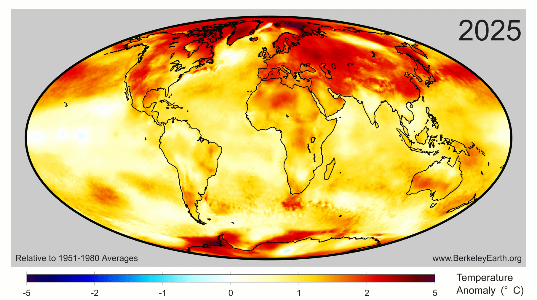
2025 Global Temperature Data Confirms Measurable Warming Trends
The 2025 global temperature data from Berkeley Earth confirms what empirical climate indicators have long signaled: warming trends are measurable and persistent. Since 2013, this independent non-profit has provided validated, peer-reviewed analyses of mean temperature changes. The findings are clear, and they demand purposeful attention. Understanding drives protection, and for deeper context on related pressures facing our oceans, see our piece "From waste to wave: measuring ocean plastic's true share."

2025 joins the warmest years on record as ocean heat persists without pause
2025 has been confirmed as one of the three warmest years on record, a stark validation of a persistent trend. The World Meteorological Organization reports that ocean heating continues without pause, and the past 11 years now constitute the 11 warmest ever measured. This is not a spike but a calibrated, measurable signal. Understanding drives protection. For deeper context on the ocean's role in this system, explore our related coverage of "From waste to wave: measuring ocean plastic's true share."

AI Illuminates the Ocean's Hidden Data, From Surface to Seafloor
From orbit to seafloor, the ocean holds more data than we can currently interpret. This review examines how artificial intelligence and machine learning are transforming our ability to analyze complex, unevenly sampled datasets across physical oceanography, ecology, and engineering. The findings are pragmatic: AI excels at predicting currents, reconstructing subsurface conditions, and classifying marine life. Yet the authors rightly caution that sparse observations and black-box models limit reliability.
Aligning Blue Finance Governance for China-ASEAN Ocean Climate Action
Blue finance must be understood as a governance mechanism, not merely a funding stream. This study builds a multi-agent framework to address the primary constraint on China-ASEAN cooperation: the lack of operational coordination among taxonomies, data systems, and verification protocols. Capital is not the bottleneck. Governance is. For deeper context on measurable ocean intelligence, see our related coverage on calibrating port resilience against cyclone-driven economic loss.

Measured sea level rise validated across decades of ocean data
Measured sea level rise, validated across decades of ocean data, tells a clear story. Seasonal estimates from Church and White (2011) align with the University of Hawaii's Fast Delivery data, both showing change in millimeters against the 1993-2008 average. This is empirical, peer-reviewed evidence of a measurable climate signal. For deeper context, our coverage of 2025 Temperature Anomalies reveals how these climate indicators connect. Understanding drives protection.

Seismic data reveals warming oceans are intensifying global wave energy
Seismic data is giving us a measurable, real-time look at how warming oceans are intensifying global wave energy. Richard Aster, a geophysics professor at Colorado State University, presents empirical evidence that connects rising ocean temperatures directly to increasing wave power. This is not speculation; it is a validated, peer-reviewed finding that underscores the urgency of ocean stewardship. For deeper context, readers may explore "A Shared Data Ecosystem to Deepen Global Ocean Understanding."
Honduran Reefs Show Context-Dependent Shifts During Fourth Global Bleaching Event
Sixty percent of live coral cover gone in three years, with fleshy macroalgae up by 58 percent: Tela Bay and Roatán are not quietly fading. They are reorganizing in real time under the Fourth Global Bleaching Event, and the data is unambiguous. What stands out is the heterogeneity. Some sites kept their corals and their diversity, suggesting resistance is not random but local. This is not a uniform collapse. It is a calibrated warning.
Validated data gaps in Europe's marine policy demand integrated solutions
Europe's marine policies set ambitious goals but fell short, the 2020 target for Good Environmental Status was missed, revealing critical gaps in monitoring, data comparability, and climate integration. This review confirms that isolated measures cannot reverse the triple crisis of biodiversity loss, climate change, and pollution. Integrated, adaptive frameworks, supported by long-term data and stakeholder engagement, offer the only viable path forward. For deeper insights into related challenges, readers can explore our study on validating DNA metabarcoding for fragile Arctic gelatinous zooplankton.
Validating DNA metabarcoding for fragile Arctic gelatinous zooplankton
Two universal primer pairs, one targeting 18S rRNA, one mitochondrial COI, reveal complementary strengths and clear limitations for detecting fragile Arctic gelatinous zooplankton. The COI primers delivered high species-level resolution but missed key hydrozoans and ctenophores; 18S captured broader diversity but lacked taxonomic precision. These findings underscore the urgent need to expand public reference databases and explore new genetic markers. Understanding drives protection, and for these elusive organisms facing climate-driven shifts, validated tools are non-negotiable.

2024 Follows 2023, a Second Record Year of Rising Climate Indicators
2024 has followed 2023 as a second consecutive record-breaking year for climate indicators, a pattern that demands our attention. The data is measurable and validated, confirming the oceans are sending us early warnings that are growing more urgent. Our related coverage on the accelerating ocean signals is a natural next step. This is not an anomaly; it is a trend that empirically links warming seas to rising atmospheric CO₂. Scientific clarity, not alarm, will guide the response.
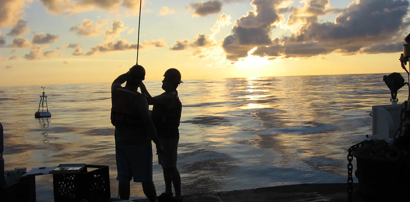
Ocean's early warnings grow urgent as climate signals accelerate
The North Pacific's surface has warmed four times faster than the global average, a signal we can no longer ignore. Ocean intelligence now shows climate indicators moving beyond modeled projections. These are not abstract trends; they are measurable, real-time shifts in a system we depend on. Understanding drives protection. Our related piece on ECCO‑Darwin's first multi‑decadal global ocean CO₂ flux estimates offers another calibrated look at how fast this change is actually happening.

Calibrated data, not altered truth: refining the global temperature record
Calibrated data is not altered truth. When the global temperature record is refined through validated, peer-reviewed methods, we gain a more accurate understanding of our climate. These adjustments, grounded in empirical science, correct for known biases, they do not manufacture a narrative. This is how we build trust in the measurements that guide us. For deeper context on the forces driving these changes, our coverage of record atmospheric CO₂ levels in 2024 offers a parallel view.
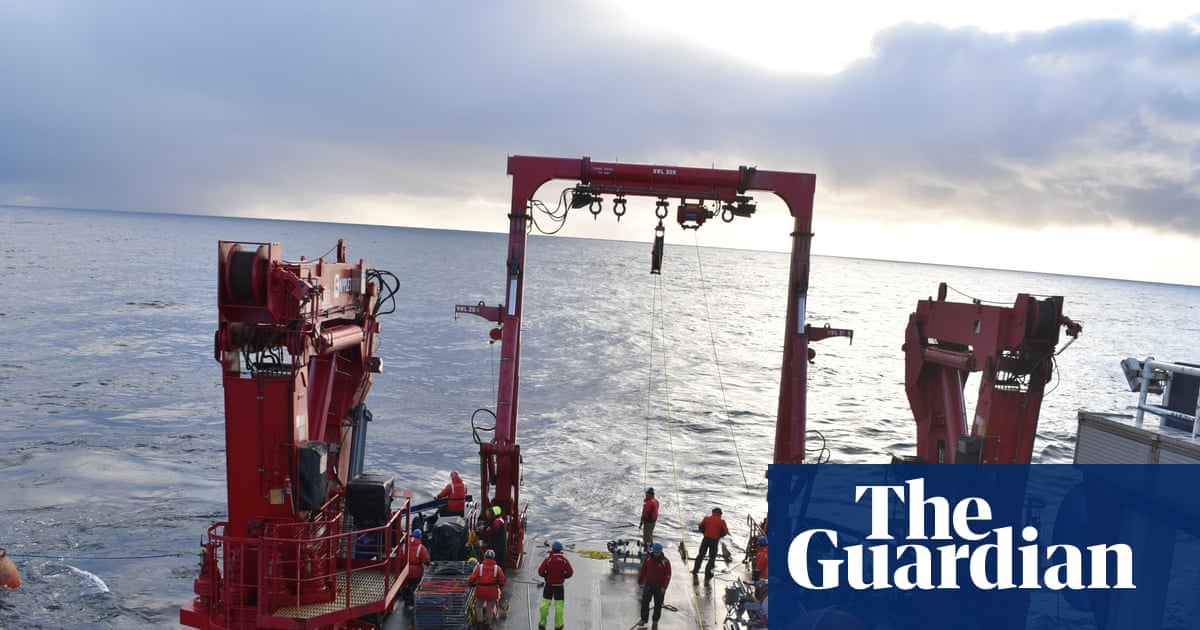
Proposed US monitoring cuts risk global loss of calibrated ocean intelligence
The Trump administration's proposal to eliminate US ocean monitoring systems would strip the world of calibrated, real-time climate intelligence. Scientists warn this leaves us flying blind on ocean warming and sea-level rise. Protecting this integrated data ecosystem is not optional, it is a matter of global scientific integrity. For context on how validated ocean data is built, see our related piece on the NCEI's *Ocean data expands from measured depths to validated insights*. Understanding drives protection; abandoning it invites risk.
Partnerships in practice: restoring reefs through shared stewardship
The Coral Nurture Program proves that community-led restoration can work at scale when science and local knowledge converge. By embedding coral propagation into routine tourism operations, this partnership between researchers, operators, and Traditional Owners has turned stewardship into a replicable model, not just a noble intention. Progress came through iteration, not perfection: tools, governance, and financing were refined across expanding sites. For deeper exploration of how sustained observation drives action, see our piece on Africa's first permanent ocean observatory and its critical data gap.
A validated open-access observatory for Africa's multi-ecosystem ocean intelligence
The Bazaruto Center for Scientific Studies (BCSS) Ocean Observatory is not another data portal; it is a managed, DOI-linked platform turning eight years of sustained effort into 22 million-plus measurements across six ecosystems. What stands out is the integration: weather, acoustics, biodiversity, and pollution under one interoperable framework, with QA/QC and FAIR compliance built in. This is the baseline Africa's marine science has needed.
Africa's first permanent ocean observatory closes a critical data gap for science and policy
Twenty-two million measurements. That is the scale of what the Bazaruto Center for Scientific Studies and Kisawa Sanctuary have built off Mozambique's coast. Africa's first permanent ocean observatory is not a small pilot project; it is a multi-ecosystem platform covering 6,850 square kilometers, generating high-frequency data across coral, seagrass, and open-ocean habitats. The numbers are impressive, but the real achievement is showing how a Resort-to-Research model can sustain serious science.
Climate-resilient coral masks a hidden population decline in Florida reefs
Mustard Hill coral has been treated as the region's resilient survivor, but the data tells a more complicated story. Across 40 Florida Keys sites, *Porites astreoides* shows declining population growth and shrinking colony sizes, especially after the 2023 marine heatwave. Its rising dominance masks a demographic slide, not a victory. That distinction matters. Resilience isn't just presence; it's persistence. For a fuller picture of how such shifts reshape reef function, our related piece on integrated ocean governance offers useful context.
Integrated Ocean Governance: Addressing Transboundary Pollution and Climate Risks
Marine pollution does not respect borders, and neither should governance. Plastic waste, ALPS-treated water, and ship-source pollution drift across jurisdictions, colliding with climate pressures to create compound risks. The Ecological and Environmental Code, while foundational, remains too fragmented to meet this challenge. Its principle-oriented provisions leave jurisdiction ambiguous, liability regimes incomplete, and cooperation largely aspirational. Strong governance demands more than intention. It requires operational mechanisms for transboundary harm. This paper outlines that institutional shift.
Integrated Monitoring Supports Ocean Resilience in Developing Economies
Ocean observation should not be a luxury of wealth. In developing economies, where monitoring gaps align with the highest climate exposure, this co-developed framework proves otherwise. By centering on user needs and open satellite data, it builds capacity without waiting for dense in-situ arrays. The South African OCIMS tool shows how integrated systems accelerate readiness. This is the practical path to resilience. For more on expanding observational reach, see our related coverage, "Bridging Data Gaps: Integrating Citizen Science for Ocean Intelligence."
Tracking Wetland Change: A Satellite Framework for Coastal Resilience
The Coastal Bend of Texas has lost 193 square kilometers of wetlands since 1984, a 17% decline that accelerated sharply between 2008 and 2016. That is not a distant problem; it is a measurable transformation happening now. The study's tools, WET-MUD and WHAMS, turn satellite records into actionable intelligence, distinguishing wetland extent from wetland health with 93% overall accuracy. This framework matters because it makes long-term monitoring reproducible elsewhere, turning raw data into a practical defense for vulnerable coastlines. Understanding drives protection.
Digital Twin Reveals Vulnerable Atoll, Enabling Ocean Monitoring
Remote coral atolls like Oeno remain critically under-observed, not because they lack importance, but because isolation makes traditional surveys nearly impossible. This digital twin changes that. By integrating satellite imagery, drone data, and acoustic bathymetry into a single calibrated framework, the team has produced the first high-resolution representation of the atoll's lagoon, benthic habitats, and terrestrial structure. It is a practical, scalable model for monitoring shoreline evolution and coral bleaching, and a clear demonstration that integrated geospatial data can close observation gaps elsewhere.
Arctic Glacier Retreat Creates New Coastal Lagoons, Expanding Ecosystems
Retreating glaciers across the Arctic are redrawing coastlines, and Svalbard now hosts a growing number of coastal lagoons where none existed before. These newly emerged paraglacial systems remain largely absent from regional monitoring, despite their rapid expansion. We see this as a missed opportunity: the lagoons form a developmental continuum, from glacier-influenced basins to biologically structured systems, and early evidence suggests they act as biogeochemical reactors, including potential methane sources.
Tracking Plankton Change: Open Data Workflow for Ocean Health Insights
Plankton imaging captures the ocean's smallest movers at scales that nets and bottles miss, yet the path from raw image to usable dataset has remained stubbornly manual. The Plankton Imager 10 aboard the R/V Simon Stevin changes that calculus in the southern North Sea. This open pipeline, built on deep learning classification and Darwin-Core Archives, turns high-frequency observations into validated, standards-based outputs. It is a practical step toward operational ocean intelligence, one we can adapt beyond the Belgian part of the North Sea.
Verifying Blue Carbon: Evidence for Legal Protection and Climate Action
The 2024 and 2025 advisory opinions do more than interpret the law; they redefine its operational core. Our analysis shows that monitoring, reporting, and verification is now the binding substance of UNCLOS duties, not a policy option. This creates an uncomfortable inversion: the States best equipped to afford proof are the ones who benefit most from protection. This is a profound challenge to common but differentiated responsibilities, one that demands we reconsider what legal protection truly requires.