ocean floor
8 stories filed under ocean floor on World Data Ocean. The newest of them: “Seafloor sediment confirmed as a vast plastic pollution reservoir”, “China Submerges AI Data Center in Ocean Floor Deployment”, and “From orbit to ocean floor: big data maps the seafloor with precision”. Seafloor sediment has been confirmed as a vast plastic pollution reservoir, according to a world-first study by the Commonwealth Scientific and Industrial Research Organisation. China submerges an AI data center on the ocean floor, a move that prioritizes speed and cooling efficiency over the land-based debates stalling U.S. A Global Hub for Ocean Intelligence 4 World Data Ocean is a centralized digital platform where researchers, scientists, and ocean enthusiasts converge to… The list below is every ocean floor story on World Data Ocean, newest first.
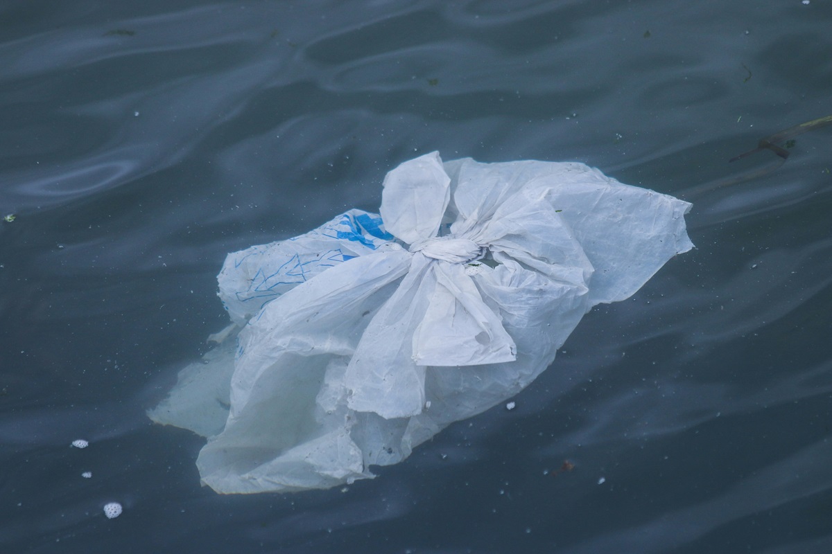
Seafloor sediment confirmed as a vast plastic pollution reservoir
Seafloor sediment has been confirmed as a vast plastic pollution reservoir, according to a world-first study by the Commonwealth Scientific and Industrial Research Organisation. This is not a surface problem, plastic is accumulating in the deep, where it becomes part of the geological record. The finding is a measurable, empirical signal of our impact. Understanding where plastic settles, from the seafloor to the Great Pacific Garbage Patch, is foundational to integrated ocean stewardship.
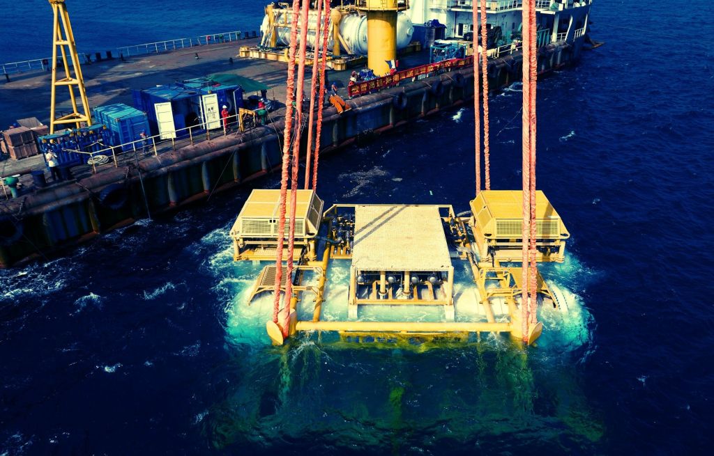
China Submerges AI Data Center in Ocean Floor Deployment
China submerges an AI data center on the ocean floor, a move that prioritizes speed and cooling efficiency over the land-based debates stalling U.S. projects. This deployment demands rigorous validation. How safe is a submerged digital infrastructure against pressure, corrosion, and real-time operational risks? The answer matters for the entire integrated data ecosystem. For deeper context on ocean system shifts, our coverage of a century of ocean intelligence revealing a measurable current slowdown provides essential reading.
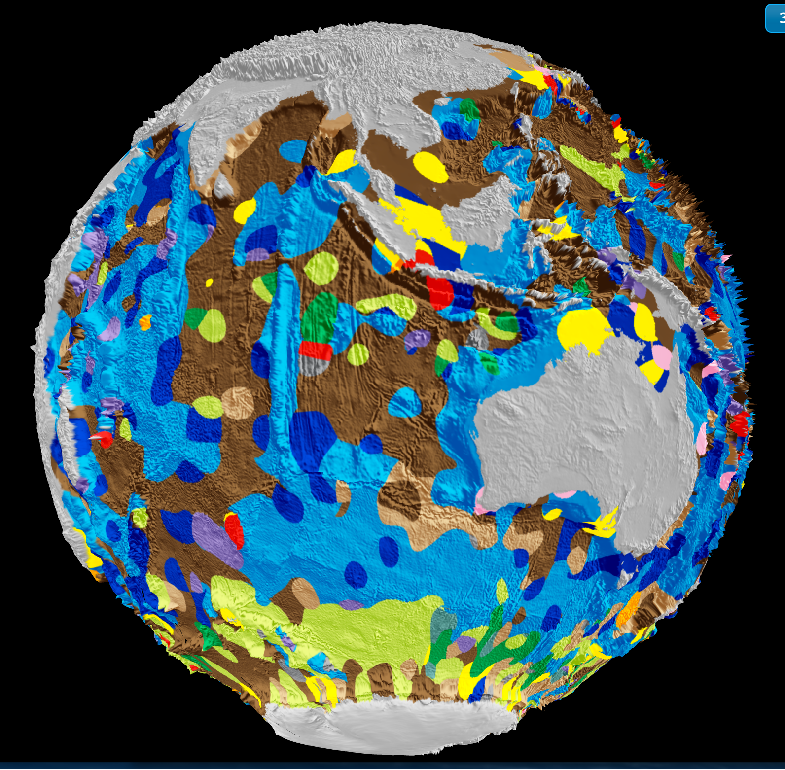
From orbit to ocean floor: big data maps the seafloor with precision
A University of Sydney-led team has integrated satellite altimetry with shipboard sonar data to produce a calibrated, high-resolution map of the global seafloor. This isn't just a sharper image, it's a validated baseline for measuring change. Understanding drives protection. When we can track sediment transport, tectonic activity, and benthic habitat shifts with empirical precision, ocean stewardship becomes measurable. For deeper context on how ocean intelligence reveals system-wide change, see our coverage of the century-long current slowdown.

Integrated Subsea Infrastructure Shifts to Enhance Indian Ocean Connectivity
The Indian Ocean is becoming the new backbone of global data flow, with integrated subsea infrastructure now shifting away from China's route. This move directly benefits India, positioning it as a key hub in a network that carries 99% of the world's data. The strategic realignment is measurable and immediate. For those tracking the region's growing commercial pulse, our related piece on Gulf of Oman STS Transfers Max Out Amid Rising Saudi Oil Exports offers further context on how this ocean's corridors are tightening.
Mapping the Ocean Floor: Geospatial Innovation Drives Global Discovery
The ocean floor remains Earth's least mapped frontier, yet geospatial innovation is closing that gap with measurable precision. This piece from Geography Realm examines how integrated data ecosystems and calibrated technologies are accelerating the effort to complete a global seafloor map. It is a practical, empirical look at a monumental task. For readers tracking maritime infrastructure's role in this work, our coverage of Van Oord's new fallpipe vessels, "Vindnes and Vestnes," offers a fitting complement.
Exploring Ocean Depths: India's Waters and the Search for Submarine Trenches
India's ocean floors hold questions we are only beginning to frame. While the Mariana Trench anchors our understanding of deep-sea extremes, the search for comparable trenches in Indian seas remains an open, empirical inquiry. This exploration is not about spectacle; it is about calibrating what we know of underwater topography and its role in climate indicators. For those tracking how such research connects to broader systems, our related piece on Cascadia's subduction zone offers useful tectonic context.
Exploring the Mariana Trench: A Hypothetical Descent and Timeline
The Mariana Trench descent is a study in patience as much as depth. A hypothetical plunge from the surface to the Challenger Deep would take roughly two and a half hours, assuming a steady drop. That timeline matters because it frames the real challenge: not just reaching the bottom, but doing so with instruments calibrated to survive the pressure. We find this a useful thought experiment for testing our integrated data ecosystems.
Underwater Explosions and Ocean Floor Exposure: A Scientific Examination.
Underwater detonations do more than disturb the seabed; they strip away the fragile sediment layers that hold centuries of climatic and biological record. This examination, submitted by /u/Lopsided-Fig6818, treats the exposed ocean floor as a scientific archive, not a casualty. We appreciate the focus on measurable, peer-reviewed evidence over alarm. For readers tracking how human activity reshapes marine geology, our related piece, "Integrated Subsea Infrastructure Shifts to Enhance Indian Ocean Connectivity," offers a parallel view of engineered change.