ocean data
ocean data on World Data Ocean: a running collection of 376 stories we have gathered and hand-picked because they are worth your time. Every post here touches on ocean data in some way — the news, the analysis, the deep dives, and the occasional surprise find. A Global Hub for Ocean Intelligence 4 World Data Ocean is a centralized digital platform where researchers, scientists, and ocean enthusiasts converge to explore, analyze, and… New stories are added to this page as we find them, so check back if you want to keep up with what is happening around ocean data, or subscribe to the RSS feed to get them as soon as they are published. Browse the collection below, or head back to the homepage to see everything World Data Ocean is covering right now.

South Korea Plans To Launch First Domestically Built Nuclear-Powered Submarine By Mid-2030s
South Korea has announced plans to launch its first domestically built nuclear-powered submarine by the mid-2030s, a significant step in enhancing its naval capabilities. Defence Minister Ahn Gyu-back revealed this initiative during a defence strategy meeting led by President Lee Jae Myung, highlighting the nation’s commitment to modernizing its military forces in response to regional security challenges. This development aligns with broader maritime security efforts, such as the recent Indian Navy's deployment of INS Kolkata to deter piracy near the Gulf of Aden.

How much plastic waste ends up in the ocean? - Our World in Data
Plastic waste poses a significant threat to our oceans, with millions of tons entering marine environments each year. Understanding the scale of this issue is crucial for effective stewardship and policy-making. Our analysis on "How much plastic waste ends up in the ocean?" provides empirical data and insights into the sources and impacts of plastic pollution. For a deeper dive into marine life and its complexities, explore our article on "Best marine biology books?" to discover essential readings that broaden your understanding of ocean ecosystems.
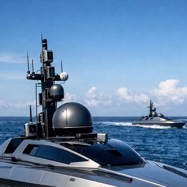
The future of marine research is looking a lot quieter, cleaner, and smarter. At World Data Ocean, we're watching the tr...
The future of marine research is evolving towards a quieter, cleaner, and smarter approach. At World Data Ocean, we are closely monitoring the shift from traditional survey ships to autonomous robotic fleets in real-time. Our Ocean Infinity Operations utilize Uncrewed Surface Vessels (USVs) to revolutionize data collection across vast ocean expanses. This transition not only reduces carbon emissions but also enhances scientific accuracy through integrated AI technology. Explore how innovations like the MOLA AUV are bringing the abyss within reach in our related article.
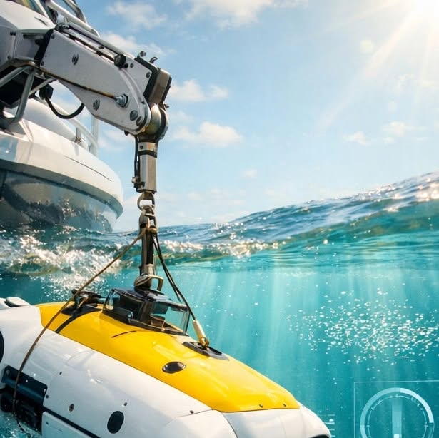
The abyss isn't as out of reach as it used to be. 🌊🤖 With the rise of portable robotics like the MOLA AUV, high-tech o...
The abyss isn't as out of reach as it once was. With the emergence of portable robotics like the MOLA AUV, high-tech ocean exploration is becoming accessible to smaller, decentralized teams. This shift is revolutionizing our understanding of the deep sea through an influx of 'bottom-up' data. At World Data Ocean, we are enhancing our platform to process this real-time information, ensuring that every insight, regardless of its origin, is validated and actionable.

Integrating megafauna into blue carbon strategies: dugongs could enhance seagrass carbon storage
Coastal seagrass ecosystems, though occupying a small fraction of the ocean, play a vital role in carbon capture and storage, increasingly recognized as blue carbon solutions. This study explores the significant yet often overlooked role of dugongs (Dugong dugon) in enhancing seagrass productivity and sediment carbon storage. By employing a carbon-nutrient cycling model in Bahrain's Halodule seagrass beds, findings reveal that dugongs can amplify seagrass net primary production and carbon balance substantially.
Decadal migration timing and temporal variation in dive behavior of an endangered beluga whale population
Understanding the migration timing and dive behavior of the endangered beluga whale population in Cumberland Sound, Nunavut, is essential for predicting their response to environmental changes. By analyzing satellite telemetry data from two distinct periods (1998–1999 and 2006–2008), this study explores the relationship between dive behavior, migration timing, and seasonal factors. Notably, our findings indicate a shift in foraging patterns from Arctic cod to capelin, likely driven by warmer ocean temperatures.
Assessing ocean changes without data centers? - Frontiers
In the pursuit of understanding ocean dynamics, traditional data centers may become obsolete. The article "Assessing Ocean Changes Without Data Centers?" from Frontiers explores innovative methodologies that leverage contemporary technologies for real-time ocean monitoring. By integrating diverse data sources and fostering collaboration, researchers can gain insights into ocean health without the constraints of conventional infrastructure. For a broader context on the evolving landscape of maritime operations, consider reading "New Autonomous Warship Concept Could Transform North Atlantic Naval Patrol Operations." Embrace the future of ocean intelligence.
How reliable is Electronic Bottom Tracking in deep or rough sea conditions?
Electronic Bottom Tracking systems are crucial for accurately measuring seabed depth and movement, particularly in challenging maritime conditions. These systems utilize acoustic signals to maintain a reference to the seafloor, but their reliability can be affected by factors such as strong currents and uneven seabeds. In deeper waters, the signal's stability may diminish over longer distances unless automatically corrected by onboard systems.
Autonomous underwater stereo vision system for non-invasive fish length estimation in marine environments
As marine ecosystems face rapid changes due to climate and human pressures, effective monitoring tools are essential. This study presents an innovative, non-invasive pipeline for automatic fish length estimation utilizing an underwater Stereo-Vision System (SVS). By synchronizing image pairs for 3D reconstruction, the method combines 2D segmentation masks with robust multi-object tracking, achieving precise measurements even in challenging underwater environments. With a Mean Absolute Error (MAE) of 1.

Tanker Fires Warning Shots After Suspicious Boat Approaches Near Yemen’s Socotra
A tanker fired warning shots after a suspicious small vessel approached near Yemen’s Socotra, raising security concerns in a region already marked by geopolitical tensions. The identity of the boat and those onboard remains unknown, but fortunately, no injuries or damage have been reported. This incident underscores the ongoing maritime risks in the area, a topic that resonates with recent developments, including Japan's receipt of its first oil tanker since the onset of the Iran conflict.

Indian Navy To Induct 45 Warships In Next Four Years, Targets 200-Ship Fleet By 2035
The Indian Navy is set to enhance its maritime capabilities by inducting 45 new warships over the next four years, aiming for a robust fleet of 200 vessels by 2035. Among the latest additions is the newly launched NGOPV Sanghamitra, which features enhanced size and capabilities compared to older offshore patrol vessels. This initiative underscores the Navy's commitment to strengthening national security and maritime readiness.

Ilya Espino de Marotta Becomes First Woman To Lead Strategically Vital Panama Canal
Ilya Espino de Marotta has made history as the first woman to lead the Panama Canal Authority, a strategically vital entity for global trade. Her selection underscores her extensive experience in technical, operational, and leadership roles, positioning her to navigate the complexities of this critical waterway. Espino de Marotta's appointment marks a significant milestone in maritime leadership and emphasizes the importance of diverse perspectives in managing crucial infrastructure.
High seas marine protected areas under the BBNJ agreement: implementation gaps and governance pathways
High seas marine protected areas (MPAs) play a crucial role in advancing the “30×30” target and enhancing biodiversity conservation in areas beyond national jurisdiction (ABNJ). However, significant implementation challenges remain, stemming from fragmented governance structures and insufficient coordination. This article examines the governance obstacles to effective high seas MPA implementation under the BBNJ Agreement, emphasizing the need for a clear operational framework.
Plastic waste emitted to the ocean per capita - Our World in Data
Plastic waste is a growing concern for ocean health, with significant implications for marine ecosystems and human communities. Our World in Data provides an insightful analysis of plastic waste emitted to the ocean per capita, highlighting regional disparities and trends over time. This data underscores the urgency of addressing plastic pollution through informed policy and collective action. For a broader understanding of maritime challenges, explore our article on "Iran Says 26 Commercial Vessels Transited Strait Of Hormuz In Past 24 Hours Under IRGC Coordination."

A global treaty is a huge win for our blue planet, but let’s be real: a signed paper is only the beginning. 🌊 The High ...
The High Seas Treaty marks a significant milestone for ocean conservation, yet a signed agreement is merely the starting point. To ensure effective enforcement, we must leverage innovative data portals that provide transparent, real-time insights into our oceans. Validated scientific data is crucial for tracking marine health and ensuring accountability. By developing digital infrastructure—essential tools for monitoring biodiversity and deep-sea conditions—we aim to turn treaty promises into tangible protections.
AI's Deep Dive: China Drops World's First 2,000-Server Data Centre Into The Ocean - NDTV Profit
In a groundbreaking move, China has launched the world's first 2,000-server data center submerged in the ocean, aiming to harness the cooling properties of deep-sea environments for enhanced energy efficiency. This innovative approach not only addresses rising energy demands but also highlights the intersection of technology and environmental stewardship. As nations explore sustainable solutions, such advancements underscore the urgency of integrating climate indicators into infrastructure planning. For further insights on global developments, read our article on the UAE’s new West-East Crude Pipeline nearing completion.

China Is Building A Great Wall Of Undersea Sensors To Track U.S Nuclear Submarines In Indo-Pacific
China is developing an extensive network of undersea sensors in the Pacific Ocean aimed at tracking U.S. Navy nuclear submarines, strengthening its sea-based nuclear deterrent. This initiative underscores the growing strategic competition in the Indo-Pacific region as nations enhance their maritime capabilities. The deployment of these sensors reflects a commitment to advanced maritime surveillance technologies. For further insights into the evolving landscape of naval technology, explore our article on Hanwha Ocean's discussions with Microsoft and Google regarding future AI warships.
Servers in the ocean: World’s first offshore underwater AI data centre launched in China - The Times of India
China has launched the world’s first offshore underwater AI data center, marking a significant advancement in oceanic technology and data management. This innovative facility aims to harness the ocean's natural cooling properties to enhance energy efficiency while supporting the growing demand for data processing. The initiative reflects a broader trend in leveraging marine environments for technological advancement. For a deeper understanding of marine conservation efforts, explore our article, "I mapped the Marine Protected Area network along the entire Welsh coast."

Video: U.S. Forces Board Iranian-Flagged Oil Tanker In Gulf Of Oman Over Alleged Blockade Violation
U.S. forces have intercepted the Iranian-flagged oil tanker M/T Celestial Sea in the Gulf of Oman, suspecting it of attempting to breach a blockade aimed at limiting Iran's oil exports. This operation underscores ongoing tensions in the region and highlights the complexities of maritime governance. For those interested in the broader implications of maritime operations, our article "INTERCARGO Releases First Dedicated STS Standard For Dry Bulk Transfers" offers insights into cargo operations where traditional port facilities are inadequate. Stay informed on these critical developments.

Hanwha Ocean Holds Discussion About Future AI Warships With Microsoft & Google
On May 20, 2026, Hanwha Ocean hosted a pivotal discussion with technology leaders Microsoft and Google to explore the future of naval technology, particularly the development of AI warships. This collaboration aims to integrate advanced artificial intelligence into maritime defense systems, reflecting a commitment to innovation and global security. As nations navigate evolving maritime challenges, insights from this event could shape the next generation of naval capabilities.

U.S. Seizes Iran-Linked Oil Tanker In Indian Ocean Amid Nuclear & Regional Shipping Tensions
The U.S. has seized the Iran-linked oil tanker Skywave in the Indian Ocean, escalating tensions related to nuclear negotiations and regional shipping security. This vessel was previously sanctioned by the United States in March for allegedly transporting Iranian oil. The interception reflects ongoing efforts to monitor and control illicit maritime activities amid rising geopolitical anxieties. For further insights into the implications of military movements in the region, see our article, “U.S.

U.S. Charges 4 Of The World’s Largest Shipping Container Manufacturers Over Multi-Billion-Dollar Trade Conspiracy
The U.S. Department of Justice has charged four of the world's largest shipping container manufacturers with a multi-billion-dollar trade conspiracy. According to the DOJ, the companies convened in Shenzhen in November 2019 to agree on production cuts, a move aimed at artificially inflating container prices. This case underscores significant concerns about market manipulation in the shipping industry, which has critical implications for global trade. For further insights into industry developments, explore our article on "WinGD Secures World-First Ethanol-Fuelled Engine Orders For Ocean-Going Ships."
Team Cymru Launches Pure Signal™ MCP Server, Bringing Agentic AI to the World’s Largest Threat Intelligence Data Ocean - Business Wire
Team Cymru has unveiled its Pure Signal™ MCP Server, a groundbreaking advancement that integrates Agentic AI into the world’s largest threat intelligence data ocean. This innovative platform enhances the ability to analyze and respond to cyber threats in real time, fostering a safer digital environment. With this launch, Team Cymru reinforces its commitment to leveraging advanced technology for proactive threat mitigation. For further insights on the intersection of technology and safety, explore our coverage of the world's first offshore wind-powered underwater data center.
Deep learning-based sea level anomaly forecasting around Taiwan Island integrating ConvLSTM and attention mechanism
The Taiwan Island Adjacent Seas Sea Level AI Forecaster (TAS-SLAF) leverages advanced deep learning techniques, including ConvLSTM and the Convolutional Block Attention Module (CBAM), to tackle the complex variability of sea surface height around Taiwan Island. By integrating 15-day sea level anomaly data alongside sea surface wind speed and ocean current information, TAS-SLAF significantly enhances forecasting accuracy, achieving remarkable reductions in root mean square errors compared to leading numerical models.