seafloor
9 stories filed under seafloor on World Data Ocean. The newest of them: “New coral family named for Tolkien tree traced through genetic analysis”, “From orbit to ocean floor: big data maps the seafloor with precision”, and “Hydrographic Surveyors Share Data, Expanding Ocean Intelligence Insights”. A brilliant yellow coral discovered off Costa Rica's deep seafloor proved so genetically distinct that scientists created an entirely new family to classify it. A University of Sydney-led team has integrated satellite altimetry with shipboard sonar data to produce a calibrated, high-resolution map of the global seafloor. A Global Hub for Ocean Intelligence 4 World Data Ocean is a centralized digital platform where researchers, scientists, and ocean enthusiasts converge to… The list below is every seafloor story on World Data Ocean, newest first.
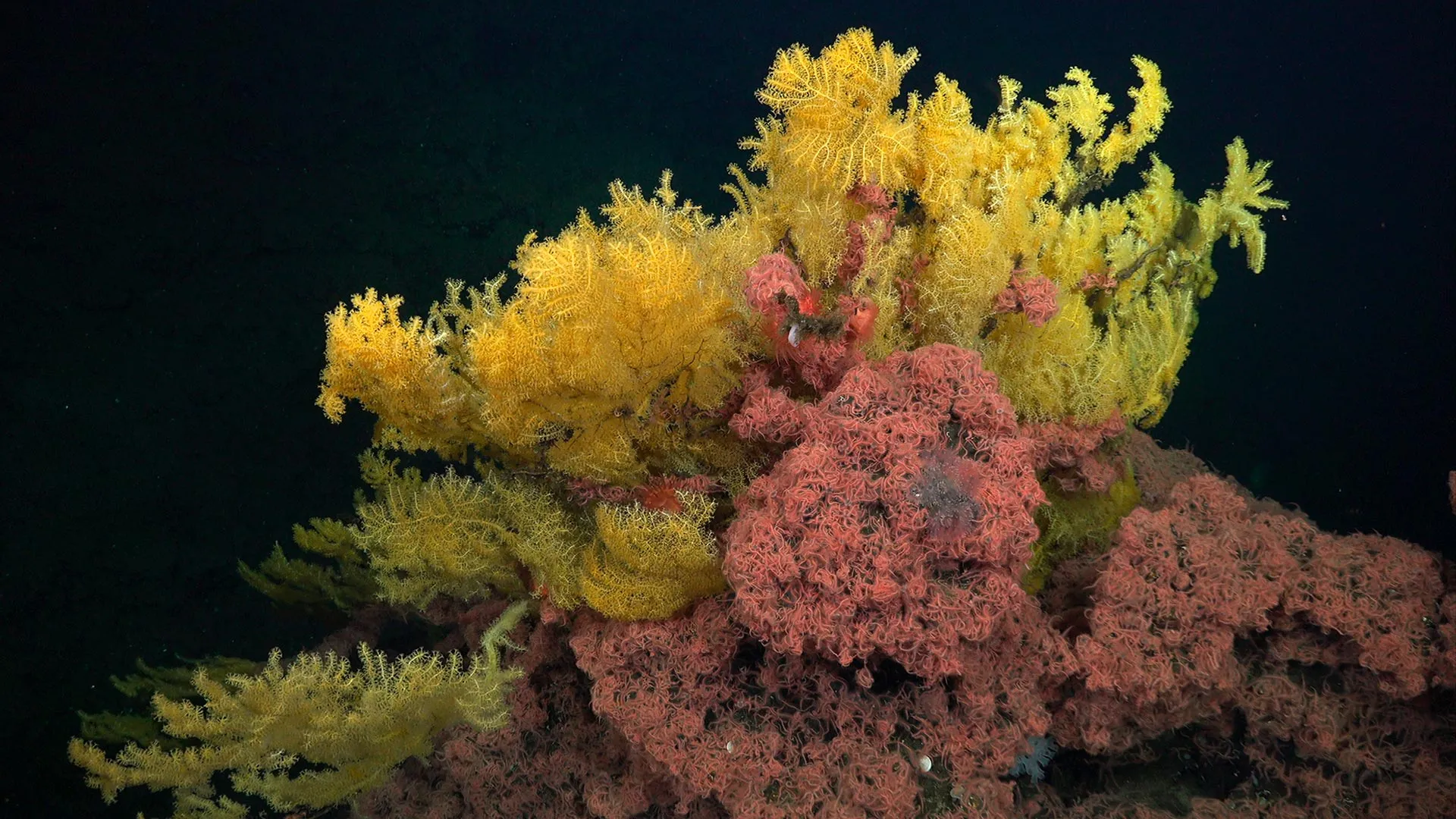
New coral family named for Tolkien tree traced through genetic analysis
A brilliant yellow coral discovered off Costa Rica's deep seafloor proved so genetically distinct that scientists created an entirely new family to classify it. Named *Laurinque elenya*, Tolkien's "golden tree of the stars", these meter-tall colonies rise among brittle stars, a living metaphor for how much remains hidden in our ocean. This discovery underscores why empirical data, like the decade of reef observations explored in "A decade of empirical data illuminates the ocean's hidden reef ecosystems," remains essential. Understanding drives protection.
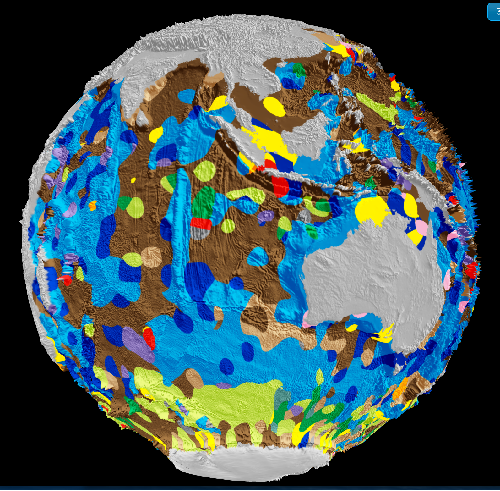
From orbit to ocean floor: big data maps the seafloor with precision
A University of Sydney-led team has integrated satellite altimetry with shipboard sonar data to produce a calibrated, high-resolution map of the global seafloor. This isn't just a sharper image, it's a validated baseline for measuring change. Understanding drives protection. When we can track sediment transport, tectonic activity, and benthic habitat shifts with empirical precision, ocean stewardship becomes measurable. For deeper context on how ocean intelligence reveals system-wide change, see our coverage of the century-long current slowdown.
Hydrographic Surveyors Share Data, Expanding Ocean Intelligence Insights
When hydrographic surveyors share their datasets, they turn individual measurements into a shared foundation for ocean intelligence. This collaborative act strengthens the integrated data ecosystem that informs navigation, climate indicators, and marine policy. We see this as a practical step toward measurable progress. For those tracking how such information shapes regional stability, our related piece on Ukraine's support for India's Black Sea shipping initiative offers useful context. Sharing data is not just transparent; it is how we build a more resilient understanding of our oceans.
Mapping the Seafloor: Detecting Ghost Nets with Side-Scan Sonar
A single sonar ping can reveal a tangled net resting on the seafloor, but telling it apart from a rock or a reef is where the real work begins. Oceanographers still guide much of the detection process manually, interpreting acoustic returns frame by frame. Ghost nets are difficult to classify because their shape and density vary with depth, current, and decay. Side-scan sonar offers a clear image, yet the final call often rests on human judgment.
Real-Time Seafloor Data: Current Availability and Coverage Insights
The question of real-time seafloor data cuts to the heart of how we share ocean intelligence. The user is right: NCEI archives raw and processed multibeam surveys, but post-processing creates a bottleneck, delaying public access. Archive-only is the current reality for most feeds, though some research vessels stream bathymetry live via satellite. Coverage skews toward U.S. EEZ and coastal priorities, not broad global reach. That gap matters. For those tracking plankton dynamics or other fine-scale phenomena, timing is everything.
Charting a Course: Exploring Marine Archaeology and Future Careers
The post from a 17-year-old uncertain about marine archaeology arrives at a pivotal moment. The student's instinct to blend a humanities background with ocean science is not a detour; it is a practical fusion. Marine archaeology demands exactly this integration of historical context and technical skill. The fear that AI will replace journalism is valid, but the field of underwater heritage needs human judgment for interpretation. This path is less about picking a side and more about combining strengths.
Exploring Ocean Depths: India's Waters and the Search for Submarine Trenches
India's ocean floors hold questions we are only beginning to frame. While the Mariana Trench anchors our understanding of deep-sea extremes, the search for comparable trenches in Indian seas remains an open, empirical inquiry. This exploration is not about spectacle; it is about calibrating what we know of underwater topography and its role in climate indicators. For those tracking how such research connects to broader systems, our related piece on Cascadia's subduction zone offers useful tectonic context.
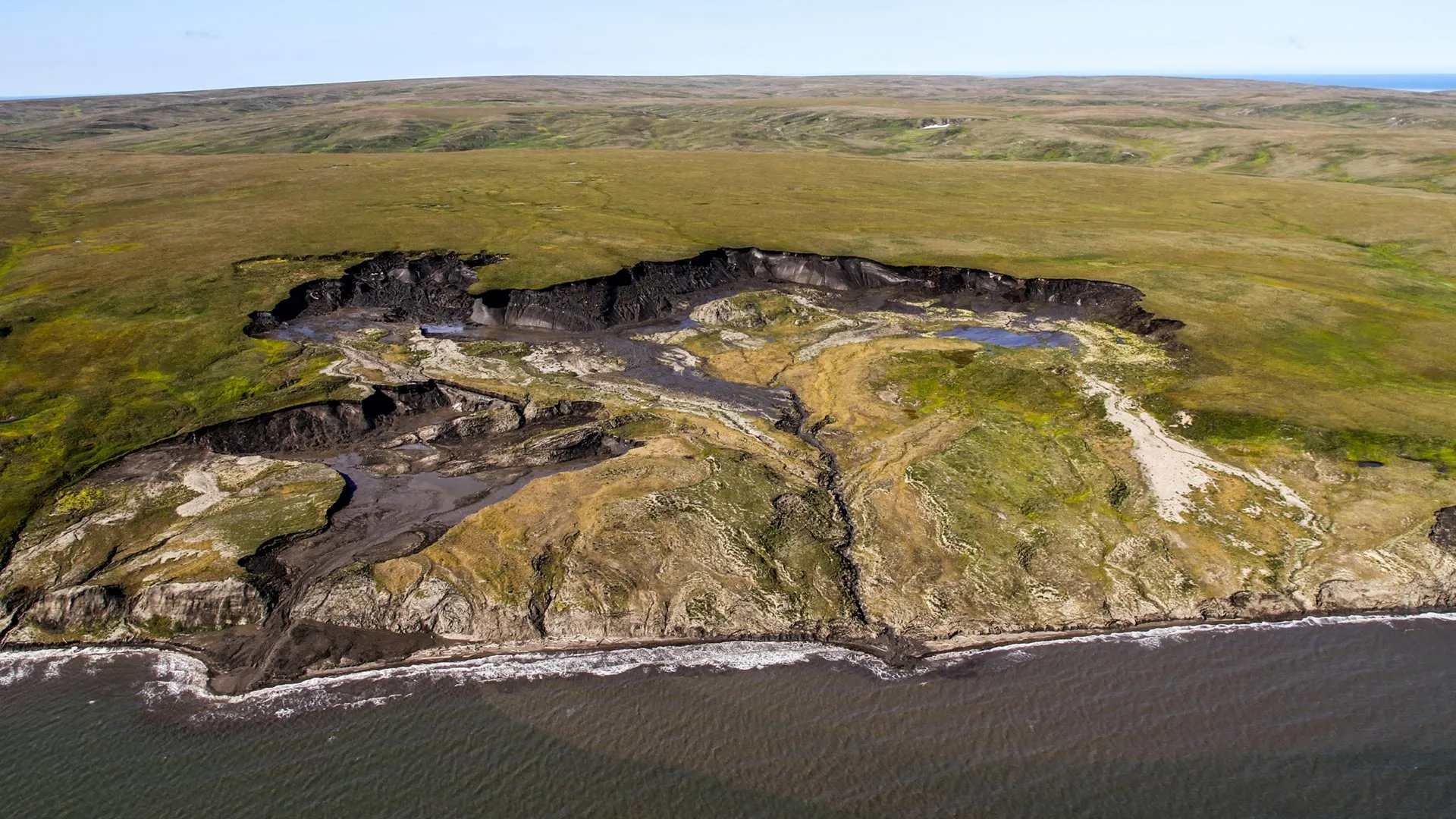
Arctic Carbon Release: Seafloor Sediment Limits Greenhouse Gas Impact
Sediment cores pulled from the seabed near Canada's Herschel Island deliver a measured counterpoint to alarm. Thawing permafrost is releasing ancient carbon into the ocean, yet the data show most of it gets buried in the seafloor, with only about 10 percent converted into greenhouse gases. That distinction matters for climate projections. We read this as a validation of integrated observation, not complacency.

Long-Term Data Reveals Shifting Fish Stocks and Litter in Sri Lanka
Forty years of surveys off Sri Lanka tell a clear story: fish abundance has dropped from roughly 280,000-395,000 tons in 1978-1980 to just 121,000 tons in 2018. The decline is uneven, with six fish families seeing lower catch per unit effort while ten others increased. Average lengths shrank for eight commercial species, yet grew for seven others. Plastic waste and fishing gear litter now appear routinely in bottom trawls. These empirical trends support harvest control rules and targeted environmental action plans.