2026
2026 at World Data Ocean is a file of 13 stories. The newest of them: “Cultivating Clarity: Solving Growth Curves in Our November Puzzle”, “Arctic sea ice thinning persists as winter and summer records decline”, and “Validated by a La Paz captain: a 2026 marlin sighting”. Growth curves are the hidden language of change, and our November crossword puzzle challenges you to read them. Arctic sea ice is not just retreating, it is thinning. A Global Hub for Ocean Intelligence 4 World Data Ocean is a centralized digital platform where researchers, scientists, and ocean enthusiasts converge to… The list below is every 2026 story on World Data Ocean, newest first.

Cultivating Clarity: Solving Growth Curves in Our November Puzzle
Growth curves are the hidden language of change, and our November crossword puzzle challenges you to read them. By connecting patterns from the microscopic to the planetary, we sharpen the very tools needed to interpret real-world data. This playful exercise in clarity builds the same observational muscle required to track a persistent signal like Arctic sea ice thinning. Solve the puzzle, and you are training yourself to see the trends that matter.
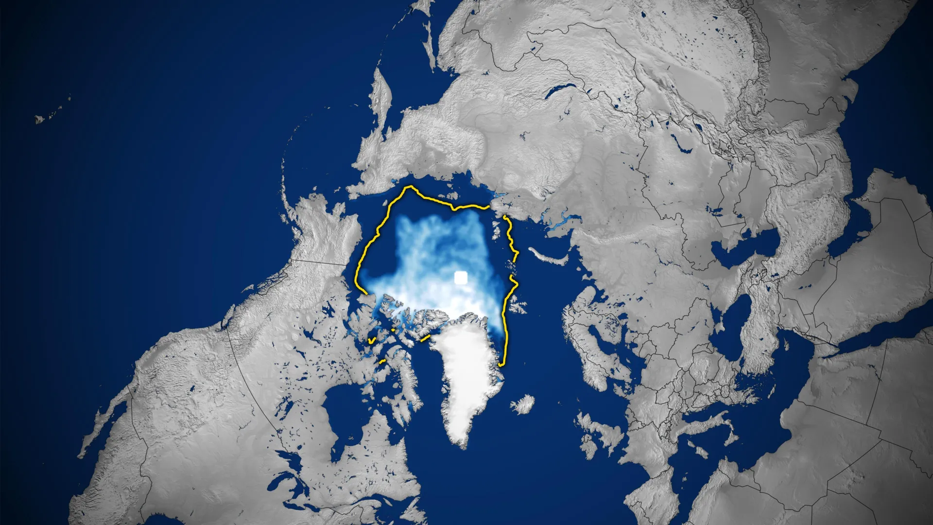
Arctic sea ice thinning persists as winter and summer records decline
Arctic sea ice is not just retreating, it is thinning. Satellite records show winter and summer ice extent declining, and the remaining ice is measurably younger and more vulnerable to melt. A nearly ice-free summer before 2050 is now a realistic projection. This loss of empirical, real-time ocean intelligence should sharpen our focus on integrated observation systems. Proposed US monitoring cuts, detailed in our related coverage, risk degrading the very data we need to track these climate indicators. Understanding drives protection.

Validated by a La Paz captain: a 2026 marlin sighting
A La Paz captain's 2026 marlin sighting adds a grounded, human-verified data point to our understanding of pelagic movement. It is a reminder that local knowledge still calibrates the instruments we rely on for ocean intelligence. The report pairs well with broader climate indicators, though we should treat it as one observation, not a trend. For deeper context on how marine life responds to warming, our related piece on marine heatwaves offers a useful framework.

Mapping American Samoa's Seabed: An ROV Exploration in 2026
In 2026, a remotely operated vehicle will descend into the waters around American Samoa, mapping the seabed with calibrated precision. This is ocean intelligence at its most tangible: measurable, peer-reviewed, and essential for informed stewardship. We see this as a vital step in building an integrated data ecosystem, one that connects seafloor topography to broader climate indicators. For a deeper look at how marine operations are adapting in challenging regions, explore our coverage of "Mitigating Supply Chain Risk: KPC Enables Ship-to-Ship Transfers."
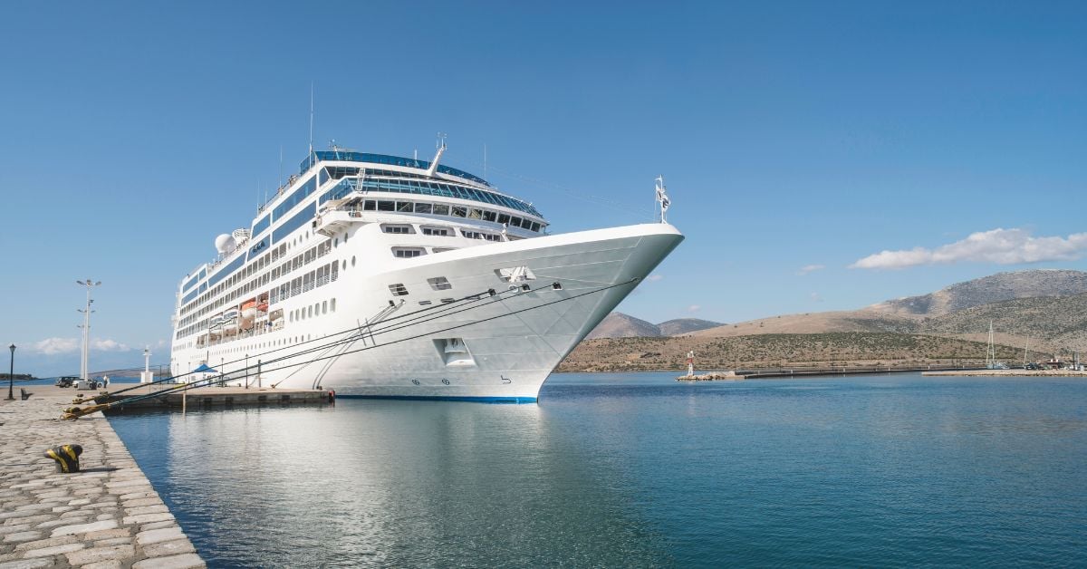
Nagoya 2026 Asian Games: Cruise Ship to Host Athlete Village
Japan has selected a cruise ship to house athletes for the 2026 Asian Games, opening in Nagoya on September 19. The decision reflects a practical, forward-looking approach to large-scale event logistics, one that prioritizes adaptability without sacrificing comfort. It is a measured solution, and we respect the operational clarity behind it. For more on maritime challenges, see our coverage of the cargo ship fire near Mykonos. Understanding these systems, from port to open water, is essential to building resilient infrastructure.
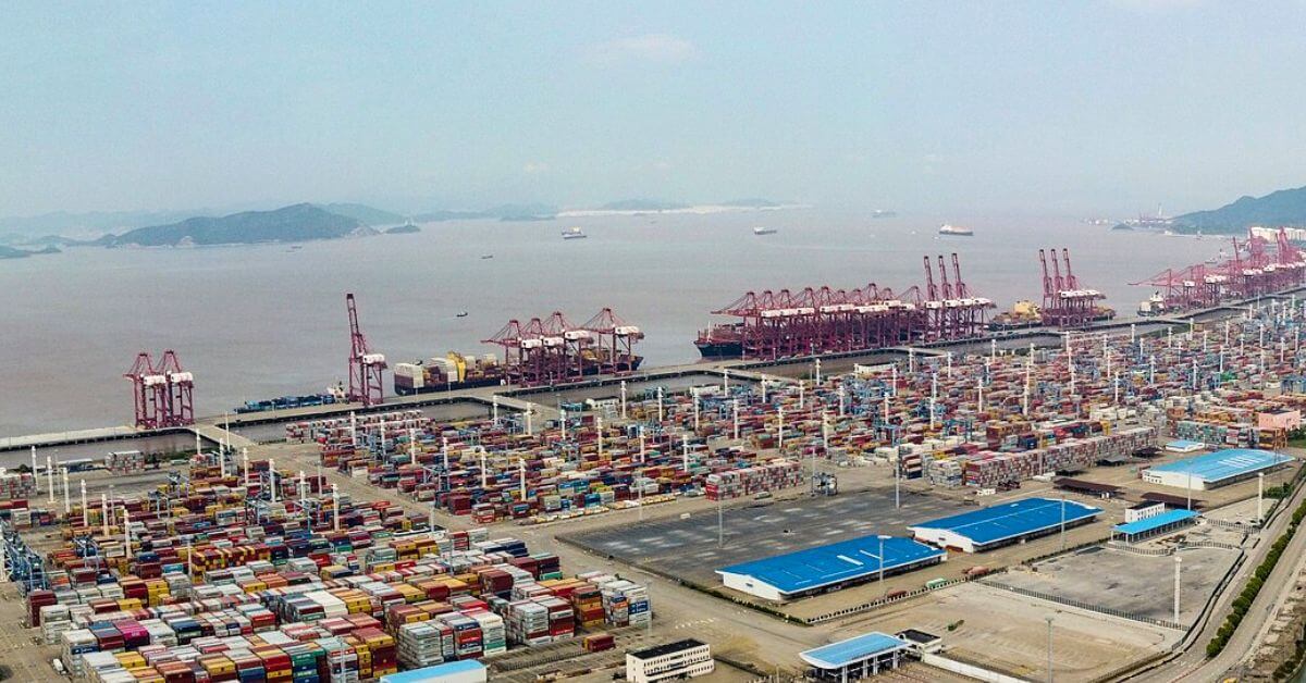
Ningbo-Zhoushan Port Surpasses Singapore, Securing Second Place Globally.
Ningbo-Zhoushan Port moved up the global ranks with 22.90 million TEU in the first half of 2026, an 8.8% year-on-year gain that places it second worldwide. This is what measured, data-driven progress looks like. Singapore's loss is not a setback but a signal of shifting trade currents. For readers tracking maritime momentum, our related piece on Paradi Port's new Mega Port status offers useful context. Growth at this scale demands calibrated investment, and China's port network is delivering it.
Mapping American Samoa's Depths: An Exploration of Ocean Intelligence.
Beneath the waves of American Samoa lies a terrain as uncharted as it is vital, and this latest expedition turns raw data into actionable insight. We're encouraged by how this work transforms seabed mapping into a tool for stewardship, not just discovery. It's precise, purposeful, and exactly the kind of empirical effort our shared ocean future demands.
Mapping American Samoa’s Depths: An Exploration with Advanced Underwater Technology
American Samoa's waters hold more than meets the eye, and this expedition proves it. Mapping these depths with advanced underwater technology reveals a seabed shaped by volcanic force and time, a place where bathymetry becomes biography. We find this work compelling because it turns raw data into actionable ocean intelligence, grounding conservation in measurable truth. For those seeking the broader picture, our related article, "Mapping American Samoa's Seabed: An ROV Exploration in 2026," expands on the tools behind this effort.

Enhanced Maritime Security: Israel Completes Dolphin II Submarine Program
The arrival of Israel's most expensive submarine completes the Dolphin II program, a milestone that sharpens maritime deterrence through proven, long-range capability. This is not flashy technology; it is calibrated naval power built for endurance. The investment signals a clear-eyed commitment to securing contested waters, echoing the strategic foresight seen in India's expanded fleet plans. For readers tracking regional shifts, our coverage of India's naval projections offers useful context.

Exploring the Cook Islands Depths: A 2026 ROV Expedition.
In 2026, a new ROV expedition will descend into the waters surrounding the Cook Islands, aiming to transform our understanding of a region whose depths remain largely unmeasured. This is not a hunt for spectacle; it is a methodical effort to gather empirical data where none currently exists. The mission's value will be defined by its calibrated instruments and the peer-reviewed findings they produce.
Mapping the Deep: Cook Islands ROV Exploration Set for 2026
In 2026, the Cook Islands will bring its seabed into sharper focus through a dedicated ROV exploration campaign. This is the kind of methodical, on-the-ground ocean intelligence we need more of, moving from satellite-level observation to direct, calibrated observation of the deep. It is a precise step for mapping what remains unseen. For a broader look at how these efforts connect, our piece on mapping American Samoa's seabed offers a useful regional comparison. Understanding drives protection, and this work is a clear example.
Exploring the Cook Islands Depths: A 2026 ROV Mission.
In early 2026, an ROV mission will descend into the waters surrounding the Cook Islands, where the seafloor remains largely uncharted. This is the kind of methodical, empirical work that turns raw data into ocean intelligence. By capturing validated, real-time imagery from the depths, the mission strengthens the integrated data ecosystem that researchers and policymakers rely on. For those tracking how these efforts connect, our piece on NOAA's calibrated ocean intelligence offers useful context. Understanding drives protection, and this expedition brings us closer to both.

Microcosms of the Pacific: Exploring Oregon's Tide Pool Ecosystems.
At Cape Blanco, Oregon, the tide pools reveal a world that feels almost alien up close. This July, photographer /u/JamTrackAdventures captures that otherness, showing how these microcosms shift perspective entirely. Each pool is a calibrated snapshot of life, measurable and immediate. The image reminds us that ocean intelligence starts at the shoreline, where small observations build larger understanding. For those exploring similar pathways, our related article, "Navigating a Marine Studies BA: Pathways to a Marine Biology Career," offers practical direction.