Mysterious 18th-Century Shipwreck Off Mexico Points To Possible Involvement In Caribbean Smuggling
Our take
The recent discovery of an 18th-century shipwreck within Mexico’s Sian Ka’an Biosphere Reserve presents a compelling opportunity to deepen our understanding of maritime history and, potentially, illicit trade routes of the era. Situated just 4.25 kilometers from the coast, the vessel’s location suggests a deliberate grounding, raising immediate questions about its final voyage and the circumstances surrounding its demise. The context of this find is particularly relevant given ongoing concerns about maritime security and the legacy of historical smuggling operations in the Caribbean. Indeed, the broader issue of illicit maritime activity is exemplified by a recent incident involving a U.S. strike on a suspected drug-smuggling boat, resulting in fatalities [Video: US Kills 4 In Strike On Suspected Drug-Smuggling Boat In Caribbean, Death Toll Hits 227]. Understanding the historical precedents for such activities, as this shipwreck promises to illuminate, is crucial for informing contemporary strategies to combat modern maritime crime. Furthermore, the complexities of maritime governance and territorial disputes are also on display, as highlighted by a recent situation involving a British crude oil tanker navigating Argentinian power struggles [‘British’ Crude Oil Tanker Finds Itself Amidst Argentinian Power Struggle Over Port Of Ushuaia].
The Sian Ka’an Reserve's designation as a UNESCO World Heritage Site underscores the significance of this discovery, not just from a historical perspective, but also from an environmental one. Any archaeological investigation must proceed with meticulous care to minimize impact on the delicate ecosystem. Initial assessments, likely involving non-invasive techniques like sonar and remote sensing, will be essential to accurately map the wreck site and document its condition before any physical excavation begins. The ship’s construction materials, cargo, and any associated artifacts will provide invaluable empirical data about shipbuilding practices, trade networks, and the economic landscape of the 18th century. It’s also worth noting the inherent challenges of marine archaeology; a career in this field requires a unique blend of skills, as explored by aspiring marine archaeologists [I wanna become a Marine Archeologist]. The preservation of such underwater heritage sites is a global priority, requiring coordinated efforts between scientific institutions, governments, and local communities.
Beyond the immediate historical insights, this shipwreck offers a window into the complex interplay of economic forces, political instability, and maritime risk that characterized the Caribbean during the colonial period. The possibility of smuggling, particularly of valuable commodities like sugar, tobacco, or even enslaved people, adds another layer of intrigue to the narrative. Analyzing the ship’s construction, likely based on longitudinal data collected from similar vessels of the era, can reveal its intended purpose and potential modifications for clandestine operations. The discovery also highlights the enduring power of the ocean as a repository of historical evidence, often concealing secrets for centuries. The integration of advanced technologies, such as underwater robotics and 3D modeling, will be critical for documenting and interpreting the wreck site in detail, contributing to a more comprehensive understanding of its significance.
The recovery and analysis of artifacts from this shipwreck will undoubtedly contribute to a more nuanced understanding of the Caribbean’s maritime history and the global trade networks of the 18th century. This underscores the importance of continued investment in ocean intelligence and the development of integrated data ecosystems to support marine archaeological research. The long-term preservation of the wreck site itself, potentially through in-situ conservation or controlled excavation and display, presents a significant challenge. What innovative strategies can be employed to safeguard this submerged heritage from environmental degradation and potential looting, ensuring that its story can be shared with future generations?
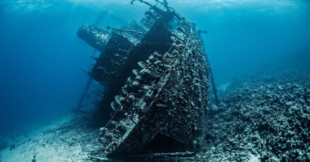
Archaeologists have traced the final movements of a ship that sank more than 250 years ago off Mexico’s Yucatán Peninsula.
The shipwreck, called the Ánimas de la Victoria, is in Espíritu Santo Bay in Quintana Roo. The site has 19 cast-iron cannons and four anchors on the seabed.
The wreck is inside the Sian Ka’an Biosphere Reserve, about 4.25 kilometres from the coast near the fishing camp of La Victoria.
The area is remote and has no roads. It is the only documented 18th-century shipwreck found in the bay so far.
Wreckage Covers 200 Metres
The wreckage is spread over about 200 metres. It runs from east to west, in the same direction as the waves that break over the reef. The site is between about 7 metres and 1.5 metres deep.
The way the objects are spread out may show what the crew tried to do before the ship sank. The four anchors are important to the study.
Anchor 1 is the smallest. It has straight, V-shaped arms and looks similar to British and French anchors. Its size and shape are closer to a French design from 1731.
Researchers think it may have been a small kedge anchor. Such an anchor could have been used to move the ship around the bay.
Anchor 2 was found below Anchor 1. It has curved arms and is linked to the Early Modern period. It was probably used in calmer waters.
Anchor 3 is the largest. Its shank is 4.70 metres long. Its shape is more common in anchors from the 16th and 17th centuries.
Researchers think it may have been made decades before the ship sank and used for many years.
British naval tables from the period suggest that the anchor would have weighed about 1,650 kg.
This suggests that the ship had a gross tonnage of between 650 and 700 tons. Its size fits a merchant frigate or, more likely, an armed merchant vessel.
Anchor 4 was found farther west. Its shank is bent. Researchers say it may have been damaged after getting stuck while the crew was pulling it back onto the ship.
19 Cannons Found at the Site
The site has 19 cast-iron cannons. Thick coral covered much of them. Researchers cleaned the cannons by hand with a hammer, chisel and wire brush.
A raised letter “C” was found on the trunnions of two cannons, C8 and C10.
The letter could be linked to the Le Creusot foundry in Burgundy, France, or the Conster foundry in Sussex, England.
Conster made cannons between 1700 and 1760. It was also known to supply weapons to British ships.
Researchers also looked at a four-pound cannon that local fishermen had taken from the wreck earlier. It is now privately owned.
The cannon appears to match British casting standards from the middle of the 18th century.
Why Researchers Suspect Smuggling?
The ship’s location is one reason researchers believe it may have been involved in smuggling.
Spanish ships generally did not use these reef-filled waters. The area was far from the Crown’s usual routes through the Yucatán Channel.
Spain also had little presence along the eastern coast of Yucatán. There were no large ports or settlements there. Bacalar was the main Spanish outpost nearby.
Navigation records also show how isolated the area was.
Even in 1810, the Practical Guide to the Antilles Islands did not give navigation instructions for waters north of the Belize River. It also warned ships about the reefs.
Researchers say smuggling is therefore the main explanation for the ship being in Espíritu Santo Bay.
The study was published in the Journal of Maritime Archaeology and was led by researcher Helena Barba-Meinicke.
References: clickpetroleoegas, dailygalaxy
Read on the original site
Open the publisher's page for the full experience