survey
6 stories filed under survey on World Data Ocean. The newest of them: “Global trust levels reveal measurable differences across integrated data ecosystems”, “Measuring visitor engagement through a collaborative social media survey”, and “From orbit to ocean floor: big data maps the seafloor with precision”. Trust varies measurably across the world's integrated data ecosystems. Partnerships grounded in empirical data produce measurable outcomes. A Global Hub for Ocean Intelligence 4 World Data Ocean is a centralized digital platform where researchers, scientists, and ocean enthusiasts converge to… The list below is every survey story on World Data Ocean, newest first.
Global trust levels reveal measurable differences across integrated data ecosystems
Trust varies measurably across the world's integrated data ecosystems. When asked whether most people can be trusted, responses diverge sharply by country, a calibrated, empirical signal of social cohesion that demands our attention. Understanding these patterns is essential for building collaborative global frameworks. For deeper context, see our related analysis of how US healthcare spending per capita leads G7 nations without leading outcomes, another case where measurable data challenges assumptions.
Measuring visitor engagement through a collaborative social media survey
Partnerships grounded in empirical data produce measurable outcomes. Clemson University and the Georgia Aquarium are collaborating on a primary research survey to calibrate social media engagement with the actual visitor experience. This brief, validated survey captures real-time feedback from customers and followers. Understanding drives protection, and that includes protecting the connection between an institution and its public. Consider contributing your perspective. For deeper insight, see our coverage of acoustic restoration: attracting marine life back to damaged reefs with sound.
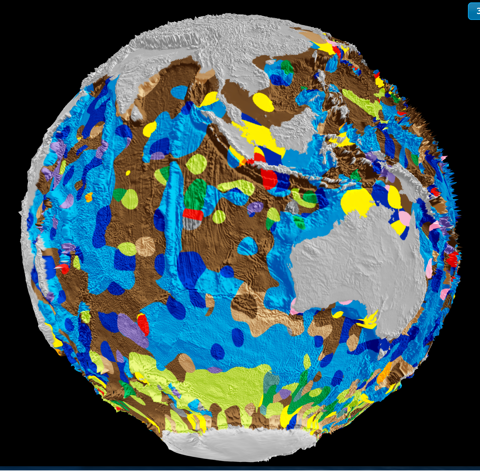
From orbit to ocean floor: big data maps the seafloor with precision
A University of Sydney-led team has integrated satellite altimetry with shipboard sonar data to produce a calibrated, high-resolution map of the global seafloor. This isn't just a sharper image, it's a validated baseline for measuring change. Understanding drives protection. When we can track sediment transport, tectonic activity, and benthic habitat shifts with empirical precision, ocean stewardship becomes measurable. For deeper context on how ocean intelligence reveals system-wide change, see our coverage of the century-long current slowdown.

6,000-nautical-mile delivery signals a new chapter for ocean-going vessel
A 6,000-nautical-mile delivery is not merely a transit; it is a statement of capability. Azurine's completion of this voyage with a 909 GT catamaran from Thailand to Turkey, now entering a major transformation, validates the growing reach of efficient ocean transport. This measured achievement aligns with the urgent need for safer global shipping, readers may find our coverage of the *New Coalition Charts Measurable Course for Safer Global Shipping* a timely companion to this story.

Exploring the Cook Islands Depths: A 2026 ROV Expedition.
In 2026, a new ROV expedition will descend into the waters surrounding the Cook Islands, aiming to transform our understanding of a region whose depths remain largely unmeasured. This is not a hunt for spectacle; it is a methodical effort to gather empirical data where none currently exists. The mission's value will be defined by its calibrated instruments and the peer-reviewed findings they produce.
Mapping the Deep: Cook Islands ROV Exploration Set for 2026
In 2026, the Cook Islands will bring its seabed into sharper focus through a dedicated ROV exploration campaign. This is the kind of methodical, on-the-ground ocean intelligence we need more of, moving from satellite-level observation to direct, calibrated observation of the deep. It is a precise step for mapping what remains unseen. For a broader look at how these efforts connect, our piece on mapping American Samoa's seabed offers a useful regional comparison. Understanding drives protection, and this work is a clear example.