Real Time
Real Time at World Data Ocean is a file of 5 stories. The newest of them: “Saildrone delivers first-ever hurricane interior video from the ocean surface”, “Real-Time Ocean Simulations Advance Understanding Through Integrated Modeling”, and “Real-Time Seafloor Data: Current Availability and Coverage Insights”. For the first time, a Saildrone has captured video from inside a hurricane at the ocean surface, offering a new window into the forces that drive these storms. Building a real-time ocean simulation tool is an exercise in patience and precision. A Global Hub for Ocean Intelligence 4 World Data Ocean is a centralized digital platform where researchers, scientists, and ocean enthusiasts converge to… The list below is every Real Time story on World Data Ocean, newest first.
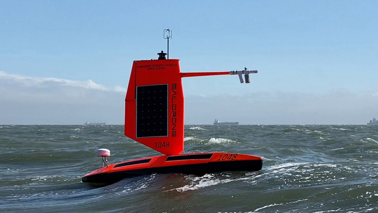
Saildrone delivers first-ever hurricane interior video from the ocean surface
For the first time, a Saildrone has captured video from inside a hurricane at the ocean surface, offering a new window into the forces that drive these storms. This is not abstract data; it is direct, empirical observation from a place we have never seen. Understanding drives protection, and this ocean intelligence is a measurable leap forward. For deeper context on the conditions fueling such storms, see our coverage of August's record-breaking ocean heat readings.
Real-Time Ocean Simulations Advance Understanding Through Integrated Modeling
Building a real-time ocean simulation tool is an exercise in patience and precision. For the past few years, the team behind this project has been systematically working through wave spectra and modeling methodologies to create what they hope will be a definitive resource for the community. Their latest tutorial breaks down the system's mechanics, with a focused look at different simulation types beginning around the 12:40 mark.
Real-Time Seafloor Data: Current Availability and Coverage Insights
The question of real-time seafloor data cuts to the heart of how we share ocean intelligence. The user is right: NCEI archives raw and processed multibeam surveys, but post-processing creates a bottleneck, delaying public access. Archive-only is the current reality for most feeds, though some research vessels stream bathymetry live via satellite. Coverage skews toward U.S. EEZ and coastal priorities, not broad global reach. That gap matters. For those tracking plankton dynamics or other fine-scale phenomena, timing is everything.

Bridging Antarctica: New Fiber Link Promises Real-Time Ocean Data Access
A feasibility study from Chile's Subtel confirms that a fiber-optic link to Antarctica is technically possible, a step toward real-time ocean data from the most remote waters on Earth. This is the kind of measurable, integrated infrastructure that turns raw observation into actionable climate indicators. For researchers tracking polar change, the promise is not just connectivity, but continuity. For deeper context on how subsea systems expand observation, see our coverage of integrated cables across the Indian Ocean.
Real-Time Wave and Boat Motion Estimation with Kalman Filtering
A Kalman filter is a precise tool for a chaotic environment, and that is exactly what this work brings to marine navigation. The open-source `ocean-imu` project, built for the atomS3R, delivers real-time heave and wave-direction estimates by fusing IMU data through an OU-driven quaternion MEKF. It is a practical, peer-reviewed approach to a complex problem. For those interested in the broader context of maritime data systems, our piece on Ukraine's Black Sea shipping initiative offers a relevant policy perspective.