marine habitats
4 stories filed under marine habitats on World Data Ocean. The newest of them: “Wildfire's hidden toll on coastal water quality, measured from orbit”, “Community Insights Shape Ocean Management in Vietnam’s Coastal Zone”, and “Optimized Image Filtering Streamlines Underwater Seabed Mapping”. Wildfire's footprint does not end at the shoreline. Coastal communities in Vietnam's Cù Lao Chàm, Hội An Biosphere Reserve are not passive observers of marine change; they are precise chroniclers of it. A Global Hub for Ocean Intelligence 4 World Data Ocean is a centralized digital platform where researchers, scientists, and ocean enthusiasts converge to… The list below is every marine habitats story on World Data Ocean, newest first.

Wildfire's hidden toll on coastal water quality, measured from orbit
Wildfire's footprint does not end at the shoreline. Nearly four billion people depend on coastal ecosystems that face an understudied threat: post-fire runoff that mobilizes sediments, nutrients, and contaminants into the sea. Our analysis, drawing on evidence from California, identifies what satellites can and cannot observe along this overlooked pathway. We present a first-order global screening that overlays fire danger with population density and marine resources. Closing these observational gaps demands transdisciplinary collaboration and integrated remote sensing.
Community Insights Shape Ocean Management in Vietnam’s Coastal Zone
Coastal communities in Vietnam's Cù Lao Chàm, Hội An Biosphere Reserve are not passive observers of marine change; they are precise chroniclers of it. Surveying 252 residents, this study reveals that local perceptions of environmental shifts are structured, place-specific, and consistent across past and future outlooks. Notably, residents perceived declines in marine resources and aquaculture, while marine habitats showed signs of improvement.
Optimized Image Filtering Streamlines Underwater Seabed Mapping
Underwater robots capture thousands of overlapping images during seabed surveys, but most of that visual data is redundant. This methodology filters out the noise, decoding and rectifying images before discarding those that add nothing new. The result is a 49.91% reduction in image load and a 30% faster processing time, all while keeping feature persistence above 0.97. That is efficient, measurable, and practical. For those interested in how we scale ocean observation, our piece on integrating citizen science offers a complementary view.
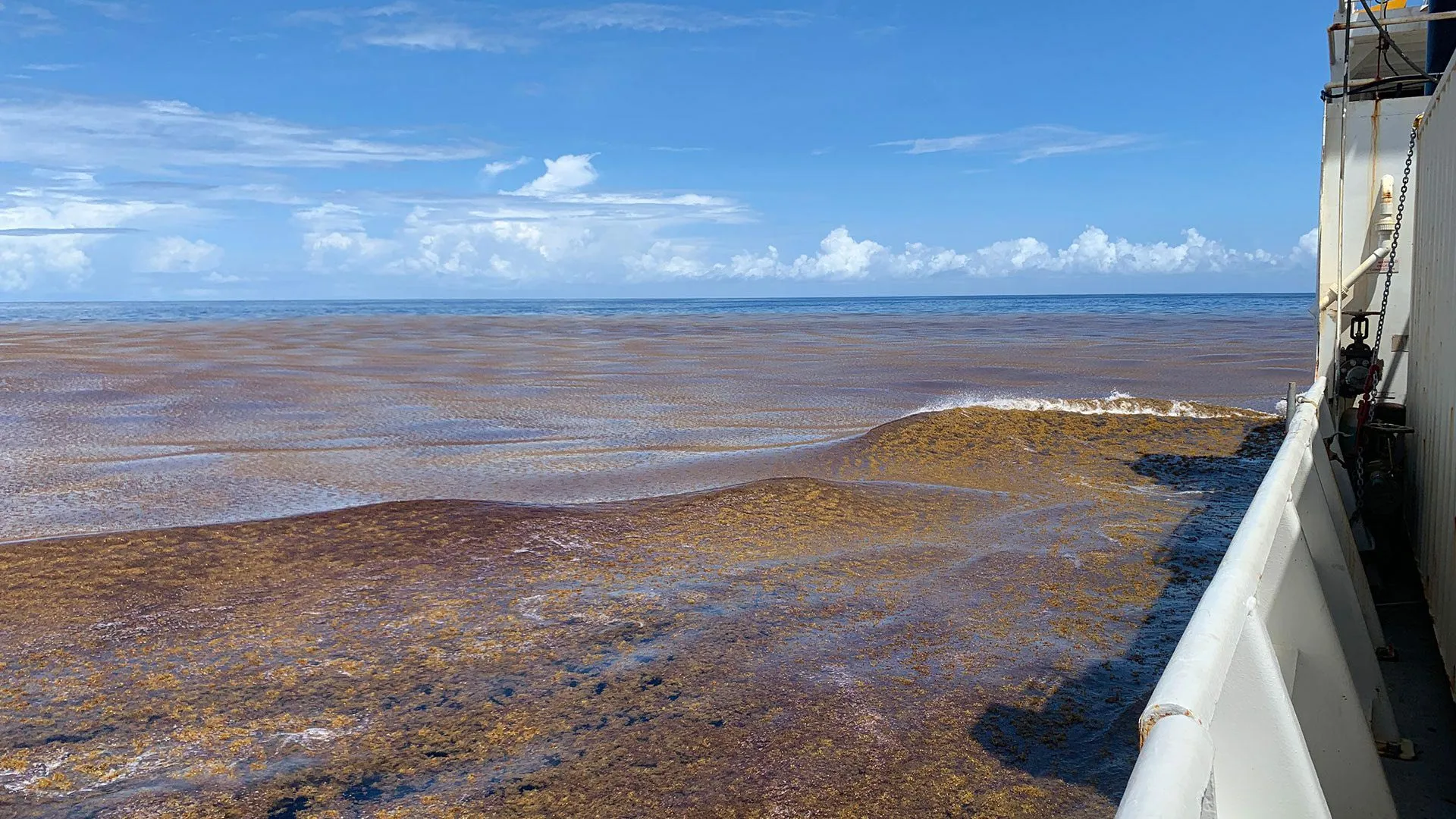
Ocean Algae Blooms Expand Globally, Revealed by AI Analysis
The ocean is changing in ways we can now measure. An AI analysis of 1.2 million satellite images reveals that floating algae blooms are expanding across the global ocean, and the implications are significant. These massive seaweed mats can reshape marine habitats, while their decay brings ecological damage and economic losses to coastlines. This is a clear signal that our ocean intelligence must improve. For a deeper understanding of the systems connecting our seas, see our coverage of the Atlantic Circulation Weakens.