hurricane
World Data Ocean keeps hurricane in one place: 4 stories so far. The section currently leads with “Saildrone delivers first-ever hurricane interior video from the ocean surface”, “Small ocean drone returns validated data from inside Category 5 hurricane”, and “Modeling Mobile Bay: measuring salt marshes' role in flood risk reduction”. For the first time, a Saildrone has captured video from inside a hurricane at the ocean surface, offering a new window into the forces that drive these storms. A small ocean drone has returned validated data from inside a Category 5 hurricane, a world first for NOAA/AOML. A Global Hub for Ocean Intelligence 4 World Data Ocean is a centralized digital platform where researchers, scientists, and ocean enthusiasts converge to… The list below is every hurricane story on World Data Ocean, newest first.
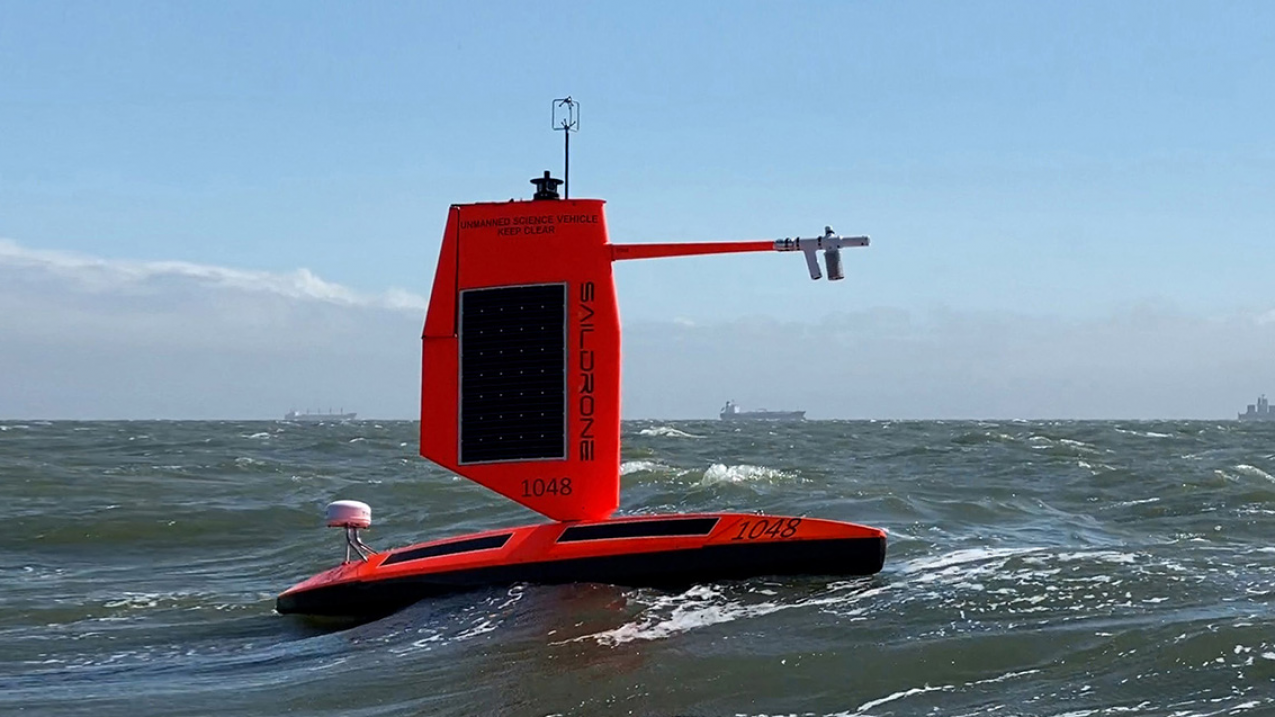
Saildrone delivers first-ever hurricane interior video from the ocean surface
For the first time, a Saildrone has captured video from inside a hurricane at the ocean surface, offering a new window into the forces that drive these storms. This is not abstract data; it is direct, empirical observation from a place we have never seen. Understanding drives protection, and this ocean intelligence is a measurable leap forward. For deeper context on the conditions fueling such storms, see our coverage of August's record-breaking ocean heat readings.

Small ocean drone returns validated data from inside Category 5 hurricane
A small ocean drone has returned validated data from inside a Category 5 hurricane, a world first for NOAA/AOML. This is empirical ocean intelligence at its most daring. Measuring what was previously unmeasurable, the drone's real-time readings from the storm's core will sharpen our climate indicators and refine the models that guide marine stewardship. For deeper context on how such data tracks progress, see our related analysis, "Ocean intelligence measures our progress toward sustainable marine stewardship."

Modeling Mobile Bay: measuring salt marshes' role in flood risk reduction
Salt marshes are not passive landscapes. They are active agents in flood defense, yet their protective power has limits. New numerical modeling of Mobile Bay, Alabama, simulates tropical cyclone conditions to measure how marsh vegetation, represented through bottom roughness, alters flood hazards. The findings are clear: during extreme hurricanes, attenuation benefits shrink, but under moderate storm scenarios, flood severity drops by roughly 21%. This is the kind of empirical, decision-ready insight managers need.

Ocean Sensors on Sharks Offer New Insights for Hurricane Forecasting
Sharks fitted with ocean sensors are delivering real-time data from beneath the surface, offering a new lens for hurricane forecasting. This is ocean intelligence at its most empirical: calibrated observations from a creature that navigates the depths we've barely measured. The potential to refine storm intensity predictions is measurable and immediate. For readers tracking how integrated data ecosystems evolve, our related piece on citizen science for ocean intelligence complements this story well. Understanding drives protection, and here, it also drives preparedness.