Geospatial
Geospatial at World Data Ocean is a file of 6 stories. The newest of them: “From orbit to ocean floor: big data maps the seafloor with precision”, “Bridging Geography and Oceanography: A Path to Marine Science Research”, and “Mapping the Ocean Floor: Geospatial Innovation Drives Global Discovery”. A University of Sydney-led team has integrated satellite altimetry with shipboard sonar data to produce a calibrated, high-resolution map of the global seafloor. A Geography undergrad with QGIS skills and a pull toward oceanography is holding a map to a door that's already slightly open. A Global Hub for Ocean Intelligence 4 World Data Ocean is a centralized digital platform where researchers, scientists, and ocean enthusiasts converge to… The list below is every Geospatial story on World Data Ocean, newest first.
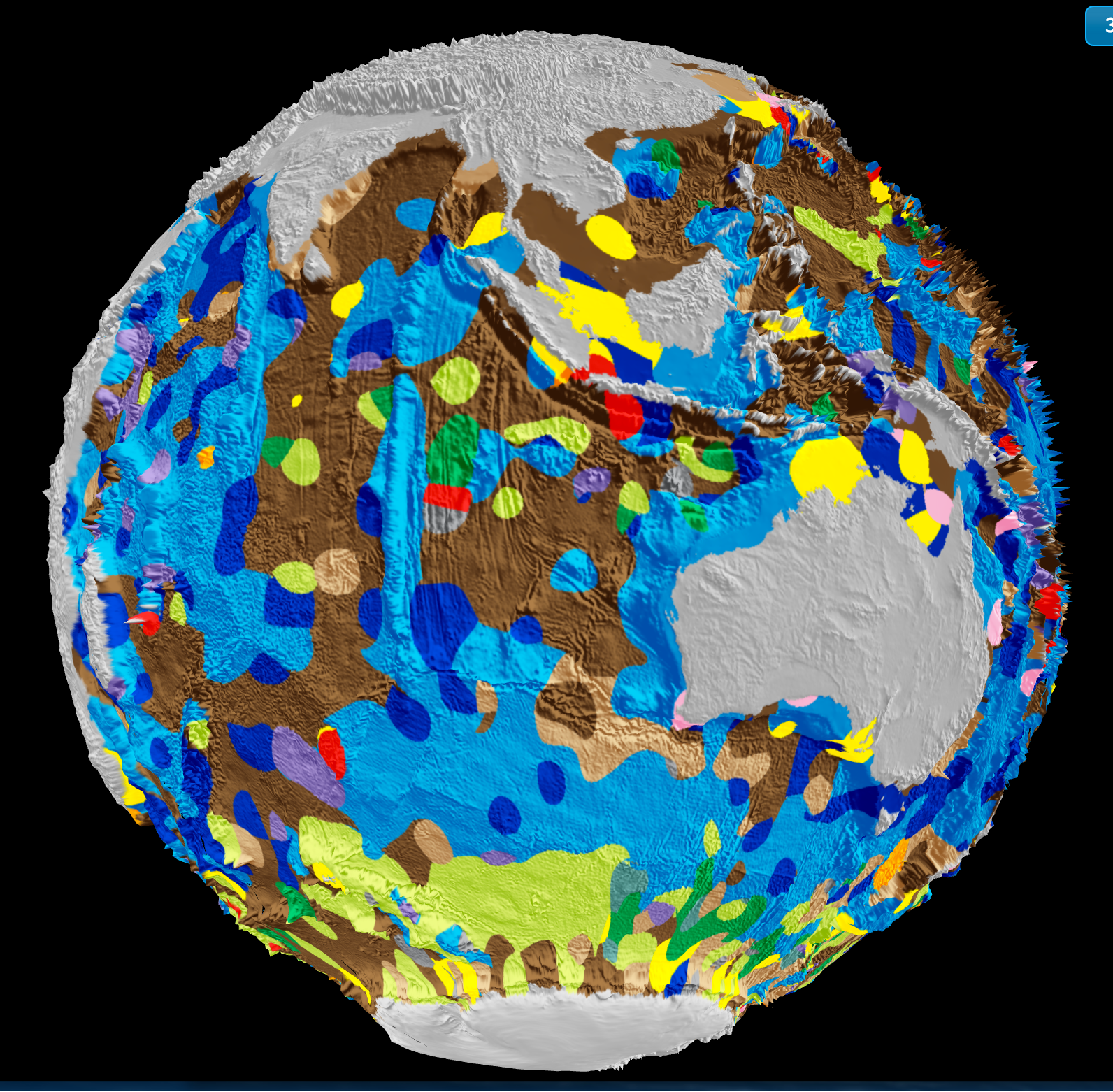
From orbit to ocean floor: big data maps the seafloor with precision
A University of Sydney-led team has integrated satellite altimetry with shipboard sonar data to produce a calibrated, high-resolution map of the global seafloor. This isn't just a sharper image, it's a validated baseline for measuring change. Understanding drives protection. When we can track sediment transport, tectonic activity, and benthic habitat shifts with empirical precision, ocean stewardship becomes measurable. For deeper context on how ocean intelligence reveals system-wide change, see our coverage of the century-long current slowdown.
Bridging Geography and Oceanography: A Path to Marine Science Research
A Geography undergrad with QGIS skills and a pull toward oceanography is holding a map to a door that's already slightly open. The gap between land-based spatial thinking and marine science is real, but it is not a wall, it's a bridge. Your GIS background is a validated entry point, not a consolation prize. Start with marine-focused QGIS tutorials and coastal data sets; pair them with open-access oceanography courses to build the science vocabulary.

Mapping the Ocean Floor: Geospatial Innovation Drives Global Discovery
The ocean floor remains Earth's least mapped frontier, yet geospatial innovation is closing that gap with measurable precision. This piece from Geography Realm examines how integrated data ecosystems and calibrated technologies are accelerating the effort to complete a global seafloor map. It is a practical, empirical look at a monumental task. For readers tracking maritime infrastructure's role in this work, our coverage of Van Oord's new fallpipe vessels, "Vindnes and Vestnes," offers a fitting complement.
Ocean Intelligence: Measuring Change in the Underwater World.
The ocean's most consequential changes often occur beyond the reach of sunlight, yet measuring them demands precision that matches the depths. NOAA's National Centers for Environmental Information anchors this effort, turning raw underwater data into validated, climate-ready intelligence. That rigor matters; without it, we are guessing at the pulse of a system that regulates everything. For those tracking how marine infrastructure evolves alongside such monitoring, our piece on Van Oord's new fallpipe vessels, *Vindnes* and *Vestnes*, offers a fitting glimpse of industrial adaptation.
Empowering Ocean Insights: Global Fishing Watch Data Now in ArcGIS.
Global Fishing Watch data is now live in ArcGIS Online and the Living Atlas, bringing validated, real-time ocean intelligence directly into the hands of researchers and policymakers. This integration is a practical step toward measurable stewardship, and we're glad to see it. For those tracking enforcement efforts, our related piece on Maritime Interdictions shows how such tools support security at sea. Understanding drives protection, and this data ecosystem makes that understanding more accessible than ever.
Mapping American Samoa's Depths: An Exploration of Ocean Intelligence.
Beneath the waves of American Samoa lies a terrain as uncharted as it is vital, and this latest expedition turns raw data into actionable insight. We're encouraged by how this work transforms seabed mapping into a tool for stewardship, not just discovery. It's precise, purposeful, and exactly the kind of empirical effort our shared ocean future demands.