coordination
coordination at World Data Ocean is a file of 6 stories. The newest of them: “Digital insights for small-scale fisheries governance in Somalia”, “Coordinated response enables medical evacuation in Andaman Sea transit”, and “A global framework to measure and map the ocean's integrated data ecosystem”. Small-scale fisheries in Somalia sustain coastal livelihoods and food security, yet fragmented information and weak governance undermine effective management. A coordinated response turned hours of uncertainty into a single, precise operation. A Global Hub for Ocean Intelligence 4 World Data Ocean is a centralized digital platform where researchers, scientists, and ocean enthusiasts converge to… The list below is every coordination story on World Data Ocean, newest first.

Digital insights for small-scale fisheries governance in Somalia
Small-scale fisheries in Somalia sustain coastal livelihoods and food security, yet fragmented information and weak governance undermine effective management. This structured review of 104 peer-reviewed sources finds that digitalization can improve monitoring, coordination, and decision support, but lasting gains in governance remain uneven. Connectivity, digital literacy, and institutional trust matter most. For Somalia, the review identifies an information, governance gap and proposes a coordinated, accountable digital framework. Related coverage of climate-driven fish migration and new rules for shared stocks deepens this picture.
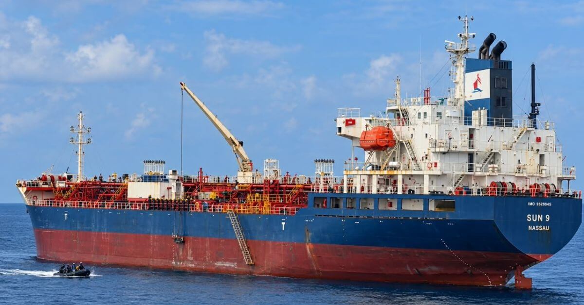
Coordinated response enables medical evacuation in Andaman Sea transit
A coordinated response turned hours of uncertainty into a single, precise operation. The Indian Navy evacuated an injured Vietnamese citizen from the merchant ship MT Sun 09 during transit in the Andaman Sea. This is what integrated maritime capability looks like: validated protocols, real-time decision-making, and a shared commitment to safety across international waters. Understanding drives protection. For deeper coverage on maritime security, see our report on delayed confirmations of five IRGC vessel incidents in the Strait of Hormuz.

A global framework to measure and map the ocean's integrated data ecosystem
A single, integrated framework can now measure and map the ocean's data ecosystem with the precision it deserves. International Coordination to Map the World Ocean on ArcGIS StoryMaps establishes a global standard for connecting fragmented marine observations into a validated, real-time ocean intelligence system. This isn't about more data, it's about calibrated, actionable knowledge. For a complementary view of connectivity, explore our related piece on the Spilhaus World Ocean Map in a Square.
Institutional Interplay: Calibrating BBNJ Governance with Regional Fisheries Bodies
Institutional interplay is no longer a theoretical concern; it is the operational core of BBNJ governance. This study asks whether the mechanisms for mutual deference between the Agreement and regional fisheries bodies are truly ready for action. The answer is conditional. Coordination requires clear rules, early participation, and genuine evaluation of RFMO input. States operating in both regimes will carry the weight of implementation. Readiness, on both sides, will determine whether this relationship strengthens integrated ocean governance.

Mundra Port Achieves Record Container Volume, Bolstering Indian Ocean Trade.
Mundra Port has set a new benchmark for Indian maritime trade, handling 21,085 TEUs on the MSC AMBRA, the highest container volume ever moved on a single vessel at an Indian port. This record signals more than operational efficiency; it reflects India's growing capacity to manage larger, more demanding shipping flows. For a nation anchoring its trade ambitions on robust port infrastructure, this achievement is a measurable step forward.
Low-Altitude Economy: A Catalyst for China’s Marine Economic Growth
China's marine economy is climbing, but the data shows it needs a new lift. From 2011 to 2023, we measured both marine quality and low-altitude economic activity, finding a clear upward yet regionally uneven trend. The low-altitude sector drives marine gains, though technology's push fades while green finance starts slow before accelerating. This isn't just about drones or data; it's about pairing innovation with policy. For deeper context on maritime shifts, see our piece on Gulf of Oman STS transfers.