camera
camera at World Data Ocean is a file of 7 stories. The newest of them: “Autonomous drone navigation validates precision landing without GPS or radar”, “Deploying deep-sea cameras to capture bioluminescent signals in the abyss”, and “Mapping American Samoa's Seabed: An ROV Exploration in 2026”. Precision landing without GPS or radar is no longer theoretical. Bioluminescent flashes in the abyss are among the ocean's most elusive signals, yet capturing them need not require a research vessel's full schedule. A Global Hub for Ocean Intelligence 4 World Data Ocean is a centralized digital platform where researchers, scientists, and ocean enthusiasts converge to… The list below is every camera story on World Data Ocean, newest first.
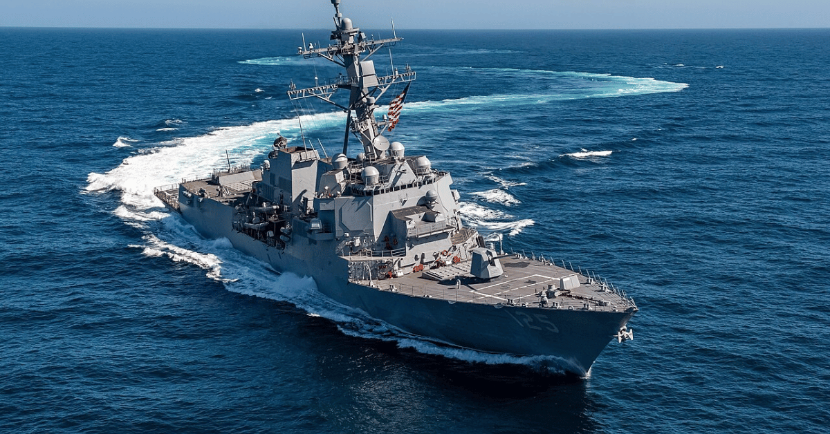
Autonomous drone navigation validates precision landing without GPS or radar
Precision landing without GPS or radar is no longer theoretical. The US Navy has validated autonomous drone navigation that uses onboard cameras and advanced software to land on moving ships. This is calibrated, real-time ocean intelligence in action. For context on why such precision matters in contested waters, read our coverage of the recent Strait of Hormuz posture analysis. Understanding drives protection, and this capability strengthens maritime security without relying on vulnerable satellite signals.
Deploying deep-sea cameras to capture bioluminescent signals in the abyss
Bioluminescent flashes in the abyss are among the ocean's most elusive signals, yet capturing them need not require a research vessel's full schedule. Deploying deep-sea cameras to record those sporadic glimmers, much like neutrino detectors resting in mine shafts, offers a low-cost, passive window into a world we rarely see. Leave the gear to brew while oceanographers tend to other duties; the resulting footage, though punctuated by darkness, promises genuine insight.

Mapping American Samoa's Seabed: An ROV Exploration in 2026
In 2026, a remotely operated vehicle will descend into the waters around American Samoa, mapping the seabed with calibrated precision. This is ocean intelligence at its most tangible: measurable, peer-reviewed, and essential for informed stewardship. We see this as a vital step in building an integrated data ecosystem, one that connects seafloor topography to broader climate indicators. For a deeper look at how marine operations are adapting in challenging regions, explore our coverage of "Mitigating Supply Chain Risk: KPC Enables Ship-to-Ship Transfers."
Mapping American Samoa’s Depths: An Exploration with Advanced Underwater Technology
American Samoa's waters hold more than meets the eye, and this expedition proves it. Mapping these depths with advanced underwater technology reveals a seabed shaped by volcanic force and time, a place where bathymetry becomes biography. We find this work compelling because it turns raw data into actionable ocean intelligence, grounding conservation in measurable truth. For those seeking the broader picture, our related article, "Mapping American Samoa's Seabed: An ROV Exploration in 2026," expands on the tools behind this effort.

Exploring the Cook Islands Depths: A 2026 ROV Expedition.
In 2026, a new ROV expedition will descend into the waters surrounding the Cook Islands, aiming to transform our understanding of a region whose depths remain largely unmeasured. This is not a hunt for spectacle; it is a methodical effort to gather empirical data where none currently exists. The mission's value will be defined by its calibrated instruments and the peer-reviewed findings they produce.
Mapping the Deep: Cook Islands ROV Exploration Set for 2026
In 2026, the Cook Islands will bring its seabed into sharper focus through a dedicated ROV exploration campaign. This is the kind of methodical, on-the-ground ocean intelligence we need more of, moving from satellite-level observation to direct, calibrated observation of the deep. It is a precise step for mapping what remains unseen. For a broader look at how these efforts connect, our piece on mapping American Samoa's seabed offers a useful regional comparison. Understanding drives protection, and this work is a clear example.
Exploring the Cook Islands Depths: A 2026 ROV Mission.
In early 2026, an ROV mission will descend into the waters surrounding the Cook Islands, where the seafloor remains largely uncharted. This is the kind of methodical, empirical work that turns raw data into ocean intelligence. By capturing validated, real-time imagery from the depths, the mission strengthens the integrated data ecosystem that researchers and policymakers rely on. For those tracking how these efforts connect, our piece on NOAA's calibrated ocean intelligence offers useful context. Understanding drives protection, and this expedition brings us closer to both.