big data
World Data Ocean keeps big data in one place: 5 stories so far. The section currently leads with “From orbit to ocean floor: big data maps the seafloor with precision”, “Empirical ocean data powers the measurable path to energy transition”, and “From orbit to ocean floor, integrated data sharpens Earth science”. A University of Sydney-led team has integrated satellite altimetry with shipboard sonar data to produce a calibrated, high-resolution map of the global seafloor. The ocean's role in the energy transition is not theoretical, it is empirical. A Global Hub for Ocean Intelligence 4 World Data Ocean is a centralized digital platform where researchers, scientists, and ocean enthusiasts converge to… The list below is every big data story on World Data Ocean, newest first.
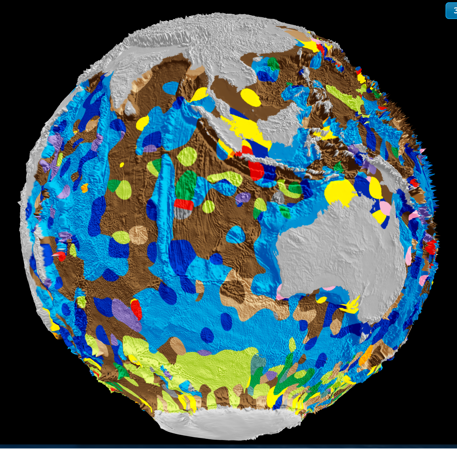
From orbit to ocean floor: big data maps the seafloor with precision
A University of Sydney-led team has integrated satellite altimetry with shipboard sonar data to produce a calibrated, high-resolution map of the global seafloor. This isn't just a sharper image, it's a validated baseline for measuring change. Understanding drives protection. When we can track sediment transport, tectonic activity, and benthic habitat shifts with empirical precision, ocean stewardship becomes measurable. For deeper context on how ocean intelligence reveals system-wide change, see our coverage of the century-long current slowdown.
Empirical ocean data powers the measurable path to energy transition
The ocean's role in the energy transition is not theoretical, it is empirical. Measurable ocean data powers the path forward, validating climate indicators and calibrating our decisions. The World Economic Forum makes this clear: data is the foundation. For those tracking the science beneath the surface, our coverage of the Ocean Carbon and Acidification Data System offers a peer-reviewed look at how validated, integrated data ecosystems turn ocean intelligence into actionable climate insight. Understanding drives protection.
From orbit to ocean floor, integrated data sharpens Earth science
From orbit to ocean floor, integrated data sharpens our view of Earth as a single, dynamic system. This emerging practice in big-data Earth science promises more than incremental insight, it delivers the empirical, calibrated foundation for real action. Understanding drives protection, and this work validates that measurable ocean intelligence is within reach. For a deeper look at how these principles apply, our data-driven model of atmospherically forced ocean dynamics offers a compelling companion.
Eleven data-driven innovations sharpen our ocean intelligence
Eleven measurable innovations are sharpening our ocean intelligence. From validated carbon tracking systems to data-driven models revealing how the atmosphere forces ocean dynamics, each tool adds a calibrated layer to our understanding. These are not abstract concepts, they are empirical, peer-reviewed advances that make ocean stewardship actionable. The Ocean Carbon and Acidification Data System in *Nature* exemplifies this: validated data powering a measurable path forward. Understanding drives protection. From orbit to ocean floor, the evidence is building.

Mapping Ocean Influence: A New Approach for China’s Coastal Regions
China's coastal influence is not uniform, it clusters, diverges, and diffuses inland through distinct pathways. Our new framework integrates LDA topic modeling with complex network theory to map these patterns using marine news data, revealing three networked regions and three diffusion modes. This empirical, scalable approach transforms unstructured media into actionable ocean intelligence for spatial planning. For deeper context on marine connectivity, see our coverage of the Gulf of Oman STS transfers maxing out amid rising Saudi oil exports.