acceleration
World Data Ocean keeps acceleration in one place: 2 stories so far. The section currently leads with “27 meters of ice loss measured across 50 years in reference glaciers” and “Zhejiang Coast Sea Level: 70 Years of Change and Future Projections”. Twenty-seven meters of water equivalent. Forty centimeters above the national datum. A Global Hub for Ocean Intelligence 4 World Data Ocean is a centralized digital platform where researchers, scientists, and ocean enthusiasts converge to… The list below is every acceleration story on World Data Ocean, newest first.
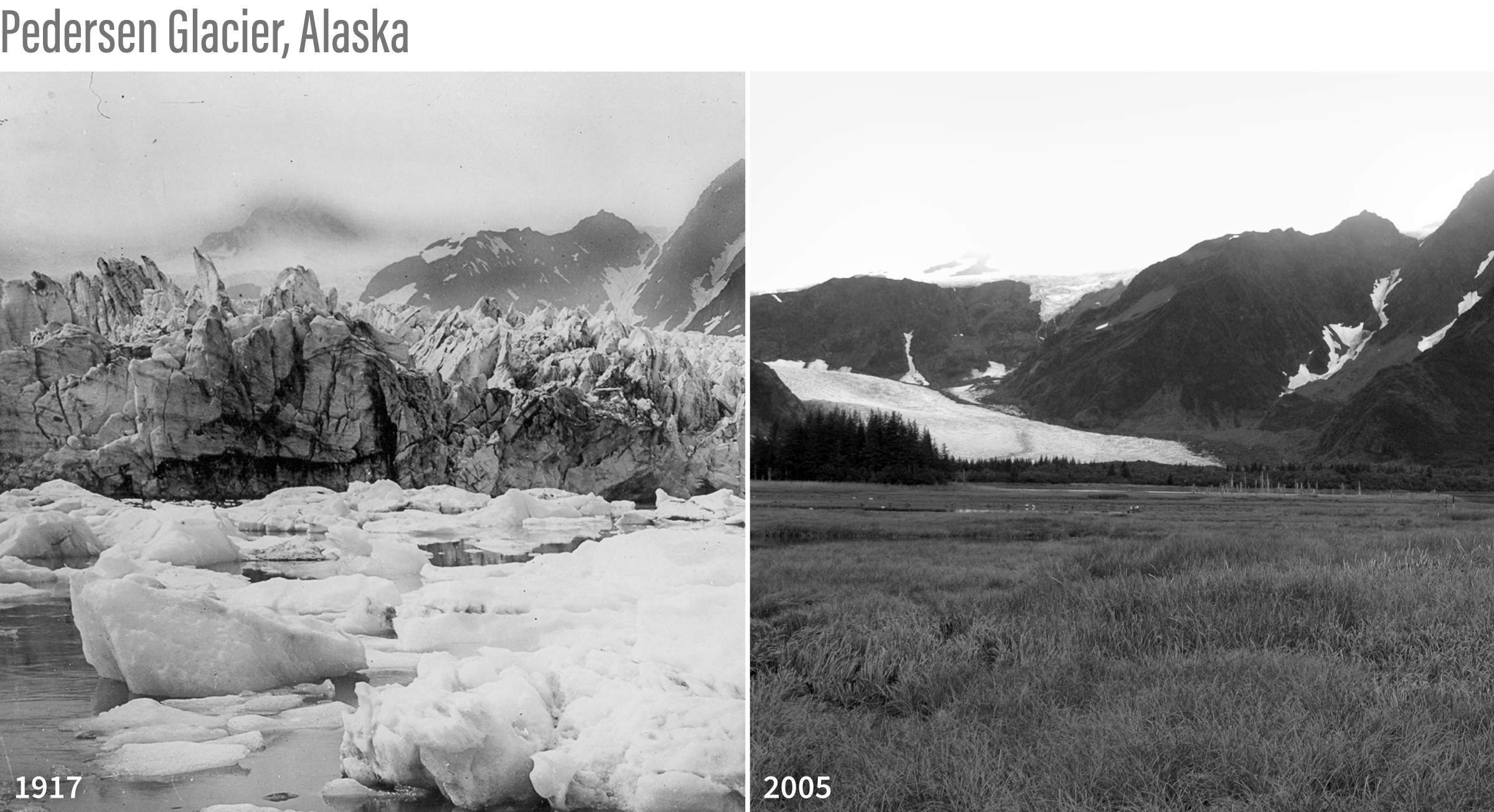
27 meters of ice loss measured across 50 years in reference glaciers
Twenty-seven meters of water equivalent. That is the cumulative ice loss measured across the World Glacier Monitoring Service's reference glaciers since 1970, a slab nearly 100 feet thick sliced from the top of each one. Glacier mass balance is a direct, empirical climate indicator. This is not a projection; it is validated, longitudinal data. Understanding drives protection. For a broader view of how such measurements fit into global ocean health, see "Measuring ocean health begins with an integrated data ecosystem."

Zhejiang Coast Sea Level: 70 Years of Change and Future Projections
Forty centimeters above the national datum. That is where Zhejiang's coast stood in 2020, a measurable reminder that the sea is no longer waiting. Our 70-year record from 10 stations confirms a moderate 0.25 cm/yr average rise, but the last two decades tell a sharper story. If acceleration persists, projections of up to 88 cm by 2100 align with high-emission models. This is empirical, actionable data. For broader maritime context, our piece on Kiwi Frigate Monitors Sanctions complements this regional picture.