AI just revealed ocean currents we’ve never been able to see
Our take
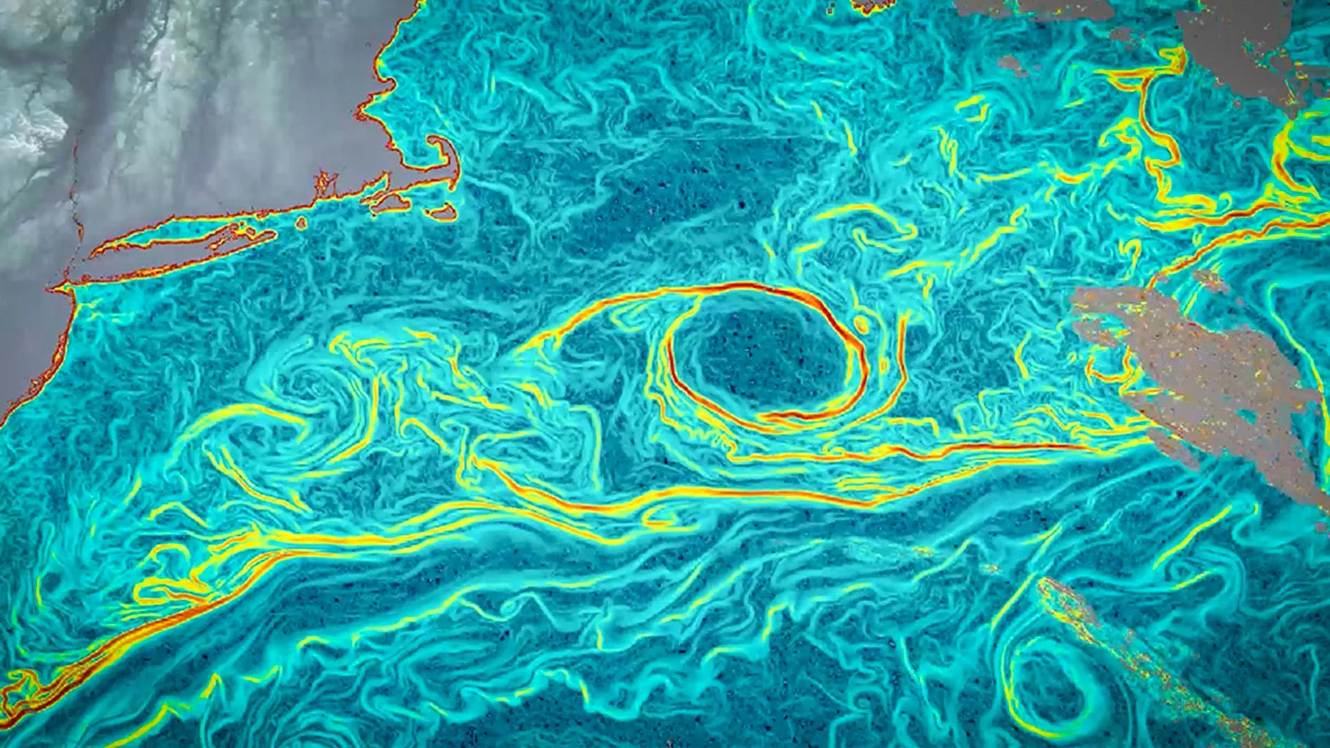
The recent introduction of the AI-driven method known as GOFLOW marks a pivotal advancement in our understanding of ocean dynamics. By utilizing existing weather satellite images to create detailed maps of ocean currents, this innovative approach enables scientists to track previously invisible fast-moving, small-scale currents. These currents are essential not only for understanding climate patterns but also for assessing the health of marine ecosystems and their role in carbon storage. The implications of this breakthrough are vast and resonate with ongoing discussions about the importance of ocean stewardship, as highlighted in articles such as Islands of biodiversity created by remote Arctic kelp forests of the central Kitikmeot Sea and World Economic Forum: Here's why we need Strategic investment in the Ocean economy.
Understanding ocean currents is critical for several reasons. Firstly, these currents serve as the lifeblood of marine ecosystems, influencing everything from nutrient distribution to the migration patterns of marine species. As climate change accelerates, the ability to monitor shifts in these currents in real time becomes increasingly crucial. The GOFLOW method's reliance on satellites already in orbit also underscores a significant advantage: it is not only powerful but also cost-effective, allowing for expanded research and monitoring capabilities without necessitating new satellite launches. This integration of AI with existing technology exemplifies a forward-thinking approach that has the potential to enhance our global understanding of marine environments and their response to climate change.
Moreover, the use of AI in oceanography opens up new avenues for research and policy-making. It allows scientists to work with longitudinal data, offering a more comprehensive view of how ocean currents evolve over time and their impact on climate indicators. This is particularly important as we strive to address pressing environmental challenges. For instance, understanding how currents affect temperature regulation can inform strategies for mitigating climate impacts, an issue also reflected in the findings surrounding the Giant squid discovery uncovers a hidden deep-sea world off Australia. The intersection of these insights could foster greater collaboration between researchers, policymakers, and stakeholders committed to ocean conservation.
As we move forward, the implications of GOFLOW and similar technologies could reshape our approach to marine research and policy. The urgency of ocean stewardship cannot be overstated; the health of our oceans is intrinsically linked to the overall health of our planet. By leveraging the power of AI to reveal the hidden dynamics of ocean currents, we can create a more informed and proactive framework for addressing climate change and promoting sustainability.
The question remains: how will this new understanding of ocean currents influence our collective efforts to safeguard marine ecosystems and combat climate change? As we continue to explore and innovate, the answers may shape our future and that of the oceans we depend on.
Read on the original site
Open the publisher's page for the full experience