environmental science
World Data Ocean keeps environmental science in one place: 22 stories so far. The section currently leads with “A thousand rivers drive eighty percent of ocean plastic emissions”, “Radiocarbon data reveal how organic carbon moves from land to ocean”, and “Leveraging Computer Science Skills for Ocean Conservation Pathways”. A thousand rivers drive eighty percent of ocean plastic emissions, a finding that demands a calibrated, not alarmist, response. Radiocarbon data now reveal the precise pathways of organic carbon as it travels from land to ocean, offering the clearest empirical picture yet of carbon transfer and accumulation across the land, ocean continuum. A Global Hub for Ocean Intelligence 4 World Data Ocean is a centralized digital platform where researchers, scientists, and ocean enthusiasts converge to… The list below is every environmental science story on World Data Ocean, newest first.
A thousand rivers drive eighty percent of ocean plastic emissions
A thousand rivers drive eighty percent of ocean plastic emissions, a finding that demands a calibrated, not alarmist, response. This is not about panic; it is about measurable action. Understanding the source of the problem allows us to target interventions where they matter most. For deeper context on how disclosure transforms data into accountability, see our related coverage, "Closing the data gap: disclosure as a calibrated step toward ocean action." Precision, not hype, guides real protection.
Radiocarbon data reveal how organic carbon moves from land to ocean
Radiocarbon data now reveal the precise pathways of organic carbon as it travels from land to ocean, offering the clearest empirical picture yet of carbon transfer and accumulation across the land, ocean continuum. This is measurable, peer-reviewed insight into a critical climate indicator. Understanding these global patterns drives better protection of coastal carbon sinks. For deeper context on how we track ocean chemistry, explore our calibrated global standard for dissolved organic phosphorus.
Leveraging Computer Science Skills for Ocean Conservation Pathways
You don't need to choose between a desk and the deck. A CS background, paired with a GIS certificate, opens a credible pathway into ocean conservation without abandoning Seattle's tech ecosystem. The market values calibrated, integrated data skills, and roles in marine spatial planning or fisheries analytics are growing. Friday Harbor's post-bach option offers tangible field exposure. It's a practical, measurable first step, not a detour. Understanding drives protection, and your skills are already part of that equation.
Southern Ocean’s Carbon Absorption Capacity Faces Uncertainty Under Climate Scenarios
The Southern Ocean has long acted as Earth's quiet carbon sink, but new research in *Science Advances* suggests its capacity to absorb emissions is not guaranteed under shifting climate scenarios. This uncertainty carries measurable weight for global climate modeling. We cannot assume stability where the system itself is changing. Understanding these dynamics is essential, not optional. For broader context on how ocean systems respond to pressure, our related coverage of Atlantic Circulation Weakens: Global Climate Reshaping Predicted offers a useful parallel.
Bridging the Gap: Oceanography Certificates to Enhance Your Chemistry Background
A bachelor's in chemistry is a strong foundation for oceanography, where the same quantitative rigor applies to seawater chemistry and climate indicators. For a year between degrees, a certificate in data analysis or GIS would complement your lab skills, as these are practical tools used in marine research. Given your diving plans, consider a seminar on ocean observation. Our related article, "Bridging Data Gaps: Integrating Citizen Science for Ocean Intelligence," offers a useful perspective on how field data is gathered.

Ocean Warming Amplifies Seismic Activity Through Increased Wave Energy
Seismic records now show something worth pausing on: ocean waves are gaining strength as the planet warms, and that energy is registering deep in the Earth's crust. This is not a distant concern; it is a measurable, peer-reviewed signal that links climate indicators directly to ground motion. The data is clear, and it demands we take the connection between warming oceans and seismic activity seriously.
Deep Ocean Warming: Longitudinal Data Reveals a Concerning Trend.
The ocean's abyss was long considered a stable, slow-motion frontier, but new longitudinal data now shows the deepest layers are warming. This is not a distant anomaly; it is a measurable shift in a system we rely on for climate stability. We find this trend deeply concerning, yet it reinforces why sustained observation matters. As we track these changes, we must connect them to broader disruptions, much like our recent analysis of Atlantic Circulation Weakens, to fully grasp the scale of what is unfolding.
Global Educators Access Ocean Research Through TRACX Program
The TRACX Program at Columbia University gives educators worldwide a direct route into ocean science research, turning classroom walls into windows on the deep sea. That matters. Teachers who engage with real-time, peer-reviewed data can bring climate indicators and ocean intelligence back to students who might otherwise never see the coast. It is a practical step toward shared responsibility. For those exploring career pathways, our related piece on international master's programs offers a useful complement. This is how knowledge moves: from lab to lesson plan.
Ocean Salinity Shifts: A Longitudinal Analysis, 1955-1998
Between 1955 and 1998, the World Ocean's salinity did not drift randomly; it shifted in measurable, persistent patterns. Boyer's longitudinal analysis, published in *Geophysical Research Letters*, offers empirical weight to what we suspect about a warming planet: the water cycle is accelerating, and the ocean is keeping the score. This isn't abstract data; it is a calibrated indicator of change. For context on how we now monitor these systems, our coverage of integrated subsea cables shows the infrastructure carrying such intelligence across the Indian Ocean.
Reconstructing Earth's Past Climate Through Empirical Data Analysis.
Earth's distant past is not a blank slate; it is written in layers of sediment, ice, and shell. Reconstructing Earth's Past Climate Through Empirical Data Analysis, mapped by Carbon Brief, shows how these 'proxy' records translate into measurable climate indicators. This is not speculation; it is calibrated, peer-reviewed science. Understanding these deep-time signals sharpens our view of present-day change. For a related thread on how ancient signals can be misread, see our coverage of magma and microbial activity potentially rewriting a 2-billion-year-old carbon signal.
Ocean Temperatures Reach Record High, Validating Climate Change Indicators.
August's ocean temperatures set a new record, and the data is unambiguous. This isn't a fleeting anomaly; it's a measurable signal that aligns with established climate indicators. We track these shifts because they carry consequences far beyond the surface. For those seeking to understand the mechanisms at play, our coverage of how magma and microbial activity may rewrite a 2-billion-year-old carbon signal offers a deeper, peer-reviewed perspective. The ocean is speaking in records; our role is to listen with calibrated, scientific rigor.
Beyond the Waves: Oceanographers Share Their Experiences and Insights
Choosing a career path without knowing what the daily reality entails is a valid concern, and it is exactly the kind of transparency that strengthens the field. Oceanography is not a single job; it is a spectrum of disciplines, and the honest answers you are seeking from practitioners are invaluable. For a deeper look at how we gather such data, our article "Bridging Data Gaps: Integrating Citizen Science for Ocean Intelligence" explores collaborative observation methods.
Advancing Earth System Science: A Call for Collaborative Research.
Understanding drives protection, and this call for collaborative research on Earth system science reflects that principle. This persistence, moving from theoretical frameworks to computational models, shows a dedication we share. They've sought dialogue elsewhere with limited success, which is why this invitation matters. For those exploring similar questions, our related article, "Calibrated ocean intelligence, now within reach through integrated data discovery," offers a practical entry point. Earth system science thrives on shared inquiry, not isolated effort. We're glad to see this conversation starting.
Tracking Plastic's Reach: Ocean Intelligence from Remote Waters.
Plastic debris doesn't stay where we drop it. New tracking from remote waters shows how far it travels, and the data is telling a clearer story than ever before. This kind of ocean intelligence turns scattered observations into something measurable, something we can act on. It's a reminder that the problem isn't out of sight, just out of sightlines. For readers drawn to the unseen, our piece on unidentified marine life offers a complementary glimpse into what else moves beneath the surface.
Simulating Ocean Change: A Hands-On Lesson in Dissolved Oxygen.
A middle school classroom tank can't replicate the ocean's full complexity, but it can reveal a core truth: nutrient pollution sets off a chain reaction that drains oxygen from the water. This hands-on lesson on dissolved oxygen gives students a tangible window into that process. The challenge of testing for DO without expensive probes is real, and we're curious what budget-friendly tricks educators have found.
Expanding Oceanographic Research Horizons: Career Opportunities in Canada
Canada's oceanographic community extends well beyond Bedford. For a physical oceanographer and a hydrology-focused civil engineer, the University of British Columbia's Institute for the Oceans and Fisheries and the University of Victoria's Ocean Networks Canada offer strong research pathways, while Quebec's Institut des sciences de la mer provides coastal expertise. These hubs value the integrated data ecosystem you both represent. For broader context on collaborative observation, our piece on "Bridging Data Gaps: Integrating Citizen Science for Ocean Intelligence" complements this career landscape.
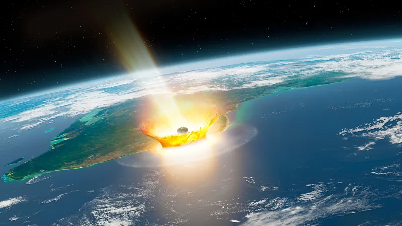
Rapid Atmospheric Heating: Asteroid Dust’s Role in Dinosaur Extinction
Within minutes of impact, debris began heating Earth's atmosphere, and fine dust trapped that heat. The result was a rapid, lethal spike in global temperatures. This mechanism, not the blast alone, may have killed the dinosaurs quickly. It is a stark reminder that extinction can arrive with terrifying speed. For a broader view of how Earth's systems respond to sudden change, see our coverage of the Cascadia Subduction Zone's fragmented tectonic process.
Ocean Salinity Shifts: A Longitudinal Analysis, 1955–1998
For four decades, the ocean has been quietly rewriting its own chemistry. The 2005 analysis by Boyer, published in *Geophysical Research Letters*, tracks linear salinity shifts from 1955 to 1998, offering empirical evidence of changing evaporation and precipitation patterns. This is not abstract data; it is a measurable climate indicator. Understanding these long-term trends sharpens our view of planetary change.
Ocean Acidification: A Measurable Link to Earth’s Deep Past.
Ocean acidification is not a new chapter in Earth's history, but a recurring one. A new study in *Earth Science Reviews* offers a measured, peer-reviewed look at how past acidification events align with today's calibrated climate indicators. It is a reminder that the ocean keeps a precise, empirical record of planetary change. For those tracking ocean intelligence, this research sharpens the lens on what is measurable.
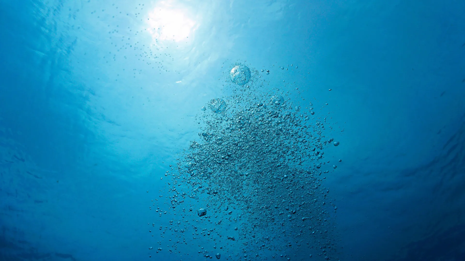
Ocean Deoxygenation Accelerates, Threatening Life and Climate Stability
Oxygen is vanishing from the ocean, and from lakes, rivers, and coastal waters, at a rate that should sharpen our focus. This deoxygenation does not merely stress marine life; it erodes the natural systems that help stabilize Earth's climate. Scientists link this decline directly to warming, pollution, and ocean acidification, making it a compounding planetary threat. We treat this as a measured alarm: the evidence is empirical, and the need for integrated observation has never been clearer.
Bridging Marine Biology and GIS: Mastering Ocean Geospatial Analysis
From orbit to ocean floor, the gap between marine biology and geospatial analysis has never felt wider, or more bridgeable. One environmental scientist in Colorado, trained in fisheries sustainability, now spends days wrangling Esri databases at 9,000 feet, building policy-focused GIS workflows while quietly missing the tide. That pivot, born from a 2020 job market that offered no harbor, is not a detour. It is an integrated data ecosystem waiting to be recalibrated.
Bridging Marine Biology & GIS: Skills for Ocean Science Analysis
From orbit to ocean floor, the gap between geospatial expertise and marine science is often wider than the Mariana Trench. One Colorado-based environmental scientist knows this firsthand: a marine biologist by training, they now spend their days wrangling Esri workflows and policy data at 9,000 feet, building a career in GIS while the tide of their original passion waits offshore. Their plan to bridge that divide, developing ocean-specific analysis methods using familiar tech, speaks to a practical truth.